ʻUalapuʻe, Hawaii facts for kids
Quick facts for kids
Ualapue, Hawaii
ʻUalapuʻe
|
|
|---|---|

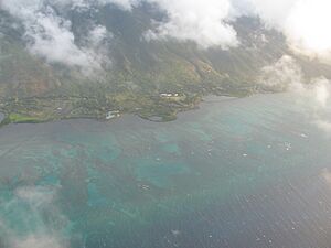
Aerial view
|
|
| Country | United States |
| State | Hawaii |
| County | Maui |
| Area | |
| • Total | 3.64 sq mi (9.42 km2) |
| • Land | 3.17 sq mi (8.20 km2) |
| • Water | 0.47 sq mi (1.22 km2) |
| Elevation | 30 ft (9 m) |
| Population
(2020)
|
|
| • Total | 393 |
| • Density | 124.17/sq mi (47.94/km2) |
| Time zone | UTC-10 (Hawaii-Aleutian) |
| ZIP code |
96748
|
| Area code(s) | 808 |
| GNIS feature ID | 364317 |
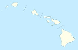
Ualapue (pronounced oo-ah-lah-POO-eh) is a small community in Maui County, Hawaii, United States. It is located on the island of Molokaʻi. Ualapue is considered an unincorporated community and a census-designated place. This means it's a recognized area for gathering population data, but it doesn't have its own local government.
As of the 2020 census, 393 people lived in Ualapue. The community is found along Hawaii Route 450. This road runs along the southeast coast of Molokaʻi. Ualapue is known for its many famous fishponds.
Exploring Ualapue's Location
Ualapue is situated on the beautiful island of Molokaʻi. It is located at about 21 degrees North latitude and 156 degrees West longitude. The community covers an area of about 3.6 square miles (9.4 square kilometers).
Most of this area, about 3.17 square miles (8.2 square kilometers), is land. The rest, about 0.47 square miles (1.2 square kilometers), is water. This includes parts of the ocean or nearby bays.
People of Ualapue
The population of Ualapue was counted during the 2020 census. At that time, 393 people lived in the community. The U.S. Decennial Census counts the population every ten years.
See also

- In Spanish: Ualapu'e para niños
 | Misty Copeland |
 | Raven Wilkinson |
 | Debra Austin |
 | Aesha Ash |


