
A11 autoroute facts for kids
Quick facts for kids
|
|
|---|---|
| l'Océane | |
 |
|
| Route information | |
| Part of |
|
| Maintained by Vinci Autoroutes | |
| Length | 343 km (213 mi) |
| Existed | 1966–present |
| Major junctions | |
| East end | |
|
|
| West end | |
| Highway system | |
| Autoroutes of France | |

The A11, also called l'Océane (which means "the Ocean" in French), is a major motorway in France. It starts near Ponthevrard where it connects to the A10 motorway. From there, it travels all the way to the city of Nantes.
Together with the A10, the A11 helps link Nantes with the capital city, Paris. This important road is about 343 kilometers (213 miles) long. It's also part of bigger European road networks, known as E50, E501, and E60.
Contents
Exploring the A11 Motorway: Key Cities and Services
The A11 motorway is managed by different companies along its route. These companies make sure the road is safe and well-maintained for drivers. As you travel along the A11, you'll find many exits to different towns and cities, as well as places to rest or get fuel.
Journey from Ponthevrard to Le Mans
The first part of the A11 is managed by a company called Cofiroute. This section takes you through some interesting areas of France.
- Near Ablis and Rambouillet: The first exit from the A10 leads towards these towns. You can find rest areas here to take a break.
- Chartres Area: The A11 passes by the historic city of Chartres. There are several exits for Chartres, including one for the city center. You'll also find service areas where you can refuel and grab a snack.
- Brou and Nogent-le-Rotrou: Further along, the motorway provides access to towns like Brou and Nogent-le-Rotrou. More rest areas are available for travelers.
- La Ferté-Bernard: This exit serves the town of La Ferté-Bernard. There are service areas nearby, perfect for longer stops.
- Connecting to the A28: The A11 connects with the A28 motorway. Near this junction, you'll find a large service area called La Sarthe-Sargé-Le-Mans.
- Le Mans City: The A11 has multiple exits for the famous city of Le Mans, known for its motor racing circuit.
From Le Mans to Angers: A New Section
After Le Mans, the management of the A11 changes to another company called ASF. This part of the motorway continues towards the city of Angers.
- Allonnes and Le Mans-South: An exit here serves the southern part of Le Mans and the town of Allonnes.
- Sablé-sur-Sarthe and La Flèche: The A11 provides access to these towns, offering more opportunities for rest.
- Durtal and Seiches-sur-le-Loir: You'll find exits for towns like Durtal and Seiches-sur-le-Loir, as well as Baugé.
- Connecting to the A85: The A11 also connects with the A85 motorway.
- Péage de Corzé: This is a toll booth where drivers pay to use the motorway.
- Pellouailles-les-Vignes: An exit serves this town, and a service area called Angers Gateway is nearby.
- Connecting to the A87: Near Angers, the A11 connects with the A87 motorway, which can take you towards Niort, Cholet, and Poitiers.
Final Stretch: Angers to Nantes
The last section of the A11, leading to Nantes, is again managed by Cofiroute.
- Angers City: There are several exits that lead directly into the city of Angers.
- Saint-Jean-de-Linières and Chalonnes-sur-Loire: The motorway continues past these towns, with rest areas available.
- Péage d'Ancenis: Another toll booth is located near the town of Ancenis.
- Ancenis: An exit serves this town, and more rest areas are available.
- Nantes City: As the A11 approaches its end, it offers multiple exits into the large city of Nantes.
- Connecting to the A811 and A844: The A11 connects with the A811 and eventually merges with the A844, which is part of the Nantes ring road system.
Images for kids
-

This symbol shows a motorway interchange, where two motorways cross or connect.
-

This symbol indicates a motorway exit, where you can leave the motorway to go to a town or city.
-
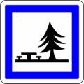
This symbol means a rest area, a place where you can stop for a break and maybe have a picnic.
-
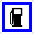
This symbol shows a service area, where you can find fuel, food, and restrooms.
-

This symbol represents a toll booth, where you pay a fee to use the motorway.


See Also
