
A4 autoroute facts for kids
Quick facts for kids
|
|
|---|---|
| Autoroute de l'Est | |
| Lua error in Module:Infobox_road/map at line 15: attempt to index field 'wikibase' (a nil value). | |
| Route information | |
| Part of |
|
| Length | 488 km (303 mi) |
| Existed | 1974–present |
| Major junctions | |
| West end | Paris (Porte de Bercy) |
|
|
| East end | Strasbourg |
| Highway system | |
| Autoroutes of France | |

The A4 is a major highway in France. It is also known as the Autoroute de l'Est, which means "Motorway of the East" in French. This road is very important for connecting different parts of the country.
The A4 is the third-longest highway in France. It stretches for about 488 kilometers (or 303 miles). To give you an idea, the longest is the A10 (549 km), and the second longest is the A89 (544 km).
Contents
About the A4 Autoroute
The A4 highway links two very important cities in France: Paris, the capital, and Strasbourg, a large city in the east. It's a key route for travel and trade across the country.
Key Connections
The A4 is part of two big European road networks. These are the E25 and E50 routes. These routes help connect countries across Europe.
Cities and Landmarks
As you travel along the A4, you'll pass by some interesting places. One of the most famous is Disneyland Paris. The highway directly connects this popular theme park with the city of Paris.
The A4 also goes through other major cities. These include Reims, famous for its cathedral and champagne, and Metz, known for its history and architecture.
The End of the Road
When the A4 reaches Strasbourg, it connects to another highway, the A35 autoroute. This A35 road then continues towards Mulhouse and even into Switzerland. This makes the A4 a gateway to other countries in Europe.
Images for kids
-
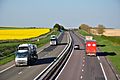
The A4 near Auve in the Marne department.
.JPG)
See also
 In Spanish: Autoroute A4 (Francia) para niños
