Abbeyville, Colorado facts for kids
Quick facts for kids
Abbeyville, Colorado
|
|
|---|---|
|
Town
|
|
| Motto(s):
Strive to excellence
|
|
| Country | |
| State | |
| Counties | Gunnison |
| Elevation | 3,027 m (9,932 ft) |
| Time zone | UTC-7 (MST) |
| • Summer (DST) | UTC-6 (MDT) |
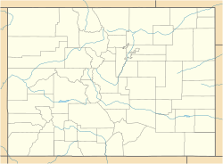
Abbeyville is a ghost town located in Gunnison County, Colorado, United States. A ghost town is a place where most people have left, and it's often empty or has very few residents. Abbeyville was once a busy mining camp.
Contents
History of Abbeyville
Abbeyville started as a mining camp around 1880. It was near a place called the Gold Cup Mine. A mining camp is a temporary settlement built for miners.
Early Days and Growth
In 1881, a special factory called a smelter was built here. A smelter is used to melt metal from ore. This helped the camp grow.
Post Office and Decline
A post office opened in Abbeyville in 1882. This meant people could send and receive mail. However, the post office closed just two years later, in 1884. By 1887, almost everyone had left. Only one person, S.S. Sutton, was still living there. This shows how quickly the town became a ghost town.
Geography of Abbeyville
Abbeyville is located at 38°46′39″N 106°29′32″W / 38.7775°N 106.4922°W. It sits very high up, at an elevation of about 9,932 feet (3,027 meters). This is like being on top of a very tall mountain!
Climate in Abbeyville
Abbeyville has a subarctic climate. This type of climate, also known as "Dfc" on climate maps, means it has very cold, snowy winters and short, cool summers.
The weather data for Abbeyville comes from the nearby Taylor Park Reservoir. The hottest temperature ever recorded was 86°F (30°C) on July 15, 1942. The coldest temperature ever recorded was a super chilly -60°F (-51°C) on February 1, 1985.
| Climate data for Taylor Park, Colorado, 1991–2020 normals, extremes 1940–present | |||||||||||||
|---|---|---|---|---|---|---|---|---|---|---|---|---|---|
| Month | Jan | Feb | Mar | Apr | May | Jun | Jul | Aug | Sep | Oct | Nov | Dec | Year |
| Record high °F (°C) | 54 (12) |
51 (11) |
61 (16) |
67 (19) |
79 (26) |
85 (29) |
86 (30) |
84 (29) |
79 (26) |
75 (24) |
65 (18) |
57 (14) |
86 (30) |
| Mean maximum °F (°C) | 40.2 (4.6) |
44.0 (6.7) |
51.3 (10.7) |
59.2 (15.1) |
69.2 (20.7) |
77.2 (25.1) |
79.1 (26.2) |
76.4 (24.7) |
73.3 (22.9) |
65.4 (18.6) |
53.4 (11.9) |
41.6 (5.3) |
79.7 (26.5) |
| Mean daily maximum °F (°C) | 28.5 (−1.9) |
32.9 (0.5) |
40.5 (4.7) |
47.1 (8.4) |
57.6 (14.2) |
68.9 (20.5) |
72.4 (22.4) |
69.8 (21.0) |
64.4 (18.0) |
53.5 (11.9) |
39.6 (4.2) |
27.6 (−2.4) |
50.2 (10.1) |
| Daily mean °F (°C) | 10.4 (−12.0) |
13.9 (−10.1) |
22.4 (−5.3) |
32.5 (0.3) |
43.1 (6.2) |
52.3 (11.3) |
57.2 (14.0) |
55.5 (13.1) |
49.3 (9.6) |
39.3 (4.1) |
26.2 (−3.2) |
12.0 (−11.1) |
34.5 (1.4) |
| Mean daily minimum °F (°C) | −7.8 (−22.1) |
−5.0 (−20.6) |
4.3 (−15.4) |
18.0 (−7.8) |
28.6 (−1.9) |
35.7 (2.1) |
42.0 (5.6) |
41.2 (5.1) |
34.3 (1.3) |
25.2 (−3.8) |
12.8 (−10.7) |
−3.5 (−19.7) |
18.8 (−7.3) |
| Mean minimum °F (°C) | −31.7 (−35.4) |
−30.1 (−34.5) |
−22.8 (−30.4) |
−1.5 (−18.6) |
16.5 (−8.6) |
27.9 (−2.3) |
34.7 (1.5) |
33.9 (1.1) |
24.8 (−4.0) |
10.7 (−11.8) |
−7.7 (−22.1) |
−28.9 (−33.8) |
−35.7 (−37.6) |
| Record low °F (°C) | −56 (−49) |
−60 (−51) |
−42 (−41) |
−29 (−34) |
−5 (−21) |
15 (−9) |
30 (−1) |
17 (−8) |
4 (−16) |
−7 (−22) |
−30 (−34) |
−49 (−45) |
−60 (−51) |
| Average precipitation inches (mm) | 1.69 (43) |
1.55 (39) |
1.32 (34) |
1.64 (42) |
1.53 (39) |
0.87 (22) |
1.95 (50) |
2.18 (55) |
1.63 (41) |
1.39 (35) |
1.36 (35) |
1.69 (43) |
18.80 (478) |
| Average snowfall inches (cm) | 25.4 (65) |
19.4 (49) |
21.2 (54) |
12.0 (30) |
2.9 (7.4) |
0.2 (0.51) |
0.0 (0.0) |
0.0 (0.0) |
0.3 (0.76) |
3.8 (9.7) |
14.6 (37) |
22.9 (58) |
122.7 (311.37) |
| Average extreme snow depth inches (cm) | 28.9 (73) |
31.2 (79) |
22.4 (57) |
3.3 (8.4) |
1.2 (3.0) |
0.0 (0.0) |
0.0 (0.0) |
0.0 (0.0) |
0.3 (0.76) |
3.2 (8.1) |
5.6 (14) |
19.8 (50) |
34.3 (87) |
| Average precipitation days (≥ 0.01 in) | 8.0 | 8.7 | 7.8 | 8.3 | 8.2 | 5.6 | 11.6 | 12.1 | 8.2 | 7.3 | 7.7 | 7.7 | 101.2 |
| Average snowy days (≥ 0.1 in) | 8.2 | 7.5 | 7.6 | 4.5 | 1.3 | 0.1 | 0.0 | 0.0 | 0.1 | 1.5 | 5.4 | 7.7 | 43.9 |
| Source 1: NOAA | |||||||||||||
| Source 2: National Weather Service (snow/snow days 1940-2022, snow depth 2008-2022) | |||||||||||||
 | Bessie Coleman |
 | Spann Watson |
 | Jill E. Brown |
 | Sherman W. White |


