
Abras, Corozal, Puerto Rico facts for kids
Quick facts for kids
Abras
|
|
|---|---|
|
Barrio
|
|
.jpg)
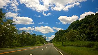
Puerto Rico Highway 821 in Abras
|
|

Location of Abras within the municipality of Corozal shown in red
|
|

Abras, Corozal, Puerto Rico
Location in Caribbean
|
|
| Commonwealth | |
| Municipality | |
| Area | |
| • Total | 3.8 sq mi (10 km2) |
| • Land | 3.8 sq mi (10 km2) |
| • Water | 0 sq mi (0 km2) |
| Elevation | 581 ft (177 m) |
| Population
(2010)
|
|
| • Total | 2,262 |
| • Density | 595.3/sq mi (229.8/km2) |
| Source: 2010 Census | |
| Time zone | UTC−4 (AST) |
Abras is a rural area, or barrio, located in the town of Corozal, Puerto Rico. It also has a small urban part. In 2010, about 2,262 people lived there.
Abras: A Look at Its Past
Abras was once part of Spain's maps and records. This changed after the Spanish–American War in 1898. Puerto Rico then became a territory of the United States.
In 1899, the U.S. government took a count of the people in Puerto Rico. They found that 1,183 people lived in the Abras barrio at that time.
Facts About Abras
Abras covers about 3.8 square miles of land. It does not have any large bodies of water. In 2010, its population was 2,262 people. This means there were about 595 people living in each square mile.
The population of Abras has changed over the years:
| Historical population | |||
|---|---|---|---|
| Census | Pop. | %± | |
| 1900 | 1,183 | — | |
| 1910 | 1,314 | 11.1% | |
| 1920 | 1,619 | 23.2% | |
| 1930 | 1,730 | 6.9% | |
| 1940 | 2,110 | 22.0% | |
| 1950 | 1,393 | −34.0% | |
| 1980 | 1,208 | — | |
| 1990 | 1,634 | 35.3% | |
| 2000 | 1,984 | 21.4% | |
| 2010 | 2,262 | 14.0% | |
| U.S. Decennial Census 1899 (shown as 1900) 1910-1930 1930-1950 1980-2000 2010 |
|||
PR-821 is the main road that runs through Abras. It goes from north to south.
-
Puerto Rico Highway 142 in Abras
-
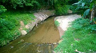
Mavilla River between Corozal and Vega Alta


Mavilla Bridge
There is an important bridge called the Mavilla Bridge. It connects Abras barrio with Palmarejo barrio, both in Corozal. This bridge is so special that it is listed on the National Register of Historic Places in Puerto Rico. This means it is protected because of its history.
-
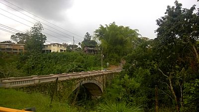
Mavilla Bridge (Around 2015)

What Are Sectors?
Barrios like Abras are often divided into smaller areas. These smaller areas are called sectores in Spanish, which means "sectors" in English. Sectors are like small neighborhoods or communities within a barrio. They can have different names, such as urbanización (a type of housing development) or reparto (another type of development).
Abras barrio has several sectors, including:
- Abras (which includes areas like Sector Cueva de Paca and Urbanización Vista del Río I, II, and III)
- Abras Centro (with areas like Sector Carretera and Sector La Capilla)
- Abras Mavilla (including Sector Adolfa and Urbanización Jardines de Mavilla)
See Also
 In Spanish: Abras para niños
- List of communities in Puerto Rico
- List of barrios and sectors of Corozal, Puerto Rico
