
Absarokee, Montana facts for kids
Quick facts for kids
Absarokee, Montana
|
|
|---|---|

Looking south toward the Beartooth Mountains
|
|

Location of Absarokee, Montana
|
|
| Country | United States |
| State | Montana |
| County | Stillwater |
| Area | |
| • Total | 2.15 sq mi (5.57 km2) |
| • Land | 2.14 sq mi (5.54 km2) |
| • Water | 0.01 sq mi (0.02 km2) |
| Elevation | 4,039 ft (1,231 m) |
| Population
(2020)
|
|
| • Total | 1,000 |
| • Density | 467.07/sq mi (180.34/km2) |
| Time zone | UTC−7 (Mountain (MST)) |
| • Summer (DST) | UTC−6 (MDT) |
| ZIP code |
59001
|
| Area code(s) | 406 |
| FIPS code | 30-00175 |
| GNIS feature ID | 0801981 |
Absarokee is a small community in Stillwater County, Montana, United States. It's called a census-designated place (CDP), which means it's a group of people living together that the government counts as a town, even if it's not officially a city. Absarokee is about 14 miles (22 km) south of Columbus on Montana Highway 78.
The town gets its name from the Crow Indians, who used to live on this land. In 2020, about 1,000 people lived in Absarokee. A large mine, the Stillwater Mine, is also located nearby.
Contents
What's in a Name?
The name Absarokee comes from Apsáalookěi. This was the name the Hidatsa people gave to the Crow Indian Tribe. Apsáa means "large-beaked bird," and lookěi means "children." So, Apsáalookěi means "children of the large-beaked bird."
French fur traders in 1743 translated Apsáalookěi as "people of the crows," which is where the name "Crow" comes from. The founder of Absarokee, Sever T. Simonson, chose the name because he thought it meant "our people."
You might notice that Absarokee is spelled differently from the nearby Absaroka Range of mountains. Many people believe this happened because an early settler had messy handwriting. Their final "a" in the name might have been mistaken for "ee."
A Look Back in Time
Absarokee was founded in 1892, just north of what was called the Second Crow Agency. This agency was the main office for the Crow Tribe's reservation. The reservation was set up by a special agreement called the Treaty of Fort Laramie (1868). At first, it was huge, covering over 35 million acres!
Over time, as more miners came to the area, the reservation got smaller. By 1875, it was reduced to 8 million acres. The Crow people were forced to stop their traditional way of life and live under the control of the U.S. government. They couldn't leave the reservation, and their main food, bison, was replaced with beef given out by the government. Many people also got sick from measles and scarlet fever.
By 1884, the Crow Agency moved again, about 60 miles southeast of Billings. Most of the old Absaroka Agency Fort was destroyed in a fire in 1891.
In the late 1800s, more settlers moved west because of laws like the Homestead Acts and the expansion of railroads. On October 15, 1892, the government officially opened the land around Absarokee for settlement. This land was part of a large area that Crow leaders had agreed to give up two years earlier.
Just before the land was opened, on October 4, Sever Simonson and his family arrived. They claimed land where the Stillwater and East Rosebud Rivers meet. Simonson and his nephew, Oliver H. Hovda, built a log hotel and started a trading post. Soon, other businesses like a saloon and a blacksmith shop opened. A post office was set up in Simonson's home in December 1892, and he became Absarokee's first postmaster.
A famous building in Absarokee is the Big Yellow House. Oliver H. Hovda built this two-story home in 1904. It's located on Absarokee's main street and is now on the National Register of Historic Places, meaning it's a very important historical building.
In 2022, Absarokee was affected by floods when the Stillwater River overflowed.
Where is Absarokee?
Absarokee is located in a valley near the Beartooth Mountains. The area is part of the Rosebud River watershed. This means that water from the land flows into the Rosebud River. The town is just south of where the Rosebud River meets the Stillwater River.
Weather in Absarokee
The weather in Absarokee has very cold winters. These winters are long, with short, clear days and not much snow. Summers are generally warm.
| Climate data for Absarokee/Columbus, Montana (1981–2010) | |||||||||||||
|---|---|---|---|---|---|---|---|---|---|---|---|---|---|
| Month | Jan | Feb | Mar | Apr | May | Jun | Jul | Aug | Sep | Oct | Nov | Dec | Year |
| Record high °F (°C) | 66 (19) |
72 (22) |
83 (28) |
87 (31) |
94 (34) |
101 (38) |
106 (41) |
101 (38) |
99 (37) |
92 (33) |
76 (24) |
67 (19) |
106 (41) |
| Mean daily maximum °F (°C) | 38.9 (3.8) |
42.8 (6.0) |
52.0 (11.1) |
60.8 (16.0) |
69.7 (20.9) |
78.3 (25.7) |
87.2 (30.7) |
85.9 (29.9) |
75.3 (24.1) |
62.2 (16.8) |
47.1 (8.4) |
37.0 (2.8) |
61.4 (16.3) |
| Mean daily minimum °F (°C) | 12.3 (−10.9) |
15.6 (−9.1) |
23.7 (−4.6) |
31.1 (−0.5) |
39.7 (4.3) |
47.3 (8.5) |
52.6 (11.4) |
50.4 (10.2) |
41.3 (5.2) |
31.9 (−0.1) |
21.5 (−5.8) |
11.9 (−11.2) |
31.6 (−0.2) |
| Record low °F (°C) | −36 (−38) |
−35 (−37) |
−27 (−33) |
−1 (−18) |
16 (−9) |
28 (−2) |
35 (2) |
31 (−1) |
18 (−8) |
−9 (−23) |
−22 (−30) |
−42 (−41) |
−42 (−41) |
| Average precipitation inches (mm) | 0.58 (15) |
0.64 (16) |
1.02 (26) |
1.89 (48) |
2.71 (69) |
2.21 (56) |
1.23 (31) |
0.89 (23) |
1.23 (31) |
1.30 (33) |
0.62 (16) |
0.56 (14) |
14.89 (378) |
| Average snowfall inches (cm) | 5.5 (14) |
6.0 (15) |
6.7 (17) |
3.2 (8.1) |
1.6 (4.1) |
0.0 (0.0) |
0.0 (0.0) |
0.0 (0.0) |
0.5 (1.3) |
2.7 (6.9) |
3.7 (9.4) |
5.6 (14) |
35.6 (90) |
| Average precipitation days (≥ 0.01 in) | 4.6 | 4.9 | 7.0 | 8.8 | 10.7 | 10.3 | 7.7 | 6.2 | 5.6 | 5.9 | 4.5 | 5.3 | 81.5 |
| Average snowy days (≥ 0.1 in) | 2.9 | 3.6 | 3.0 | 1.5 | 0.4 | 0 | 0 | 0 | 0.1 | 1.0 | 1.7 | 3.4 | 17.6 |
| Source: NOAA | |||||||||||||
Who Lives in Absarokee?


The population of Absarokee has changed over the years:
| Historical population | |||
|---|---|---|---|
| Census | Pop. | %± | |
| 2000 | 1,234 | — | |
| 2010 | 1,150 | −6.8% | |
| 2020 | 1,000 | −13.0% | |
| U.S. Decennial Census | |||
In 2000, there were 1,234 people living in Absarokee. About 27.6% of the people were under 18 years old. The average age was 40 years.
The Stillwater Mine nearby has a big effect on the people who live in Absarokee. Many families who work at the mine move more often than the local farming families. This means you might see some changes in the town and especially at the schools.
Schools in Absarokee
Absarokee has two school buildings. The elementary school is on the south side of town in what used to be the high school. The newer high school building, built in 1989, is where both junior high and high school students go to class.
Absarokee High School is a "Class C" school. This means it has fewer than 108 students. This class size affects how sports competitions are organized. For example, Class C schools play eight-man football, which is a version of football with fewer players on the field.
The school sports teams are called the Huskies, and their colors are orange and black.
News and Media
The local newspaper for Absarokee is called the Stillwater County News. It comes out every week and you can also read it online. People in Absarokee get their radio and television channels from the larger Billings area.
Images for kids
-
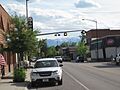
Looking south toward the Beartooth Mountains
-
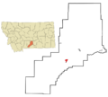
Location of Absarokee, Montana
See also
 In Spanish: Absarokee (Montana) para niños
