Aguaytía facts for kids
Quick facts for kids
Aguaytía
|
|
|---|---|
|
Town
|
|
 |
|
| Country | |
| Region | Ucayali |
| Province | Padre Abad |
| District | Padre Abad |
| Elevation | 287 m (942 ft) |
| Time zone | UTC-5 (PET) |
| Website | www.padreabadaguaytia.com |
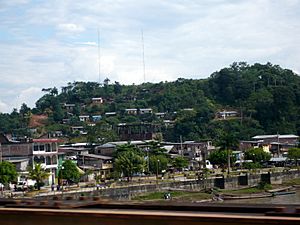
Aguaytía is a town in Peru. It's the main town of the Padre Abad area, located in the Ucayali part of Peru. The town sits right next to the Aguaytía River, which flows into the bigger Ucayali River. Aguaytía is on the main road that connects Pucallpa and Tingo María. Many people in the region visit Aguaytía because it's close to a beautiful waterfall called "El Velo de la Novia," which means "The Bridal Veil."
Climate in Aguaytía
The climate in Aguaytía is generally warm and humid. This section shows the average temperatures and rainfall throughout the year. Knowing the climate helps us understand what the weather is usually like in this Peruvian town.
| Climate data for Aguaytía, Padre Abad, elevation 316 m (1,037 ft), (1991–2020) | |||||||||||||
|---|---|---|---|---|---|---|---|---|---|---|---|---|---|
| Month | Jan | Feb | Mar | Apr | May | Jun | Jul | Aug | Sep | Oct | Nov | Dec | Year |
| Mean daily maximum °C (°F) | 30.4 (86.7) |
30.0 (86.0) |
30.4 (86.7) |
30.8 (87.4) |
30.3 (86.5) |
30.2 (86.4) |
30.5 (86.9) |
31.9 (89.4) |
32.3 (90.1) |
31.7 (89.1) |
31.2 (88.2) |
30.6 (87.1) |
30.9 (87.5) |
| Mean daily minimum °C (°F) | 22.1 (71.8) |
22.0 (71.6) |
22.0 (71.6) |
21.9 (71.4) |
21.7 (71.1) |
21.1 (70.0) |
20.7 (69.3) |
21.1 (70.0) |
21.5 (70.7) |
22.0 (71.6) |
22.2 (72.0) |
22.1 (71.8) |
21.7 (71.1) |
| Average precipitation mm (inches) | 577.6 (22.74) |
623.0 (24.53) |
504.1 (19.85) |
351.1 (13.82) |
335.7 (13.22) |
233.9 (9.21) |
181.4 (7.14) |
124.7 (4.91) |
174.4 (6.87) |
343.5 (13.52) |
501.1 (19.73) |
608.4 (23.95) |
4,558.9 (179.49) |
| Source: National Meteorology and Hydrology Service of Peru | |||||||||||||
See also
 In Spanish: Aguaytía para niños
Black History Month on Kiddle
Distinguished African-American Artists:
 | Sharif Bey |
 | Hale Woodruff |
 | Richmond Barthé |
 | Purvis Young |

All content from Kiddle encyclopedia articles (including the article images and facts) can be freely used under Attribution-ShareAlike license, unless stated otherwise. Cite this article:
Aguaytía Facts for Kids. Kiddle Encyclopedia.

