Pucallpa facts for kids
Quick facts for kids
Pucallpa
May Ushin
Pukallpa
|
|||
|---|---|---|---|
|
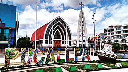
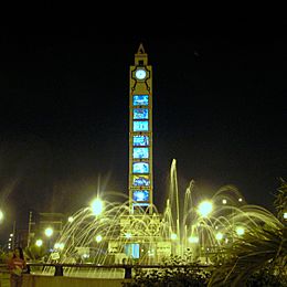
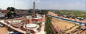
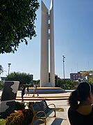
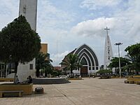
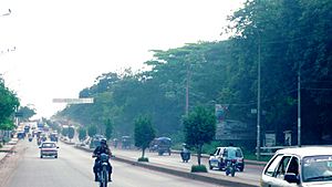
Main Square, Saint Francis port, Tacna avenue, Natural park of Pucallpa and San Martín Square.
|
|||
|
|||
| Nickname(s):
La tierra colorada (The Crimson Land)
|
|||
| Country | Peru | ||
| Region | Ucayali | ||
| Province | Coronel Portillo | ||
| Settled | 1840s | ||
| Elevation | 154 m (505 ft) | ||
| Population
(2017)
|
|||
| • Total | 326,040 | ||
| • Estimate
(2015)
|
211,651 | ||
| Time zone | UTC-5 (PET) | ||
| • Summer (DST) | UTC-5 (PET) | ||
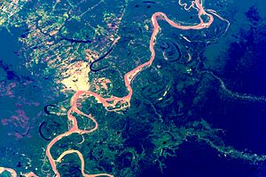
Pucallpa (/pʊˈkælpə/, Quechua: puka allpa, lit. 'red dirt') is a city in eastern Peru. It sits on the banks of the Ucayali River. This river is a big branch of the famous Amazon River. Pucallpa is the capital of the Ucayali region. It is also the main city in the Coronel Portillo Province.
Pucallpa is the biggest city in the Ucayali region. It is the tenth most populated city in Peru. It is also the second largest city in the Peruvian Amazon, after Iquitos. In 2013, about 211,611 people lived there. The city has grown to include nearby towns like Puerto Callao and San Fernando.
Most people travel to Pucallpa by the Ucayali River. This river has the second most important river port in the Peruvian Amazon. There is also a main highway called Federico Basadrees. It connects the city to the Captain Rolden International Airport. From this airport, you can even fly to Brazil.
Pucallpa's economy relies on trade, the timber industry, and tourism. People enjoy ecological tourism at places like the Parque Natural. They also like cultural tourism, which includes shamanism. Fishing, farming, raising animals, and cutting timber are key activities. There are also small oil and gas refineries nearby. These supply fuel to the city and other parts of Peru.
The first people to live here were the Pano. They lived along the Ucayali River thousands of years ago.
Contents
History
Before Europeans arrived, native people lived all over the jungle. It was hard for early explorers to learn about their lives. This was due to diseases and attacks. Explorations began in the 15th century. Franciscan missionaries slowly started founding villages. These were between the Ucayali River and the Perené River.
Pucallpa started in the central jungle area. This is where Peru, Brazil, and Bolivia meet today. The Shipibo-Konibo people lived here. They are an indigenous group from eastern Peru. They lived along the Ucayali River and its branches. They also lived by the Tamaya and Yarinacocha lakes. These groups often mixed together. The Shetebo, an older culture, are now part of the Shipibos.
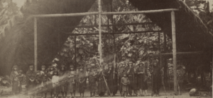
Around that time, about 25,000 people lived in 108 native communities. Their environment was very natural and well-preserved. Houses were made of palm leaves and were open for air. People lived in the forest. They buried their dead secretly in vessels inside their homes. They got food by fishing. They also used medicinal plants for health.
The city of Pucallpa was founded in the 1840s. Franciscan missionaries helped several families of the Shipibo-Conibo group settle there. For many years, Pucallpa was a small town. It was cut off from the rest of Peru by the Amazon rainforest and the Andes mountains.
In 1901, Pucallpa got its first city council. The mayor at the time, Pedro Pablo Gaviria Saldaña, recognized two people as founders. They were Antonio Maya de Brito and Agustín Cauper Videira. Many people believe Pucallpa was founded on October 13, 1888. This date matches the city's celebration week. However, there isn't one fixed founding date. The city grew slowly over time, rather than being founded in one official act. Early settlers started arriving in the 1850s. A small native village was already there.
From the 1880s to the 1920s, there were plans for a railway. This railway would connect Pucallpa to the rest of Peru. But the project was started and stopped many times. It was finally given up. Pucallpa's isolation ended in 1945. This was when a highway to Lima was finished. The highway went through Tingo Maria. This road helped Pucallpa's products reach other parts of the country. This improved the city's economy.
However, heavy rains in the Amazon rainforest can damage the highway. They can cause flash floods. Pucallpa also has air travel through the Captain Rolden International Airport. It has river travel through its port Pucallpillo. During high water season, other floating ports are used. There are plans for a huge port project called San Lorenzo Megaport. It aims to connect Lima with the Atlantic Ocean. This would happen through a rail link to Pucallpa and the Amazon. Many projects in the 2000s helped improve life in Pucallpa.
Geography
Pucallpa is a small part of the Coronel Portillo province. The city's urban area has grown unevenly over the years. It borders the Campoverde district and nearby villages.
Climate
Pucallpa has a tropical monsoon climate. This means it has warm temperatures all year. The average temperature is 26 °C (79 °F). On the hottest days, it can reach 34 °C (93 °F). In 2008, the temperature even hit 37 °C (99 °F). Rain falls mostly between October and December. During this time, the temperature drops to about 21.5 °C (71 °F). The highest temperature ever recorded was over 41.1 °C (106 °F). This is one of the hottest records in the lowland jungle. The yearly rainfall is about 1570 mm (62 inches).
Ultraviolet (UV) levels can be very high, reaching 10+. Thunderstorms are rare in Pucallpa. But strong winds can happen, reaching 40 km/h (25 mph). These winds have caused problems for air travel.
| Climate data for Pucallpa | |||||||||||||
|---|---|---|---|---|---|---|---|---|---|---|---|---|---|
| Month | Jan | Feb | Mar | Apr | May | Jun | Jul | Aug | Sep | Oct | Nov | Dec | Year |
| Record high °C (°F) | 42.0 (107.6) |
40.8 (105.4) |
37.8 (100.0) |
37.2 (99.0) |
34.2 (93.6) |
36.2 (97.2) |
36.5 (97.7) |
40.5 (104.9) |
37.2 (99.0) |
36.5 (97.7) |
36.2 (97.2) |
37.8 (100.0) |
42.0 (107.6) |
| Mean daily maximum °C (°F) | 31.3 (88.3) |
30.7 (87.3) |
30.7 (87.3) |
30.9 (87.6) |
30.4 (86.7) |
30.3 (86.5) |
30.4 (86.7) |
31.8 (89.2) |
32.3 (90.1) |
31.7 (89.1) |
31.5 (88.7) |
31.6 (88.9) |
31.1 (88.0) |
| Daily mean °C (°F) | 26.7 (80.1) |
26.4 (79.5) |
26.2 (79.2) |
26.2 (79.2) |
26.2 (79.2) |
25.6 (78.1) |
25.4 (77.7) |
26.0 (78.8) |
26.7 (80.1) |
26.8 (80.2) |
26.6 (79.9) |
26.9 (80.4) |
26.3 (79.3) |
| Mean daily minimum °C (°F) | 22.4 (72.3) |
22.3 (72.1) |
22.3 (72.1) |
22.1 (71.8) |
21.5 (70.7) |
20.5 (68.9) |
19.8 (67.6) |
20.4 (68.7) |
21.1 (70.0) |
21.8 (71.2) |
22.2 (72.0) |
22.4 (72.3) |
21.6 (70.9) |
| Record low °C (°F) | 18.5 (65.3) |
17.6 (63.7) |
13.8 (56.8) |
12.8 (55.0) |
15.0 (59.0) |
12.2 (54.0) |
11.1 (52.0) |
11.6 (52.9) |
14.0 (57.2) |
15.0 (59.0) |
17.8 (64.0) |
17.8 (64.0) |
11.1 (52.0) |
| Average rainfall mm (inches) | 147 (5.8) |
165 (6.5) |
191 (7.5) |
163 (6.4) |
104 (4.1) |
66 (2.6) |
51 (2.0) |
56 (2.2) |
91 (3.6) |
168 (6.6) |
185 (7.3) |
180 (7.1) |
1,565 (61.6) |
| Average rainy days (≥ 1.0 mm) | 14 | 11 | 12 | 12 | 9 | 6 | 5 | 6 | 7 | 11 | 10 | 11 | 114 |
| Average relative humidity (%) | 87 | 88 | 88 | 88 | 87 | 88 | 86 | 84 | 85 | 86 | 87 | 86 | 86 |
| Source: Deutscher Wetterdienst | |||||||||||||
Water and Electricity
The company for drinking water and sewers is called EMAPCOP. It started in 1992. This company provides water and sewer services to the Coronel Portillo Province. Many homes in the area are connected to public water.
Electricity is managed by Electro Ucayali. This company started in 1995. It provides power to the region. Since 2001, new power lines have been installed. Sometimes, there are power outages. This has caused some people to be unhappy with the service.
Demographics
The city of Pucallpa includes three districts. These are Callería, Yarinacocha, and Manantay. In 2017, Pucallpa had a population of 341,465 people. It is the tenth most populated city in Peru.
Pucallpa is one of the fastest-growing cities in Peru. Many people move there from other parts of the country. In 2000, it had about 170,000 residents. Its population grew by about 5.6% each year between 1981 and 1993. By 2005, it had reached 248,878 people.
Economy
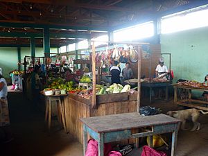
Pucallpa has nine main municipal markets. Five are in the Callería district. One is in the Yarinacocha district.
Municipal Markets
- Municipal Market 1: This market is by the Ucayali River.
- Municipal Market 2: It's in the city center, near the municipality building.
- Municipal Market 3: You can find it between Guillermo Sisley and Victor Montalvo streets.
- Municipal Market 4 (Micaela Bastidas): This market is in the Manantay district. It's on Centenario Avenue. In 2009, it also had a fair with 800 shops.
- Yarinacocha Municipal Market: This market is in the Yarinacocha district. It's a few blocks east of the main square.
- Manantay Municipal Market: This market is in the Manantay district. It's on Maya de Brito street.
- Wholesale Market: This market has been under construction since 2010.
- Retail Market: This market has also been under construction since 2010.
Other Markets
- Bellavista Market: This is a non-municipal market in the Callerino district. It's on Bellavista Avenue.
- La Hoyada Market: This is a non-municipal market by the river. It's on Sáenz Peña Avenue.
To help with trade, transfers between markets were set up. This helped the economy. In 2014, a large hypermarket opened on Centenario Avenue. Big stores like Real Plaza and Ripley opened there. This created 200 jobs.
Culture
Architecture
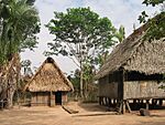
The way houses are built in Pucallpa has changed a lot. Native groups used to live in large communal homes called maloca. Now, many build individual houses on stilts. They often use wood, which is important for rural buildings. Some groups still use the maloca for ceremonies. With mosquito nets, people stopped using separate sleeping houses. They built bigger main houses. Over time, buildings became smaller. Fewer families lived in one house. Today, traditional houses are mostly found in rural areas.
Since the 1970s, many buildings have been updated. In the city center, cement is often used. In other areas, wood, especially mahogany, is used for protection. Some buildings have jungle-inspired designs. The city's architecture is becoming more modern. Cement is now the main building material. The Public Clock in Plaza Grau is an example. It has 8 floors with images and a clock on each side. The Immaculate Conception Cathedral is in the Plaza de Armas. It is the largest and most famous cathedral in the city.
Cuisine
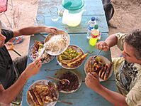
Pucallpa's food is a special version of Peruvian cuisine. It uses animals found in the region. The jungle area of Peru has many different animals. So, people traditionally eat various meats. These include wild meats like suri (a type of grub), tapir, and local rodents. Armadillo and land turtle are also eaten. The paiche is a very important fish. It is the second largest freshwater fish. It can weigh up to 300 kilos (660 pounds) and be over 2.5 meters (8 feet) long.
Religion
The main religion in Pucallpa is Christianity. The biggest tradition is the festival of San Juan. In rural areas, native customs are also common. Catholicism is very popular. Pucallpa has the only cathedral in Ucayali. It is located in the Plaza de Armas. Other Christian groups also have churches there.
Sport
In Pucallpa, the most popular sport is football, also known as soccer. This is true for most of Peru. The three main football clubs in Pucallpa are Sport Loreto, Deportivo Pucallpa, and Deportivo Bancos. The main place for football games is the Estadio Aliardo Soria Pérez. It is in the city center and can hold 25,000 people. Other sports places include the San Fernando Closed Coliseum and the Olympic swimming pool.
Education
Education has always been important in Pucallpa. Franciscan missionaries started formal education around the time the town was founded.
Education has grown a lot since then. In 2010, there were 700 public schools and 60 private schools. The school with the most students was La Inmaculada. It had 2,879 students in 1998.
Here's a look at education levels:
- No education: 18,568 people (many are young children)
- Complete initial (preschool): 6,922 people
- Complete primary: 80,049 people
- Complete secondary: 106,672 people
For university, the main ones are:
- The public University of Ucayali (UNU)
- The National Intercultural University of the Amazon (UNIA)
- The University of Peru (UAP)
In 2010, the government made an agreement with Brazil. This was to encourage education and cultural exchange between the two countries.
Transport
Air Travel
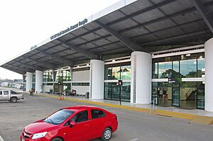
Pucallpa has the most important airport in the region. It is called FAP Captain David Abensur Rengifo International Airport. It was built in 1934. Flights arrive daily from different parts of Peru. Lima is the main destination. You can also fly to Iquitos and Tarapoto. Sometimes, special flights are added for small towns. You can also get flights to Brazil.
Road Travel
Pucallpa is one of the few cities in the Peruvian jungle connected by road. It is the end point of the Federico Basadre highway. This highway connects the city to other roads. These roads go to Aguaytía, Tingo María, Huánuco, and Lima. This is the only land route. So, the highway is very important for moving goods. The road is not fully paved yet. This can cause traffic problems, especially during rainy seasons.
River Travel
Pucallpa is a key river port. The Ucayali River connects it to Iquitos. It also connects to Leticia, a city where Peru, Colombia, and Brazil meet. River transportation was important even before the highway was built. It helped explorers and immigrants arrive.
Public Services
Hygiene
One big problem in Pucallpa is the pollution of Lake Yarinacocha. This lake is where the city's drainage ends up. This pollution has harmed the lake and its animals. The city has been working to improve pollution control since 1960. One idea is to use "ecological bathrooms."
Because of the city's climate, poor hygiene can lead to serious illnesses. For example, constant humidity during the rainy season has caused cases of dengue fever.
See also
 In Spanish: Pucallpa para niños
 | Dorothy Vaughan |
 | Charles Henry Turner |
 | Hildrus Poindexter |
 | Henry Cecil McBay |


