ʻĀinapō Trail facts for kids
Quick facts for kids |
|
|
ʻĀinapō Trail
|
|
 |
|
| Nearest city | Mauna Loa, Hawaii |
|---|---|
| Built | 1870 |
| NRHP reference No. | 74000290 |
| Added to NRHP | August 30, 1974 |
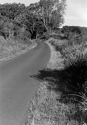
The ʻĀinapō Trail is a very old path on Mauna Loa, one of the biggest volcanoes in Hawaii. For many years, it was the main way to reach the top of the mountain. People used this trail from ancient times until about 1916.
The trail starts low on the mountain, around 2,000 feet (610 m) up. It then climbs all the way to the summit crater called Mokuaweoweo, which is about 13,200 feet (4,023 m) high! Sometimes, people called it the Menzies Trail. This was named after Archibald Menzies, who was one of the first non-Hawaiians to climb the mountain in 1794. The ʻĀinapō Trail is so important that it was added to the National Register of Historic Places in 1974.
Contents
History of the ʻĀinapō Trail
This trail is about 35 miles (55 km) long. It starts near a small community called Kapapala, close to Pahala. In Ancient Hawaii, people used this path to make special offerings to Pele, the goddess of volcanoes, during eruptions.
What the Trail's Name Means
The name ʻāina pō comes from the Hawaiian language. It means "darkened land." This is because thick clouds often cover the middle parts of the trail. Higher up, above the clouds, the land changes. It becomes very dry and is mostly made of barren lava rock.
Camps and Markers on the Trail
Along the trail, there were special camps. These camps offered places for travelers to rest. They also helped people get used to the higher altitude, or elevation. The camps had simple huts or shelters made from rocks. One shelter was even inside a lava tube, which is a natural tunnel formed by flowing lava.
In some places, the trail was hard to see. So, people built rock cairns (piles of stones) to mark the way. These cairns were placed so that climbers could easily spot them against the sky as they moved up the mountain.
Early Explorers on the Trail
In 1794, a scientist named Archibald Menzies used the ʻĀinapō Trail. He was part of the Vancouver Expedition. About 100 Hawaiian helpers carried his supplies. Menzies used a barometer (a tool that measures air pressure) to figure out how high the summit was.
Later, in 1840, Lieutenant Charles Wilkes tried to climb Mauna Loa. He was with the United States Exploring Expedition. He first tried a shorter path. But it was too slow, so he switched to the ʻĀinapō Trail to reach the top.
The trail was made wider in 1870. It was widened again in 1913. This was done so that horses and mules could carry more visitors to the summit.
The Trail's Decline and Return
In 1915, the United States Army built a new trail. This new path went straight from Kilauea Crater to Mokuaweoweo. When Hawaii Volcanoes National Park was created in 1916, the National Park Service took care of this new trail.
Because of the new trail, the old ʻĀinapō Trail was used less and less. The lower parts of the historic trail were on private land used for ranching and farming.
What Remains Today
Today, only about 11 miles (18 km) of the original trail are left. This section is above 11,650 feet (3,551 m) in elevation. It is still in its original condition.
This special section of the trail was added to the National Register of Historic Places on August 30, 1974. It is also a state historic site in Hawaii.
In the late 1990s, a new shelter was built. It is at a historic camp site, about 7,750 feet (2,362 m) up the mountain.
The lower area of Kapapala is now a private ranch. However, you can still arrange to go hunting or camping there. Today, people can use modern trails to reach the historic part of the ʻĀinapō Trail. These trails start from Ainapo Road, north of Hawaii Belt Road, and go all the way to the summit.
 | Anna J. Cooper |
 | Mary McLeod Bethune |
 | Lillie Mae Bradford |


