Akron, Pennsylvania facts for kids
Quick facts for kids
Akron, Pennsylvania
|
|
|---|---|
|
Borough
|
|

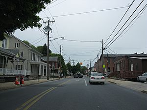
Main Street at Pennsylvania Route 272
|
|

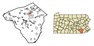
Location of Akron in Lancaster County, Pennsylvania (left) and of Lancaster County in Pennsylvania (right)
|
|
| Country | United States |
| State | Pennsylvania |
| County | Lancaster |
| Area | |
| • Total | 1.23 sq mi (3.19 km2) |
| • Land | 1.23 sq mi (3.18 km2) |
| • Water | 0.01 sq mi (0.02 km2) |
| Elevation | 509 ft (155 m) |
| Population
(2020)
|
|
| • Total | 4,152 |
| • Density | 3,383.86/sq mi (1,307.03/km2) |
| Time zone | UTC-5 (EST) |
| • Summer (DST) | UTC-4 (EDT) |
| ZIP Code |
17501
|
| Area code(s) | 717 |
Akron is a small town, called a borough, located in Lancaster County, Pennsylvania, in the United States. In 2020, about 4,169 people lived here.
Contents
A Look Back at Akron's History
Akron officially became a borough in 1895. Before that, it was a small village known as New Berlin. A railroad once ran through Akron, with a station right in town. There was also a trolley system in some parts of the borough. Today, the old railroad path is a walking and biking trail called the Warwick to Ephrata Rail Trail.
Akron's Location and Landscape
Akron is found in the northern part of Lancaster County, Pennsylvania. It's next to the borough of Ephrata to the north. Two main roads, Main Street and 7th Street (Pennsylvania Route 272), go through the town.
Lancaster, the main city of the county, is about 11 miles southwest. Reading is about 21 miles to the northeast. Akron sits on top of a hill. The town covers about 1.23 square miles of land. A stream called Cocalico Creek flows along the northern edge of Akron. It eventually joins the Conestoga River, which then flows into the large Susquehanna River.
Schools in Akron
Elementary Schools
- Akron Elementary School is part of the Ephrata Area School District.
What is Akron's Economy Like?
Akron's economy is mostly made up of small businesses. Since it's a smaller, mostly residential town, there aren't many large companies. The main office for North America of the Mennonite Central Committee is located here. This group also started the Fair Trade store Ten Thousand Villages.
Fun Things to Do in Akron
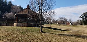
Loyd H. Roland Memorial Park, also known as Akron Park, is a big park with over 70 acres. You can find it on Main Street on the east side of Akron. The park has many cool features for everyone to enjoy:
- Baseball fields
- Tennis courts
- A beach volleyball court
- A basketball court
- A playground
- Hiking trails
- A pond
- Picnic areas
- A gazebo
- An 18-hole disc golf course
Akron's Unique Traditions
Akron is one of many towns in Pennsylvania that has a special way to celebrate New Year's Eve. They have an event called the "Shoe-In." It starts a few hours before midnight with fun activities for kids, carriage rides, music, and a bonfire. People bring children's shoes to donate to those in need. To honor the town's history of shoemaking, a giant sneaker is lowered at midnight!
Images for kids
See also
 In Spanish: Akron (Pensilvania) para niños
 | Madam C. J. Walker |
 | Janet Emerson Bashen |
 | Annie Turnbo Malone |
 | Maggie L. Walker |


