Alger, Ohio facts for kids
Quick facts for kids
Alger, Ohio
|
|
|---|---|
|
Village
|
|

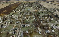
Alger, Ohio - November 2014
|
|

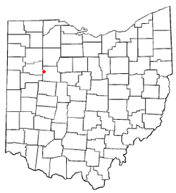
Location of Alger, Ohio
|
|

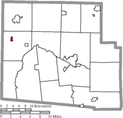
Location of Alger in Hardin County
|
|
| Country | United States |
| State | Ohio |
| County | Hardin |
| Township | Marion |
| Area | |
| • Total | 0.30 sq mi (0.77 km2) |
| • Land | 0.30 sq mi (0.77 km2) |
| • Water | 0.00 sq mi (0.00 km2) |
| Elevation | 984 ft (300 m) |
| Population
(2020)
|
|
| • Total | 837 |
| • Estimate
(2023)
|
824 |
| • Density | 2,827.70/sq mi (1,092.41/km2) |
| Time zone | UTC-5 (Eastern (EST)) |
| • Summer (DST) | UTC-4 (EDT) |
| ZIP code |
45812
|
| Area code(s) | 419 and 567 |
| FIPS code | 39-01210 |
| GNIS feature ID | 2397930 |
Alger is a small village in Hardin County, Ohio, United States. It is pronounced like "AL-jer". In 2020, about 837 people lived there.
Contents
History of Alger
Alger started as a settlement along a railroad and a turnpike, which is now State Route 235. It was founded after a large marsh area called the Scioto marsh was drained.
How Alger Got Its Name
The village was first called Jagger. It was named in 1882 after Elias Jagger, who helped plan the town. Later, its name changed to Alger. This new name honors Russell A. Alger, who was the 20th Governor of Michigan. The village officially became a town in 1896.
Geography of Alger
Alger is located in the state of Ohio. You can find it on State Route 235. It is about 4 miles (6.4 km) south of a town called Ada.
Size of the Village
According to the United States Census Bureau, Alger is quite small. It covers an area of about 0.28 square miles (0.72 square kilometers). All of this area is land, with no large bodies of water.
People of Alger
The number of people living in Alger has changed over the years. A census is like a big count of everyone living in a place.
| Historical population | |||
|---|---|---|---|
| Census | Pop. | %± | |
| 1900 | 462 | — | |
| 1910 | 730 | 58.0% | |
| 1920 | 787 | 7.8% | |
| 1930 | 857 | 8.9% | |
| 1940 | 811 | −5.4% | |
| 1950 | 943 | 16.3% | |
| 1960 | 1,068 | 13.3% | |
| 1970 | 1,071 | 0.3% | |
| 1980 | 992 | −7.4% | |
| 1990 | 864 | −12.9% | |
| 2000 | 888 | 2.8% | |
| 2010 | 860 | −3.2% | |
| 2020 | 837 | −2.7% | |
| 2023 (est.) | 824 | −4.2% | |
| U.S. Decennial Census | |||
Alger's Population in 2010
In 2010, the census showed that 860 people lived in Alger. These people lived in 347 households. A household is a group of people living together in one home. About 232 of these households were families.
The village had about 3,071 people per square mile. There were 413 homes in total.
Who Lives in Alger?
Many different kinds of people live in Alger. Most residents were White. A small number of people were African American, Native American, or Asian. Some people identified with two or more races. About 1.2% of the population was Hispanic or Latino.
Households and Families
About 34% of households had children under 18 living there. Nearly half of the households were married couples. Some homes had a female head of household without a husband. A few had a male head of household without a wife. About one-third of households were not families.
About 28% of all households had only one person living there. Around 14% of homes had someone aged 65 or older living alone. The average household had about 2.48 people. The average family had about 3 people.
Age Groups
The average age of people in Alger in 2010 was 37.1 years old.
- About 27% of residents were under 18 years old.
- About 6.5% were between 18 and 24 years old.
- About 28% were between 25 and 44 years old.
- About 24% were between 45 and 64 years old.
- About 15% were 65 years old or older.
There were slightly more females (53.8%) than males (46.2%) in the village.
Transportation in Alger
State Route 235 is an important road that runs through Alger. It helps people travel to and from the village.
Famous People from Alger
- Ray Brown – He was a famous baseball pitcher for the Homestead Grays. He is also a member of the Baseball Hall of Fame.
See also
 In Spanish: Alger (Ohio) para niños
 | Janet Taylor Pickett |
 | Synthia Saint James |
 | Howardena Pindell |
 | Faith Ringgold |

