Allabands Mill Stream (Isaac Branch tributary) facts for kids
Quick facts for kids Allabands Mill Stream |
|
|---|---|
|
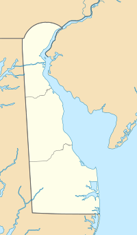
Location of Allabands Mill Stream mouth
|
|
| Other name(s) | Tributary to Isaac Branch |
| Country | United States |
| State | Delaware |
| County | Kent |
| Physical characteristics | |
| Main source | divide between Allabands Mill Stream and Willow Grove Prong (Choptank River) about 2 miles west-southwest of Alms House, Delaware 58 ft (18 m) 39°06′55″N 075°36′14″W / 39.11528°N 75.60389°W |
| River mouth | Isaac Branch about 0.5 miles east of Wild Quail, Delaware 39 ft (12 m) 39°05′41″N 075°36′30″W / 39.09472°N 75.60833°W |
| Length | 1.80 mi (2.90 km) |
| Basin features | |
| Progression | north |
| River system | St. Jones River |
| Basin size | 0.80 square miles (2.1 km2) |
| Tributaries |
|
| Bridges | Jebb Road, Westville Road |
Allabands Mill Stream is a small stream, about 1.80 mi (2.90 km) long, located in Kent County, Delaware. It flows into a larger stream called Isaac Branch. Think of it as a small "feeder" stream for Isaac Branch.
Contents
What is Allabands Mill Stream?
Allabands Mill Stream is a natural waterway in the state of Delaware, United States. It is part of a bigger river system that eventually leads to the St. Jones River. This stream helps carry water from the land into the larger rivers.
History of the Stream's Name
Allabands Mill Stream got its name from a person named William Allaband. In the early 1800s, William Allaband owned and ran a grist mill nearby. A grist mill is a special building where grain, like corn or wheat, is ground into flour. The stream was important for the mill, likely providing water power.
Where Does the Stream Flow?
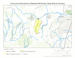
Allabands Mill Stream begins its journey about 2 miles (3.2 km) west-southwest of a place called Alms House in Kent County, Delaware. It starts in an area where the land divides, sending water either towards this stream or towards Willow Grove Prong.
From its starting point, the stream flows generally north. It travels for a short distance until it meets and joins Isaac Branch. This meeting point is about 0.5 miles (0.8 km) east of Wild Quail, Delaware.
The Stream's Watershed
A watershed is like a big bowl or area of land where all the rain and snowmelt drain into a common stream, river, or lake. The watershed for Allabands Mill Stream covers about 0.80 square miles (2.1 km2) (2.07 sq km) of land.
This area gets about 44.8 inches (114 cm) of rain and other precipitation each year. Only a small part of this watershed, about 2%, is covered by forests. The rest might be farms, towns, or other types of land.
Maps
 | Precious Adams |
 | Lauren Anderson |
 | Janet Collins |


