Alveringem facts for kids
Quick facts for kids
Alveringem
|
|||
|---|---|---|---|

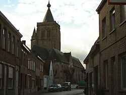
Saint Audomar Church in Alveringem
|
|||
|
|||
| Country | Belgium | ||
| Community | Flemish Community | ||
| Region | Flemish Region | ||
| Province | West Flanders | ||
| Arrondissement | Veurne | ||
| Area | |||
| • Total | 80.01 km2 (30.89 sq mi) | ||
| Population
(2018-01-01)Lua error in Module:Wd at line 1575: attempt to index field 'wikibase' (a nil value).
|
|||
| • Total | Lua error in Module:Wd at line 1,575: attempt to index field 'wikibase' (a nil value). | ||
| Postal codes |
8690, 8691
|
||
| Area codes | 058 | ||
| Website | www.alveringem.be | ||
Alveringem is a municipality located in the Belgian province of West Flanders. A municipality is like a town or a district that has its own local government.
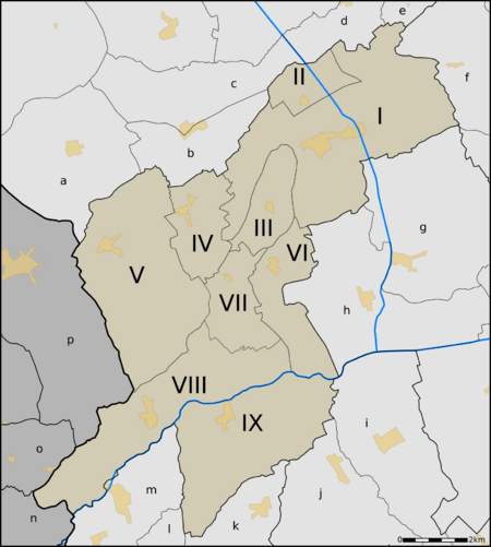
Alveringem is made up of nine smaller towns or villages. These include Alveringem itself, plus Beveren-aan-de-IJzer, Gijverinkhove, Hoogstade, Izenberge, Leisele, Oeren, Sint-Rijkers, and Stavele.
In 2006, about 4,887 people lived in Alveringem. The total area of the municipality is about 80 square kilometers. This means there are about 61 people living in each square kilometer.
The mayor of Alveringem is Gerard Liefooghe. He has been the mayor since 2006 and belongs to the Gemeentebelangen political party. A mayor is the leader of the local government.
Exploring Alveringem's Towns
Alveringem is a rural area, meaning it has lots of countryside and not many people living close together. The number of people living here has gone down a bit in recent years.
The municipality is quite large and includes nine smaller towns, also called deelgemeentes. The main town is Alveringem, located in the northeast part of the municipality.
Over the years, some of these towns joined together to form the larger municipality we see today. For example, in 1971, Hoogstade, Oeren, and Sint-Rijkers became part of Alveringem. Later, in 1977, Leisele and Stavele also joined.
Leisele had already included Gijverinkhove and Izenberge since 1971. Beveren-aan-de-IJzer was part of Stavele. So, by 1977, the new, bigger municipality of Alveringem included all nine of these rural towns.
| # | Name | Area | Population (1999) |
|---|---|---|---|
| I | Alveringem | 1.583 (*) | |
| II | Oeren | (*) | |
| III | Sint-Rijkers | (*) | |
| IV | Izenberge | 395 | |
| V | Leisele | 774 | |
| VI | Hoogstade | 352 | |
| VII | Gijverinkhove | 308 | |
| VIII | Beveren | 659 | |
| IX | Stavele | 661 |
(*) The number of people living in the small villages of Oeren and Sint-Rijkers is counted together with the population of Alveringem proper. Source: Streekplatform Westhoek [1]
Because Alveringem covers a large rural area, it shares borders with many other small villages and towns. These include:
|
|
Map of Alveringem
See also
 In Spanish: Alveringem para niños
 | DeHart Hubbard |
 | Wilma Rudolph |
 | Jesse Owens |
 | Jackie Joyner-Kersee |
 | Major Taylor |


