
West Flanders facts for kids
Quick facts for kids West Flanders (Dutch: West-VlaanderenFrench: Flandre-Occidentale) |
|||
| Province of Belgium | |||
 Bruges from the Belfry
|
|||
|
|||
| Country | |||
|---|---|---|---|
| Region | |||
| Capital | Bruges | ||
| - coordinates | 51°13′N 3°14′E / 51.217°N 3.233°E | ||
| Highest point | Kemmelberg | ||
| - location | Heuvelland, Ypres, West Flanders | ||
| - elevation | 156 m (512 ft) | ||
| - coordinates | 50°46′45″N 2°48′52″E / 50.77917°N 2.81444°E | ||
| Lowest point | North Sea | ||
| - elevation | 0 m (0 ft) | ||
| Area | 3,125 km² (1,207 sq mi) | ||
| Population | 1,186,532 (1 January 2017) | ||
| Density | 380 /km² (984 /sq mi) | ||
| Subdivisions | 8 Arrondissements 64 Municipalities |
||
| Governor | Carl Decaluwé | ||
| Timezone | CET (UTC+1) | ||
| - summer (DST) | CEST (UTC+2) | ||
| Postal codes | 8000-8999 | ||
| ISO 3166-2 | BE-VWV | ||


West Flanders (Dutch: West-Vlaanderen) is one of the ten provinces in Belgium. It is also one of the five provinces in the Flemish Region, which is also called Flanders. West Flanders is the most western province in Flanders.
Its capital city is Bruges (Dutch: Brugge).
The entire Belgian North Sea coast is in West Flanders. This coast is a very popular place for tourism. A special tram line runs along the whole coast. It goes from De Panne near the French border, through the port city of Ostend (Dutch: Oostende), all the way to Knokke-Heist near the Dutch border.
Contents
Geography of West Flanders

The province of West Flanders is in a very busy part of Western Europe. Many people live here. It has about 1,186,532 people. This means there are about 379.7 people living in each square kilometer.
West Flanders borders the North Sea. It also shares borders with northern France and Zeeland in the Netherlands. Inside Belgium, it borders the Flemish province of East Flanders and the Walloon province of Hainaut. West Flanders is the only Belgian province that touches both France and the Netherlands.
The province covers an area of 3,125 km2 (1,207 sq mi). It is the largest province in the Flemish Region by size. It is also the fifth largest province in all of Belgium.
West Flanders has a very flat landscape. It has many polders, which are low-lying lands protected from the sea. There are also dunes along the coast. In one area, there are small hills called the 'Westvlaamse Bergen'. The highest point in the province is the Kemmelberg, which is 159 meters high.
The main rivers in West Flanders are the Leie and the Yser. The Yser river flows into the North Sea at the town of Nieuwpoort. The Leie river flows into the Scheldt river.
Industries and Tourism
In the northern part of West Flanders, most industries are found around the cities of Bruges and Ostend. Both of these cities have important seaports. These are the port of Bruges-Zeebrugge and the port of Ostend. The southern part of the province is well-known for its textile industry, which makes fabrics and clothes.
Tourism is also a very important industry in West Flanders. Many people visit the Belgian coast for holidays. The historic center of Bruges is also a big attraction. People also visit places around Ypres where important battles happened during World War I.
How West Flanders is Governed
The province of West Flanders is split into 8 main areas called arrondissements. These arrondissements are then divided into a total of 64 smaller areas called municipalities. This system helps to manage the different towns and cities within the province.

Images for kids
-
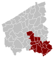
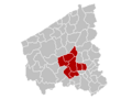
Map of Kortrijk Arrondissement
-
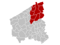
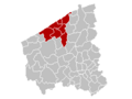
Map of Bruges Arrondissement
-
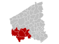
Location of Kortrijk Arrondissement
-
Map of Diksmuide Arrondissement
-
Map of Ostend Arrondissement
-
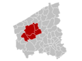
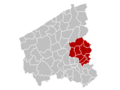
Map of Roeselare Arrondissement
-
Map of Tielt Arrondissement
-
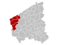
Map of Veurne Arrondissement
-
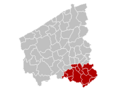
Map of Ypres Arrondissement


See also
 In Spanish: Provincia de Flandes Occidental para niños
