Anacoco, Louisiana facts for kids
Quick facts for kids
Anacoco, Louisiana
|
|
|---|---|
|
Village
|
|

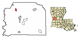
Location of Anacoco in Vernon Parish, Louisiana.
|
|

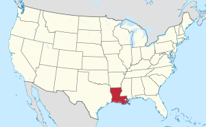
Location of Louisiana in the United States
|
|
| Country | United States |
| State | Louisiana |
| Parish | Vernon |
| Incorporated | 1979 |
| Area | |
| • Total | 3.09 sq mi (8.00 km2) |
| • Land | 3.08 sq mi (7.98 km2) |
| • Water | 0.01 sq mi (0.02 km2) |
| Elevation | 335 ft (102 m) |
| Population
(2020)
|
|
| • Total | 851 |
| • Density | 276.03/sq mi (106.58/km2) |
| Time zone | UTC-6 (CST) |
| • Summer (DST) | UTC-5 (CDT) |
| Area code(s) | 337 |
| FIPS code | 22-01920 |
Anacoco is a small village located in Vernon Parish, Louisiana, in the United States. In 2020, about 851 people lived there. It is part of the wider Fort Johnson South area.
Contents
History of Anacoco
Anacoco got its name from a nearby bayou and prairie. People believe the name originally came from a Spanish phrase, "Llano Cuco." This phrase means "Raincrow Plain." Later, the French called it "l'Anacoco." English speakers then shortened it to just "Anacoco."
Fun Things to Do in Anacoco
- South Toledo Bend State Park is a cool place to visit near Anacoco. It's located on small hills that reach over and into the Toledo Bend Reservoir. You can do lots of fun things there like bass fishing (they even have tournaments!), hiking, cycling, and birding. It's also a great spot for picnics and camping. Keep an eye out for bald eagles, as they often nest in this area!
Geography of Anacoco
Anacoco is located at 31°15′10″N 93°20′38″W / 31.25278°N 93.34389°W.
The village covers a total area of about 3.1 square miles (8.0 square kilometers). Almost all of this area is land.
Anacoco's Climate
Anacoco has a climate with hot, humid summers and mild winters. This type of weather is called a humid subtropical climate. On climate maps, you might see it labeled as "Cfa."
| Climate data for Anacoco, Louisiana | |||||||||||||
|---|---|---|---|---|---|---|---|---|---|---|---|---|---|
| Month | Jan | Feb | Mar | Apr | May | Jun | Jul | Aug | Sep | Oct | Nov | Dec | Year |
| Mean daily maximum °C (°F) | 14 (57) |
16 (61) |
21 (69) |
24 (76) |
29 (84) |
32 (89) |
34 (93) |
34 (93) |
31 (87) |
26 (78) |
20 (68) |
16 (60) |
24 (76) |
| Mean daily minimum °C (°F) | 2 (36) |
4 (39) |
8 (46) |
12 (53) |
16 (61) |
20 (68) |
22 (71) |
21 (70) |
18 (65) |
12 (54) |
7 (45) |
3 (38) |
12 (54) |
| Average precipitation mm (inches) | 130 (5.3) |
120 (4.6) |
120 (4.9) |
91 (3.6) |
120 (4.8) |
140 (5.6) |
91 (3.6) |
86 (3.4) |
91 (3.6) |
110 (4.4) |
140 (5.5) |
140 (5.6) |
1,400 (55) |
| Source: Weatherbase | |||||||||||||
People of Anacoco
| Historical population | |||
|---|---|---|---|
| Census | Pop. | %± | |
| 1980 | 820 | — | |
| 1990 | 823 | 0.4% | |
| 2000 | 866 | 5.2% | |
| 2010 | 869 | 0.3% | |
| 2020 | 851 | −2.1% | |
| U.S. Decennial Census | |||
In 2000, there were 866 people living in Anacoco. These people made up 346 households and 255 families. The village had about 280 people per square mile (108 people per square kilometer).
About 34.4% of households had children under 18 living with them. Most households (63.0%) were married couples. The average household had 2.50 people.
The population was spread out by age. About 26.9% of the people were under 18 years old. The median age in the village was 38 years.
See also
 In Spanish: Anacoco para niños

