Andover, Illinois facts for kids
Quick facts for kids
Andover
|
|
|---|---|
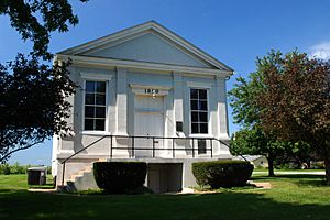
Jenny Lind Chapel in Andover
|
|
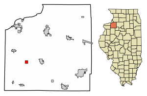
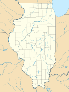
Location of Andover in Henry County, Illinois.
|
|

Location of Illinois in the United States
|
|
| Country | United States |
| State | Illinois |
| County | Henry |
| Area | |
| • Total | 0.99 sq mi (2.57 km2) |
| • Land | 0.99 sq mi (2.57 km2) |
| • Water | 0.00 sq mi (0.00 km2) |
| Population
(2020)
|
|
| • Total | 555 |
| • Density | 560.04/sq mi (216.20/km2) |
| Time zone | UTC-6 (CST) |
| • Summer (DST) | UTC-5 (CDT) |
| ZIP Code(s) |
61233
|
| Area code(s) | 309 |
| FIPS code | 17-01491 |
Andover is a small village in Henry County, Illinois, in the United States. In 2020, about 555 people lived there.
Contents
History of Andover
Andover is the oldest community in Henry County. It was the first place in the county to be settled as a town. The first mill was built there between 1836 and 1837. Soon, Andover became an important stop for wagons traveling through the area.
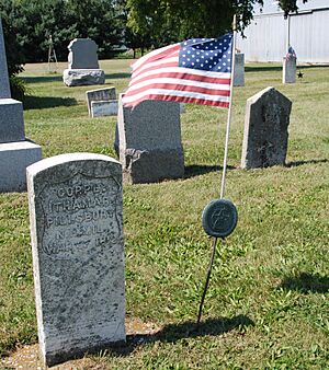
Andover was started in September 1835 by a minister named Ithamar Pillsbury. He was working for a group called the Andover Colony. Pillsbury had been a soldier in the War of 1812. After a close call during the war, he decided to become a Presbyterian minister.
Swedish Immigrants and Jenny Lind Chapel
In 1849, a Swedish Lutheran minister named Lars Paul Esbjörn arrived in Andover with a group of Swedish immigrants. They worked together to build the Jenny Lind Chapel. This church became very important to the Swedish Lutheran community.
The church was built with money mostly given by a famous Swedish singer, Jenny Lind. She was on a concert tour in the eastern United States at the time. The cemetery next to the chapel is where Jonas Swensson, an important leader of the Augustana Synod church group, is buried.
After some changes in 1948, Jenny Lind Chapel was recognized as a special place for the Augustana Evangelical Lutheran Church. In 1975, it was named a National Historic Site and added to the National Register of Historic Places. This means it's a very important historical landmark.
Geography of Andover
Andover is located at coordinates 41°17′42″N 90°17′26″W / 41.29500°N 90.29056°W.
The village covers a total area of about 0.99 square miles (2.57 square kilometers). All of this area is land.
Population and People
| Historical population | |||
|---|---|---|---|
| Census | Pop. | %± | |
| 1880 | 302 | — | |
| 1890 | 259 | −14.2% | |
| 1900 | 238 | −8.1% | |
| 1910 | 222 | −6.7% | |
| 1920 | 281 | 26.6% | |
| 1930 | 197 | −29.9% | |
| 1940 | 248 | 25.9% | |
| 1950 | 256 | 3.2% | |
| 1960 | 295 | 15.2% | |
| 1970 | 420 | 42.4% | |
| 1980 | 612 | 45.7% | |
| 1990 | 579 | −5.4% | |
| 2000 | 594 | 2.6% | |
| 2010 | 578 | −2.7% | |
| 2020 | 555 | −4.0% | |
| U.S. Decennial Census | |||
In 2020, there were 555 people living in Andover. There were 185 households, and 135 of these were families. The village had about 242 housing units.
About 26.5% of the people in Andover were under 18 years old. About 19.3% were 65 years old or older. The average age of people in Andover was 41.8 years.
See also
 In Spanish: Andover (Illinois) para niños


