Anras facts for kids
Quick facts for kids
Anras
|
||
|---|---|---|

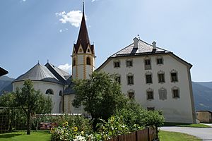
Anras Castle with St Stephen's Church
|
||
|
||

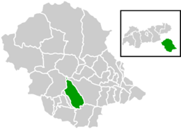
Location within Lienz district
|
||
| Country | Austria | |
| State | Tyrol | |
| District | Lienz | |
| Area | ||
| • Total | 62.07 km2 (23.97 sq mi) | |
| Elevation | 1,261 m (4,137 ft) | |
| Time zone | UTC+1 (CET) | |
| • Summer (DST) | UTC+2 (CEST) | |
| Postal code |
9912
|
|
| Area code | 04846 | |
| Vehicle registration | LZ | |
| Website | www.anras.at | |
Anras is a small town, also known as a municipality, located in the Lienz area of Tyrol, Austria. It's a charming place with a rich history and beautiful natural surroundings.
Contents
Where is Anras Located?
Anras is found in the eastern part of Tyrol, specifically in the Puster Valley. This valley stretches along the upper part of the Drava river. The town is nestled between two mountain ranges. To the north are the Villgraten Mountains, and to the south are the foothills of the Lienz Dolomites. These are the westernmost peaks of the Gailtal Alps.
Many of the farms in Anras are built on sunny terraces. Others are located on the valley floor, north of the Drava river.
What are Cadastral Communities?
The area of Anras is divided into smaller parts called cadastral communities. Think of them as official land divisions. The main parts of Anras include Anras itself, along with Asch-Winkl and Ried.
A Look Back: The History of Anras
Anras has a long and interesting past, especially connected to its castle.
Anras Castle: A Bishop's Home
Around the year 1200, Anras Castle was built. It was a summer home for the Bishops of Brixen. These bishops were important religious leaders who also had political power. In 1236, a powerful ruler named Emperor Frederick II gave the bishops control over the lands around Anras. These lands stretched all the way to the town of Lienz.
In 1754, the castle was rebuilt in a fancy style called Baroque. It then became the main office for local leaders.
How Anras Became Part of Austria
The Brixen bishops, who were also called prince-bishops, ruled these territories for many centuries. However, in 1803, there was a big change called secularisation. This meant that the church's control over these lands ended, and they became part of the government's rule.
Today, the land around Anras is very fertile. It's known as the "East Tyrolean breadbasket" because it produces a lot of food, especially grains.
See also
 In Spanish: Anras para niños
 | Percy Lavon Julian |
 | Katherine Johnson |
 | George Washington Carver |
 | Annie Easley |


