Apatzingán facts for kids
Quick facts for kids
Apatzingán
|
||
|---|---|---|
|
City
|
||
| Apatzingán de la Constitución | ||

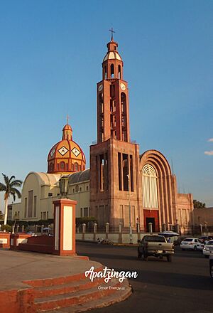
Immaculate Conception Cathedral, Apatzingán, Michoacán Mexico
|
||
|
||
| Nicknames:
La Perla de Tierra Caliente, Cuna de la Constitución Mexicana
|
||
| Country | Mexico | |
| State | Michoacán | |
| Municipality | Apatzingán | |
| Founded | 1617 | |
| Elevation | 325 m (1,066 ft) | |
| Population
(2010)
|
||
| • Total | 99,010 | |
| Time zone | UTC-6 (CST) | |
| • Summer (DST) | UTC-5 (CDT) | |
| Area code(s) | 453 | |
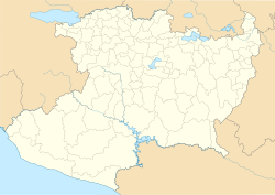
Apatzingán, officially known as Apatzingán de la Constitución, is a lively city in the west-central part of Michoacán, a state in Mexico. It is an important city and the main hub for the surrounding Apatzingán municipality. People sometimes call it "La Perla de Tierra Caliente" (The Pearl of the Hot Land) or "Cuna de la Constitución Mexicana" (Cradle of the Mexican Constitution).
History of Apatzingán
Apatzingán has a very special place in Mexican history. In 1814, during the Mexican War of Independence, an important document called the Constitution of Apatzingán was signed here. This happened when Mexico was fighting for its freedom from the Spanish Empire. This constitution was a big step towards Mexico becoming an independent country.
In more recent times, the city has faced challenges, including events involving local groups and police.
Geography of Apatzingán
The Municipality of Apatzingán is located in the Tierra Caliente Valley. This area is known for its warm climate. The municipality covers an area of about 1,656.67 square kilometers (639.64 square miles). In 2010, it had a population of 99,010 people.
The city of Apatzingán is one of the largest cities in Michoacán. In 2015, it had about 128,250 residents. It is the sixth-largest city in the state. Other large cities include Morelia, Uruapan, Zamora, Lázaro Cárdenas, and Zitacuaro.
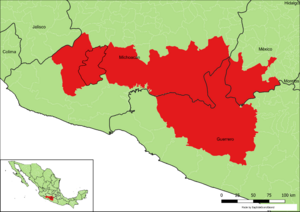
To the west of Apatzingán, you can find the major Sierra Madre del Sur mountain range. Also nearby is the municipality of Coalcomán de Vázquez Pallares.
Climate in Apatzingán
Apatzingán has a type of climate called a semi-arid climate. This means it's generally hot and dry. Even though it gets about 752 millimeters (29.6 inches) of rain each year, the high temperatures cause a lot of water to evaporate. This makes the climate feel dry.
| Climate data for Apatzingán | |||||||||||||
|---|---|---|---|---|---|---|---|---|---|---|---|---|---|
| Month | Jan | Feb | Mar | Apr | May | Jun | Jul | Aug | Sep | Oct | Nov | Dec | Year |
| Record high °C (°F) | 38.0 (100.4) |
39.0 (102.2) |
42.0 (107.6) |
43.0 (109.4) |
46.5 (115.7) |
44.0 (111.2) |
43.0 (109.4) |
39.5 (103.1) |
39.0 (102.2) |
41.5 (106.7) |
43.0 (109.4) |
37.0 (98.6) |
46.5 (115.7) |
| Mean daily maximum °C (°F) | 32.3 (90.1) |
33.8 (92.8) |
36.4 (97.5) |
39.0 (102.2) |
40.0 (104.0) |
37.8 (100.0) |
34.7 (94.5) |
34.1 (93.4) |
33.7 (92.7) |
34.1 (93.4) |
34.0 (93.2) |
32.9 (91.2) |
35.2 (95.4) |
| Daily mean °C (°F) | 24.7 (76.5) |
26.0 (78.8) |
28.4 (83.1) |
30.7 (87.3) |
32.7 (90.9) |
31.6 (88.9) |
29.2 (84.6) |
28.5 (83.3) |
28.2 (82.8) |
28.2 (82.8) |
27.3 (81.1) |
25.7 (78.3) |
28.4 (83.1) |
| Mean daily minimum °C (°F) | 17.1 (62.8) |
18.1 (64.6) |
20.3 (68.5) |
22.4 (72.3) |
25.4 (77.7) |
25.5 (77.9) |
23.6 (74.5) |
22.9 (73.2) |
22.7 (72.9) |
22.2 (72.0) |
20.7 (69.3) |
18.5 (65.3) |
21.6 (70.9) |
| Record low °C (°F) | 8.5 (47.3) |
10.0 (50.0) |
13.0 (55.4) |
13.0 (55.4) |
17.5 (63.5) |
15.0 (59.0) |
17.0 (62.6) |
18.5 (65.3) |
19.0 (66.2) |
14.0 (57.2) |
11.0 (51.8) |
10.0 (50.0) |
8.5 (47.3) |
| Average precipitation mm (inches) | 17.1 (0.67) |
1.1 (0.04) |
0.8 (0.03) |
0.6 (0.02) |
11.2 (0.44) |
129.5 (5.10) |
166.2 (6.54) |
175.2 (6.90) |
148.5 (5.85) |
81.9 (3.22) |
14.6 (0.57) |
5.2 (0.20) |
751.9 (29.60) |
| Average precipitation days (≥ 0.1 mm) | 1.3 | 0.4 | 0.3 | 0.2 | 1.6 | 11.4 | 14.6 | 14.3 | 12.3 | 5.6 | 1.5 | 0.6 | 64.1 |
| Source: Servicio Meteorologico Nacional | |||||||||||||
See also
 In Spanish: Apatzingán de la Constitución para niños
 | Georgia Louise Harris Brown |
 | Julian Abele |
 | Norma Merrick Sklarek |
 | William Sidney Pittman |


