Uruapan facts for kids
Quick facts for kids
Uruapan, Michoacán
|
||
|---|---|---|
| Uruapan del Progreso | ||
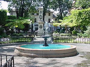
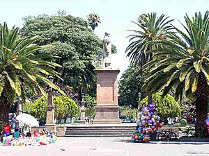
Uruapan Plaza
|
||
|
||
| Nickname(s):
Capital mundial del aguacate. (World capital of the avocado)
|
||
| Motto(s):
Salvaguarda del espíritu, la tradición y la mexicanidad. (Safeguard of the spirit, tradition, and Mexican nationalism)
|
||
| Country | Mexico | |
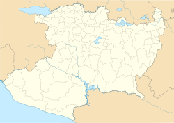
| State | Michoacán | |
| Municipality | Uruapan | |
| Founded | 1533 | |
| Founded by | Fray Juan de San Miguel | |
| Elevation | 1,620 m (5,310 ft) | |
| Population
(2020)
|
||
| • Total | 299,523 | |
| Time zone | UTC−6 (CST) | |
| • Summer (DST) | UTC−5 (CDT) | |
| Area code(s) | 452 | |
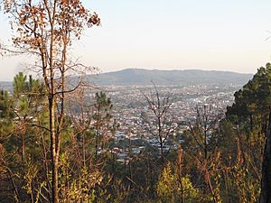
Uruapan is a large city in the Mexican state of Michoacán. It is the second biggest city in the state. Uruapan is located where the Purépecha highlands meet the warmer Tierra Caliente region. This location has made it an important city for trade and business for a very long time.
The Spanish took control of the city in 1522. The modern city was planned in 1534 by a friar named Juan de San Miguel. Uruapan played a big part in Mexico's fight for independence. It was also the capital of Michoacán for a while during a conflict with France. Today, Uruapan is known as the center of Mexico's avocado growing area. Most avocados from this region are sent from Uruapan to other parts of Mexico and around the world.
Contents
Exploring the City of Uruapan
Uruapan is the second most populated and economically important city in Michoacán. It sits at 1,620 meters (about 5,315 feet) above sea level. The city center has old buildings with unique designs, mixing Spanish and Moorish styles.
Historic Neighborhoods and Festivals
Uruapan has six old neighborhoods: San Miguel, San Pedro, San Francisco, Santa Maria Magdalena, San Juan Bautista, and Santiago. Each has its own old chapel. These neighborhoods celebrate their patron saints with colorful festivals. For example, you can see traditional dances like Los Negritos.
Main Plaza and Important Buildings
The heart of Uruapan is the large Plaza de Martires de Uruapan. Around this plaza, you'll find shops and important landmarks. On the north side is the La Huatápera Museum. Its name comes from a Purépecha word meaning "meeting place." This building was originally a hospital built in 1533 by Juan de San Miguel. It was the first hospital of its kind in the Americas! It helped sick people and also taught new skills.
The museum has a chapel called Santo Entierro with beautiful stone carvings. Inside, you can see paintings of angels and important Catholic figures. The rest of the building shows Moorish influences and displays local crafts. Next to the museum is the Immaculate Concepción church, built in the late 1900s.
The Casa de Cultura (Cultural Center) is on the west side of the museum. It was built in 1992 on the site of an old Franciscan monastery. The church of this monastery is now the city's main parish church. It was built in 1533 and still has its original 16th-century entrance.
Behind these buildings, there's a market called Mercado de Antojitos. Here, you can find delicious traditional foods like carnitas and quesadillas.
Barranca del Cupatitzio National Park
On the west side of Uruapan, you'll find the Barranca del Cupatitzio National Park. It's one of Mexico's most visited national parks. Even though it's surrounded by the city, it has very old trees, springs, and streams. The park protects the beginning of the Cupatitzio River. This river starts from springs, including one called "Rodilla del Diablo" (Devil's Knee). A local story says that Friar Juan de San Miguel made the Devil kneel, and his knee left a mark where the first spring appeared. The park has beautiful waterfalls, bridges, and fountains.
San Pedro Textile Factory
The San Pedro Factory is an old textile factory from the late 1800s. It used to make cotton, linen, and silk products. It's still working today, making bedspreads and tablecloths by hand. Part of the factory is now used for cultural events.
World's Narrowest House
Uruapan is home to the narrowest house in the world! It's listed in the Guinness Book of World Records. This tiny house is only 1.40 meters (about 4.6 feet) wide and 7.70 meters (about 25 feet) long. You can find it at 50-C Carrillo Puerto.
Festivals and Celebrations
- Palm Sunday Handcraft Market: This big market happens during Holy Week. Over a thousand artisans come to sell their crafts in the main city square.
- Festival de Velas: Around Day of the Dead, candles are lit to create figures in the plazas and streets.
- Avocado Festival: From mid-November to mid-December, this festival celebrates avocados with exhibitions and cultural events.
Delicious Local Food
Uruapan's food is a mix of different cultures. Some popular dishes include:
- Corundas: A type of tamale.
- Churipo: A beef and vegetable stew.
- Mutton barbacoa.
- Quesadillas with squash flowers.
- Sweet and spicy atole (a warm drink).
- Hot chocolate.
- Uchepos: Another type of tamale.
- Sweet potatoes and plantains cooked in many ways.
Uruapan Municipality
The city of Uruapan is the main center for the surrounding communities. This larger area is called the municipality. It covers about 954 square kilometers (368 square miles). The main communities outside the city are Capacuaro, Angahuan, and Jucutacato. Most people in these areas work in farming or forestry.
The municipality has a population of over 315,000 people. About 18,000 of them speak an indigenous language, mostly Purépecha. Traditional music here often features pirecuas and sons, played with wind instruments.
El Sabino Zoocriadero
The El Sabino Zoocriadero is a place where different exotic animals live. It's about 17 kilometers (10.5 miles) outside the city. Its main attraction is its crocodiles, but it also has lions, deer, ostriches, and turtles.
Economy and Products
For a long time, Uruapan has been an important farming area. People grow bananas, chicozapote, mamey, limes, oranges, lemons, and avocados. Today, Uruapan is the second most important city for business in Michoacán.
The Avocado Capital
Uruapan is known as the "world capital of avocado." This is because it has six big companies that pack avocados from the region. From here, avocados are sent all over Mexico and exported to the United States, Central America, Europe, and Japan. In 2000, Uruapan even made the Guinness Book of World Records for making the largest batch of guacamole! They made 1,288 kilograms (about 2,840 pounds) of guacamole from one ton of fresh avocados.
Macadamia Nuts
Macadamia nuts, which originally came from Australia, have been grown in Uruapan since the late 1900s. The city makes many products from these nuts, like flavored nuts, brittle, cookies, candies, and oil.
Handcrafts and Art
Uruapan has been a center for making maque since colonial times. Maque is a special type of lacquer used to decorate wooden items like plates, boxes, and gourds. Other crafts made here include masks, papel picado (cut paper designs), and textiles.
Geography and Nature
Climate of Uruapan
Uruapan has a humid subtropical climate with very wet summers and dry winters. The area is mountainous and part of the Trans-Mexican Volcanic Belt. The weather is a mix of temperate and tropical, with most rain falling in the summer.
| Climate data for Uruapan | |||||||||||||
|---|---|---|---|---|---|---|---|---|---|---|---|---|---|
| Month | Jan | Feb | Mar | Apr | May | Jun | Jul | Aug | Sep | Oct | Nov | Dec | Year |
| Record high °C (°F) | 31.7 (89.1) |
36.0 (96.8) |
39.0 (102.2) |
35.4 (95.7) |
35.6 (96.1) |
36.5 (97.7) |
33.0 (91.4) |
31.5 (88.7) |
33.0 (91.4) |
32.5 (90.5) |
34.5 (94.1) |
36.0 (96.8) |
39.0 (102.2) |
| Mean daily maximum °C (°F) | 24.7 (76.5) |
26.1 (79.0) |
28.3 (82.9) |
30.0 (86.0) |
30.1 (86.2) |
27.6 (81.7) |
26.3 (79.3) |
26.1 (79.0) |
26.0 (78.8) |
26.4 (79.5) |
26.0 (78.8) |
24.9 (76.8) |
26.9 (80.4) |
| Daily mean °C (°F) | 16.9 (62.4) |
17.8 (64.0) |
19.5 (67.1) |
21.2 (70.2) |
22.0 (71.6) |
21.4 (70.5) |
20.5 (68.9) |
20.3 (68.5) |
20.2 (68.4) |
19.9 (67.8) |
18.8 (65.8) |
17.6 (63.7) |
19.7 (67.5) |
| Mean daily minimum °C (°F) | 9.1 (48.4) |
9.4 (48.9) |
10.7 (51.3) |
12.5 (54.5) |
14.0 (57.2) |
15.3 (59.5) |
14.7 (58.5) |
14.6 (58.3) |
14.5 (58.1) |
13.3 (55.9) |
11.6 (52.9) |
10.3 (50.5) |
12.5 (54.5) |
| Record low °C (°F) | −1.0 (30.2) |
−0.1 (31.8) |
0.2 (32.4) |
−2.5 (27.5) |
1.0 (33.8) |
3.4 (38.1) |
7.2 (45.0) |
5.3 (41.5) |
3.1 (37.6) |
−0.5 (31.1) |
1.8 (35.2) |
−1.2 (29.8) |
−2.5 (27.5) |
| Average precipitation mm (inches) | 45.2 (1.78) |
10.5 (0.41) |
6.3 (0.25) |
9.0 (0.35) |
31.9 (1.26) |
270.5 (10.65) |
326.0 (12.83) |
338.1 (13.31) |
299.3 (11.78) |
138.3 (5.44) |
32.1 (1.26) |
13.5 (0.53) |
1,520.7 (59.87) |
| Average precipitation days (≥ 0.1 mm) | 2.4 | 1.7 | 1.2 | 1.2 | 4.8 | 18.0 | 23.9 | 23.8 | 21.9 | 13.2 | 4.2 | 2.1 | 118.4 |
| Source 1: Servicio Meteorologico Nacional | |||||||||||||
| Source 2: Servicio Meteorologico Nacional (extremes) | |||||||||||||
Plants and Animals of Uruapan
The forests around Uruapan have a mix of pine, oak, and tropical trees. Common trees used for wood include pine, oak, and oyamel fir. Areas without trees often have different kinds of bushes. You can find animals like coyotes, skunks, deer, foxes, cacomixtles, hares, opossums, ducks, and other birds here.
Rivers and Waterfalls
The municipality has many small rivers that flow into the Tepalcatepec basin. The main river is the Cupatitzio. Other important water spots include the Caltzontzin Reservoir and beautiful waterfalls like Salto Escondido and La Tzaráracua.
The La Tzararacua Ecotourism Center is about 10 kilometers (6 miles) south of the city. It's famous for its 40-meter (131-foot) high waterfall. Nearby is the Tzararcuita (Little Tzararacua), which is 16 meters (52 feet) high.
History of Uruapan
What Does Uruapan Mean?
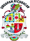
The name Uruapan comes from the Purépecha word uruapani. This word means "plants that flower and fruit at the same time" or "those which are always giving fruit." The city's coat of arms shows its history and natural resources.
Early History of Uruapan
Uruapan was a settlement long before the Spanish arrived. It was mainly home to the Purépecha people. We don't know much about its very early history because many ancient sites have not been fully explored. We do know that in 1400, an alliance of lords from Pátzcuaro, Tzintzuntzan, and Ihuatzio took control of the area.
Uruapan in Colonial Times
When the Spanish came to the Purépecha Empire, the last Purépecha ruler fled to Uruapan in 1522. This led the Spanish to the area. In 1524, the area became an encomienda (a Spanish land grant) under Francisco de Villegas. Franciscan friars also began teaching Christianity here.
Friar Juan de San Miguel is seen as the founder of the modern city. In 1534, he planned Uruapan into nine neighborhoods. Each neighborhood had its own chapel and a patron saint. In 1540, the area became an "Indian Republic," which meant it had some self-governance.
During the colonial period, Uruapan was a key location for trade. It connected the Purépecha highlands with the warmer coastal region. In 1577, a terrible plague greatly reduced the population.
By 1754, Uruapan was a mix of Purépecha, European, African, and mixed-race people. In 1766, people in Uruapan protested against the Spanish trying to force them into military service. This led to punishments and executions in 1767.
From 1795 to 1798, José María Morelos, an important leader in the Mexican War of Independence, lived in Uruapan. During the war, the city often gave shelter to those fighting for independence.
Uruapan in the 1800s
In 1806, an earthquake destroyed the hospital. In 1817, a fire burned parts of the city. Uruapan officially became a municipality in 1831. Because of its role in the War of Independence, it was named a Ciudad del Progreso (City of Progress) in 1858.
During the French Intervention in Mexico, Uruapan was the temporary capital of Michoacán from 1863 to 1867. In 1864, French troops took control of the city. In 1865, General José María Arteaga and four other officers were executed here. They are known as the Martyrs of Uruapan.
The first textile factory opened in Uruapan in 1874. The first local newspaper, El Precursor Uruapense, started in 1880. The first train line reached the city in 1899, and a trolley line was built in 1900.
Uruapan in the 1900s and 2000s
In 1910, a fire destroyed several factories. The city was attacked several times during the Mexican Revolution. In the 1930s, efforts began to share agricultural land more fairly. In 1947, the Tepalcatepec Commission was created. This group helped modernize the area's economy and build new infrastructure.
Transportation
- Uruapan International Airport
See also
 In Spanish: Uruapan del Progreso para niños
 | William M. Jackson |
 | Juan E. Gilbert |
 | Neil deGrasse Tyson |


