Apishapa River facts for kids
Quick facts for kids Apishapa River |
|
|---|---|

The river at Aguilar, Colorado.
|
|
| Physical characteristics | |
| Main source | 37°21′12″N 105°01′04″W / 37.35333°N 105.01778°W |
| River mouth | Confluence with Arkansas 4,268 ft (1,301 m) 38°07′40″N 103°56′57″W / 38.12778°N 103.94917°W |
| Basin features | |
| Progression | Arkansas—Mississippi |
| Basin size | 1,080 sq mi (2,800 km2) |
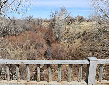
The Apishapa River is a river in Colorado, United States. It's about 139-mile-long (224 km). It's a tributary of the Arkansas River. This means it's a smaller river that flows into a larger one. The Apishapa River starts near West Spanish Peak in southern Colorado. It then flows until it joins the Arkansas River, east of Fowler, Colorado.
Understanding the Apishapa River
The Apishapa River plays an important role in the local environment. Rivers like this help shape the land. They also provide water for plants and animals. Understanding how rivers work is key to keeping our planet healthy.
How We Measure River Water
The United States Geological Survey (USGS) helps us understand rivers. They have a special station, #07119500, near Fowler. This station measures the river's discharge. Discharge is how much water flows through the river at a certain point over time. It's like measuring how much water comes out of a faucet in a minute. Knowing the discharge helps scientists understand floods and droughts. It also helps manage water resources.
Keeping an Eye on River Health
Since 2007, scientists have been watching the Apishapa River closely. They use special tools called gaging stations. These stations are set up at three places along the river's beginning, called the headwaters. They check the water level and salinity. Salinity means how much salt is in the water. Monitoring these things helps scientists understand the river's health. It also shows how the river changes over time. This information is important for protecting the river and the life it supports.
 | Emma Amos |
 | Edward Mitchell Bannister |
 | Larry D. Alexander |
 | Ernie Barnes |

