Aracena Island facts for kids
|
Native name:
Isla Aracena
|
|
|---|---|

Aracena Island, at the Strait of Magellan
|
|
| Geography | |
| Coordinates | 54°10′S 71°20′W / 54.167°S 71.333°W |
| Area | 1,164 km2 (449 sq mi) |
| Coastline | 457 km (284 mi) |
| Highest elevation | 1,158 m (3,799 ft) |
| Highest point | Monte Vernal |
| Administration | |
| Region | Magallanes Region |
| Province | Magallanes Province |
| Communes of Chile | Punta Arenas |
| Additional information | |
| NGA UFI -875166 | |
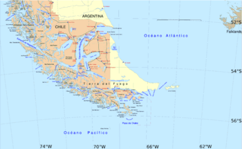
Aracena Island (Spanish: Isla Capitán Aracena or Isla Aracena) is an island in the Magallanes Region of Chile. It is part of the Tierra del Fuego group of islands. This island is also a part of the Alberto de Agostini National Park.
About Aracena Island
Aracena Island is located in the southern part of Chile. It is a beautiful island known for its natural landscapes. The island is part of a larger group of islands called Tierra del Fuego.
Who Lives on Aracena Island?
For about 6,000 years, the Alacalufe people have lived along the coasts of Aracena Island. They are also known as the Kawésqar people. They have a rich history and culture connected to the sea. Today, efforts are made to help preserve their traditions and way of life.
What is the Highest Point?
The tallest spot on Aracena Island is a mountain called Monte Vernal. It stands high above the rest of the island. This mountain is a key feature of the island's geography.
See also
 In Spanish: Isla Capitán Aracena para niños
 | Selma Burke |
 | Pauline Powell Burns |
 | Frederick J. Brown |
 | Robert Blackburn |

