Magallanes Province facts for kids
Quick facts for kids
Magallanes Province
Provincia de Magallanes
|
||
|---|---|---|

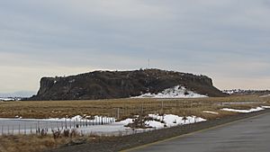
Morro Chico, Laguna Blanca
|
||
|
||

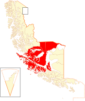
Location in the Magallanes Region
|
||
| Country | ||
| Region | ||
| Named for | Ferdinand Magellan | |
| Capital | Punta Arenas | |
| Communes |
List of 4:
|
|
| Government | ||
| • Type | Provincial | |
| Area | ||
| • Total | 36,400.8 km2 (14,054.4 sq mi) | |
| Population
(2012 Census)
|
||
| • Total | 129,199 | |
| • Density | 3.549345/km2 (9.19276/sq mi) | |
| • Urban | 116,005 | |
| • Rural | 5,670 | |
| Sex | ||
| • Men | 62,360 | |
| • Women | 59,315 | |
| Time zone | UTC-3 (CLST) | |
| • Summer (DST) | UTC-3 (CLST) | |
| Area code(s) | 56 + 61 | |
| Website | Government of Magallanes | |
Magallanes Province (called Provincia de Magallanes in Spanish) is one of four provinces in the southern part of Chile. It's located in the Magallanes and Antártica Chilena Region. The main city and capital of this province is Punta Arenas.
Contents
Exploring Magallanes Province
Where is Magallanes Province located?
The eastern part of Magallanes Province is along the northern shore of the Strait of Magellan. This famous strait connects the Atlantic and Pacific Oceans. The western part of the province also touches the strait, stretching towards the Pacific.
Magallanes Province shares its borders with other areas. To the north, it is next to the Última Esperanza Province. To the south, it borders Tierra del Fuego.
How do people get to Magallanes Province?
This province is a key entry point for visitors coming to southern Chile. You can arrive by car from Argentina, often through Río Gallegos. Many people also fly in, landing at the Carlos Ibáñez Del Campo International Airport.
What can you see in Magallanes Province?
There are many interesting places to visit in Magallanes Province. Some historical sites include Port Famine and Fuerte Bulnes. You can also find two large penguin colonies, which are popular with tourists. The province is also home to Chile's first marine park, protecting ocean life.
How many people live here?
According to a 2002 census, Magallanes Province covers about 36,400.8 square kilometers (about 14,054.4 square miles). This makes it the ninth largest province in Chile.
In 2002, about 121,675 people lived here. This means there were about 3.3 people per square kilometer. Most of the population, about 116,005 people (95.3%), lived in cities. Only 5,670 people (4.7%) lived in rural areas. Between 1992 and 2002, the number of people living in the province grew by 4.4%.
How Magallanes Province is Governed
Magallanes is a province, which is a type of local government area in Chile. It is led by a governor. The governor is chosen by the President of Chile.
The province is divided into four smaller areas called comunas (communes). These communes are:
See also
 In Spanish: Provincia de Magallanes para niños
 | Kyle Baker |
 | Joseph Yoakum |
 | Laura Wheeler Waring |
 | Henry Ossawa Tanner |


