Aratz facts for kids
Quick facts for kids Aratz |
|
|---|---|

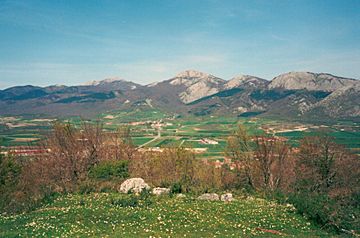
Aratz seen from the Llanada Alavesa plains.
|
|
| Highest point | |
| Elevation | 1,443 m (4,734 ft) |
| Naming | |
| English translation | Pure |
| Language of name | Lua error in Module:ISO_639_name at line 108: attempt to index local 'data' (a nil value). |
| Pronunciation | Basque: [aˈɾats̻] |
| Geography | |
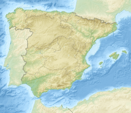
| Location | Álava, Spain |
| Parent range | Basque mountains, Altzania |
| Climbing | |
| Easiest route | From San Adrian/Ezkaratza spring |
Aratz is a beautiful mountain located in the Basque Country in Spain. Its name means 'pure' in the Basque language. This name comes from its rocky surface, which doesn't have much plant life.
Aratz is part of the Altzania mountain range, sometimes called Urkilla. This range connects to the larger Aizkorri massif. The mountain sits right on the border between the Gipuzkoa and Álava provinces. Its highest point reaches 1,443 meters (about 4,734 feet) above sea level. Right next to it is another peak called Elurzuloak, which is 1,431 meters tall. In 2006, the entire Aizkorri and Aratz area was made into the Aizkorri-Aratz Natural Park. This means the area is protected to keep its nature safe.
Getting to Aratz Mountain
People can start their climb to Aratz from a few different places. The main starting points are the town of Araia and the Ezkaratza spring.
From Araia
The town of Araia is on the edge of the Álava plains. If you start here, you will climb about 840 meters (2,756 feet) to reach the top of Aratz. A popular path (called PR-A11) goes north. It passes the old ruins of a fortress called Marutegi, which was built on a rock in the 8th century.
After a short while, you leave this path to find the Iturriotz spring. This spring has drinking water and is about an hour and ten minutes from the start. From there, you can connect to other trails (GR-121 and PR-A12) that come from Ezkaratza. The final part to the top of Aratz is on the south-east side. It involves climbing steep, rocky slopes made of limestone. This part can be a bit tricky because there isn't a very clear path. It usually takes about an hour and 45 minutes from the spring.
From Ezkaratza
Another way to reach Aratz is from the Ezkaratza spring. This spring is very close to the San Adrian tunnel. A trail called PR-A12 goes south-east into the forest. It eventually joins up with the GR-121 trail and the path coming from Araia.
From Beunda
A third way to climb Aratz is less common. It starts in Beunda, on the way to San Adrian. A concrete track goes west until it reaches a marker called Aldaola (at 850 meters high). Here, the path splits. If you take the left path, it goes downhill and crosses a stream. At this point, you can see the tall northern side of Aratz. This side is covered with a large beech forest. After about 150 meters, the track turns sharply east, then south-east. It continues until you reach a mountain pass called Allarte, which is 1,141 meters (3,743 feet) high.
See also
 In Spanish: Aratz para niños
 | Aurelia Browder |
 | Nannie Helen Burroughs |
 | Michelle Alexander |


