Archambault Lake (Lac-Jacques-Cartier) facts for kids
Quick facts for kids Archambault Lake |
|
|---|---|
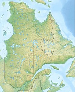
| Location | Lac-Jacques-Cartier (TNO), La Côte-de-Beaupré Regional County Municipality, Capitale-Nationale |
| Coordinates | 47°24′54″N 71°15′46″W / 47.415°N 71.26278°W |
| Lake type | Natural |
| Primary inflows | Discharge of lac Nouvel and unidentified stream. |
| Primary outflows | Sautauriski River |
| Basin countries | Canada |
| Max. length | 2.2 km (1.4 mi) |
| Max. width | 0.7 km (0.43 mi) |
| Surface area | 102 ha (0.39 sq mi) |
| Surface elevation | 772 m (2,533 ft) |
Lac Archambault is a freshwater lake in Quebec, Canada. The Sautauriski River flows right through it, from north to south. This lake is located in the unorganized territory of Lac-Jacques-Cartier. It's part of the La Côte-de-Beaupré Regional County Municipality in the Capitale-Nationale region.
Lac Archambault is also found inside the beautiful Jacques-Cartier National Park.
A main road, Quebec Route 175, runs along the east side of the lake. This road connects the cities of Quebec and Saguenay. There are also smaller roads in the area. These roads are used for logging and for people visiting for fun activities.
The main economic activity around the lake is forestry, which means cutting down trees. Recreational tourism, like visiting for fun, is the second most important activity.
The surface of Lac Archambault usually freezes over from early December to late March. However, it's generally safe to walk or play on the ice from late December to early March.
Lake Archambault's Shape and Flow
Lac Archambault is about 2.2 kilometres (1.4 mi) long and 0.7 kilometres (0.43 mi) wide. Its surface is 772 metres (2,533 ft) above sea level. This lake is nestled between mountains and has a shape like a triangle.
The lake gets most of its water from two places. One is the outlet from Lac Nouvel, which comes from the northwest. The other is an unnamed stream flowing from the north. The water then flows out of Lac Archambault from its southwest side. The lake covers an area of about 102.5 hectares (253 acres).
From Lac Archambault, the water flows for about 26.7 kilometres (16.6 mi) generally south along the Sautauriski River. After that, it continues for many kilometers south along the Jacques-Cartier River. Finally, it reaches the northeast bank of the mighty Saint Lawrence River.
Why is it Called Archambault Lake?
The name of this lake, "Lac Archambault," was officially given in 1931. This was done by the Commission de géographie du Québec. They were systematically naming many lakes and rivers in the Parc des Laurentides. This park was later partly replaced by the Laurentides Wildlife Reserve.
The goal of this naming process was to remember soldiers. These soldiers were from the Royal 22e Régiment and fought in World War I. One of these soldiers was Private René Archambault. He was born in Montreal in 1898. He joined the army in Montreal in March 1917. He was part of the 245th Battalion, which later became the Royal 22e Régiment. Sadly, he died in August 1918 during a battle in Chérisy, France.
The name "Lac Archambault" was officially confirmed on December 5, 1968, by the Commission de toponymie du Québec.
 | Jackie Robinson |
 | Jack Johnson |
 | Althea Gibson |
 | Arthur Ashe |
 | Muhammad Ali |


