
Arlington, Wisconsin facts for kids
Quick facts for kids
Arlington, Wisconsin
|
|
|---|---|

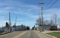
Panorama of Arlington
|
|

Location of Arlington in Columbia County, Wisconsin.
|
|
| Country | |
| State | Wisconsin |
| County | Columbia |
| Area | |
| • Total | 1.04 sq mi (2.69 km2) |
| • Land | 1.04 sq mi (2.69 km2) |
| • Water | 0.00 sq mi (0.00 km2) |
| Elevation | 1,073 ft (327 m) |
| Population
(2020)
|
|
| • Total | 844 |
| • Density | 812/sq mi (313.8/km2) |
| Time zone | UTC-6 (Central (CST)) |
| • Summer (DST) | UTC-5 (CDT) |
| FIPS code | 55-02825 |
| GNIS feature ID | 1582713 |
Arlington is a small village in Columbia County, Wisconsin, in the United States. It is home to 844 people, according to the 2020 census. The village is part of the larger Madison area.
Contents
History of Arlington
Arlington was first settled in 1838. The village was officially planned out in 1871. This planning was done by David Bullen and Mrs. Sarah Pierce. They owned all the land that makes up the village today.
The very first building in Arlington was built in the summer of 1871. It was constructed by Winslow Bullen, who was David Bullen's son.
Geography and Location
Arlington is located in Wisconsin. Its exact coordinates are 43°20′19″N 89°22′36″W / 43.338506°N 89.376695°W.
The village covers a total area of about 1.01 square miles (2.62 square kilometers). All of this area is land, with no water.
Weather and Climate
Arlington has a type of weather called a warm-summer humid continental climate. This means it has warm summers and cold, snowy winters. On climate maps, this is shown as "Dfb."
Temperature Extremes
The hottest temperature ever recorded in Arlington was 103°F (39°C). This happened between July 5 and 7, 2012. The coldest temperature ever recorded was a chilly -36°F (-38°C). This extreme cold occurred on January 18, 1994.
| Climate data for Arlington, Wisconsin, 1991–2020 normals, extremes 1962–present | |||||||||||||
|---|---|---|---|---|---|---|---|---|---|---|---|---|---|
| Month | Jan | Feb | Mar | Apr | May | Jun | Jul | Aug | Sep | Oct | Nov | Dec | Year |
| Record high °F (°C) | 55 (13) |
69 (21) |
83 (28) |
90 (32) |
96 (36) |
100 (38) |
103 (39) |
102 (39) |
96 (36) |
90 (32) |
75 (24) |
67 (19) |
103 (39) |
| Mean maximum °F (°C) | 45.0 (7.2) |
50.0 (10.0) |
65.3 (18.5) |
77.8 (25.4) |
85.4 (29.7) |
90.6 (32.6) |
91.9 (33.3) |
90.3 (32.4) |
87.5 (30.8) |
79.9 (26.6) |
63.6 (17.6) |
49.5 (9.7) |
93.8 (34.3) |
| Mean daily maximum °F (°C) | 26.4 (−3.1) |
30.7 (−0.7) |
42.8 (6.0) |
56.6 (13.7) |
69.0 (20.6) |
78.7 (25.9) |
82.2 (27.9) |
80.2 (26.8) |
73.4 (23.0) |
60.4 (15.8) |
44.4 (6.9) |
31.9 (−0.1) |
56.4 (13.6) |
| Daily mean °F (°C) | 17.6 (−8.0) |
21.3 (−5.9) |
33.0 (0.6) |
45.4 (7.4) |
57.5 (14.2) |
67.5 (19.7) |
71.0 (21.7) |
69.0 (20.6) |
61.4 (16.3) |
49.1 (9.5) |
35.4 (1.9) |
23.8 (−4.6) |
46.0 (7.8) |
| Mean daily minimum °F (°C) | 8.7 (−12.9) |
12.0 (−11.1) |
23.1 (−4.9) |
34.2 (1.2) |
45.9 (7.7) |
56.2 (13.4) |
59.8 (15.4) |
57.8 (14.3) |
49.4 (9.7) |
37.8 (3.2) |
26.4 (−3.1) |
15.7 (−9.1) |
35.6 (2.0) |
| Mean minimum °F (°C) | −13.2 (−25.1) |
−8.9 (−22.7) |
1.4 (−17.0) |
19.8 (−6.8) |
30.5 (−0.8) |
41.9 (5.5) |
47.6 (8.7) |
46.1 (7.8) |
33.7 (0.9) |
23.3 (−4.8) |
9.3 (−12.6) |
−6.1 (−21.2) |
−17.1 (−27.3) |
| Record low °F (°C) | −36 (−38) |
−30 (−34) |
−16 (−27) |
7 (−14) |
19 (−7) |
34 (1) |
38 (3) |
34 (1) |
25 (−4) |
14 (−10) |
−9 (−23) |
−26 (−32) |
−36 (−38) |
| Average precipitation inches (mm) | 1.24 (31) |
1.40 (36) |
1.98 (50) |
3.74 (95) |
4.24 (108) |
5.14 (131) |
4.17 (106) |
3.80 (97) |
3.34 (85) |
2.78 (71) |
2.23 (57) |
1.45 (37) |
35.51 (904) |
| Average snowfall inches (cm) | 10.7 (27) |
11.2 (28) |
5.3 (13) |
1.9 (4.8) |
0.1 (0.25) |
0.0 (0.0) |
0.0 (0.0) |
0.0 (0.0) |
0.0 (0.0) |
0.3 (0.76) |
2.4 (6.1) |
10.7 (27) |
42.6 (106.91) |
| Average precipitation days (≥ 0.01 in) | 7.3 | 6.7 | 6.8 | 10.2 | 11.2 | 11.3 | 9.4 | 8.8 | 9.1 | 8.4 | 7.6 | 7.7 | 104.5 |
| Average snowy days (≥ 0.1 in) | 6.1 | 5.3 | 2.7 | 1.2 | 0.0 | 0.0 | 0.0 | 0.0 | 0.0 | 0.2 | 1.9 | 5.0 | 22.4 |
| Source 1: NOAA | |||||||||||||
| Source 2: National Weather Service | |||||||||||||
Population and People
The number of people living in Arlington has changed over the years. Here's how the population has grown:
| Historical population | |||
|---|---|---|---|
| Census | Pop. | %± | |
| 1880 | 56 | — | |
| 1950 | 255 | — | |
| 1960 | 349 | 36.9% | |
| 1970 | 379 | 8.6% | |
| 1980 | 440 | 16.1% | |
| 1990 | 440 | 0.0% | |
| 2000 | 484 | 10.0% | |
| 2010 | 819 | 69.2% | |
| 2020 | 844 | 3.1% | |
| U.S. Decennial Census | |||
2010 Census Information
In 2010, there were 819 people living in Arlington. These people lived in 317 households, and 233 of these were families. The village had about 811 people per square mile.
Most of the people in Arlington were White (97.3%). A smaller number were African American (1.2%), or from other backgrounds. About 1.3% of the population was Hispanic or Latino.
Many households (41.6%) had children under 18 living with them. Most households (59.6%) were married couples. Some households were led by a single female (9.5%) or a single male (4.4%).
The average age of people in the village was 32.1 years old.
- 26.7% of residents were under 18 years old.
- 35.5% were between 25 and 44 years old.
- 9.9% were 65 years or older.
The population was almost evenly split between males (49.1%) and females (50.9%).
Famous People from Arlington
Some notable people who have connections to Arlington include:
- Hugh McFarlane: A politician who served as a state representative in Wisconsin.
- Charles R. Robertson: A politician from North Dakota.
- Vincent James Ryan: A bishop in the Roman Catholic Diocese of Bismarck.
- Clarion A. Youmans: A politician who served as a state senator in Wisconsin.
Images for kids
-
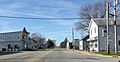
Looking west in downtown Arlington on WIS 60
-
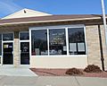
Post office
-
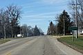
The sign for Arlington on WIS 60
-
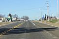
The intersection of WIS 60 and US 51 in Arlington
-
Railroad tracks


See also
 In Spanish: Arlington (Wisconsin) para niños
