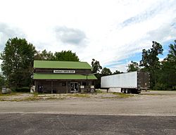
Armathwaite, Tennessee facts for kids
Quick facts for kids
Armathwaite, Tennessee
|
|
|---|---|
 |
|
| Country | United States |
| State | Tennessee |
| County | Fentress |
| Elevation | 1,470 ft (450 m) |
| Time zone | UTC-6 (Central (CST)) |
| • Summer (DST) | UTC-5 (CDT) |
| ZIP code |
38504
|
| Area code(s) | 931 |
| GNIS feature ID | 1314597 |
Armathwaite is a small, quiet place in Fentress County, Tennessee, United States. It's known as an unincorporated community, which means it doesn't have its own local government like a city or town. Instead, it's part of the larger county.
Contents
Discovering Armathwaite
Armathwaite is located in a beautiful part of Tennessee called the Cumberland Plateau. This area is famous for its flat-topped mountains and deep valleys. You can find Armathwaite along Tennessee State Route 52, a road that connects it to nearby places like Allardt and Rugby.
Nature Around Armathwaite
Just northeast of Armathwaite, you'll find the Big South Fork National River and Recreation Area. This is a huge natural park where people can enjoy outdoor activities. It's a great place for hiking, camping, and exploring the beautiful river and forests.
A Glimpse into History
People first started settling in the Armathwaite area way back in the 1840s. It was a time when many families were moving to new lands to build homes and farms.
How Armathwaite Got Its Name
Around 1881, an important person named Alwyn Maude came to the area. He was part of a group of settlers from a place called Rugby, England. Alwyn Maude set up a post office in the community. He decided to name the new post office, and the community, "Armathwaite" after his home village in England.
Early Industries
In the late 1800s and early 1900s, Armathwaite was a busy place for a couple of important industries. People were drilling for oil in the ground, hoping to find valuable resources. There was also a lot of logging happening, which means trees were cut down to be used for wood. These activities helped the community grow during those times.
 | James Van Der Zee |
 | Alma Thomas |
 | Ellis Wilson |
 | Margaret Taylor-Burroughs |


