Arnoldsville, Georgia facts for kids
Quick facts for kids
Arnoldsville, Georgia
|
|
|---|---|

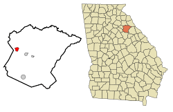
Location in Oglethorpe County and the state of Georgia
|
|
| Country | United States |
| State | Georgia |
| County | Oglethorpe |
| Area | |
| • Total | 1.71 sq mi (4.44 km2) |
| • Land | 1.71 sq mi (4.43 km2) |
| • Water | 0.00 sq mi (0.01 km2) |
| Elevation | 797 ft (243 m) |
| Population
(2020)
|
|
| • Total | 431 |
| • Density | 251.75/sq mi (97.18/km2) |
| Time zone | UTC-5 (Eastern (EST)) |
| • Summer (DST) | UTC-4 (EDT) |
| ZIP code |
30619
|
| Area code(s) | 706 |
| FIPS code | 13-03124 |
| GNIS feature ID | 0354397 |
Arnoldsville is a small city in Oglethorpe County, Georgia, in the United States. In 2020, about 431 people lived there. It's a quiet place with a rich history of changing names!
History of Arnoldsville
Arnoldsville has had a few different names over the years. It was first known as "Cherokee Corner." This name likely came from its location near lands important to the Cherokee people.
In 1894, the town's name changed to "Edwin." This new name honored Edwin Shaw, who owned a local country store. Just two years later, in 1896, the store was sold to N. D. Arnold. Because of this, the town's name changed again to "Arnoldsville." The city officially became an incorporated town in 1969.
Geography of Arnoldsville
Arnoldsville is located in the state of Georgia. Its exact coordinates are 33°54′20″N 83°13′0″W / 33.90556°N 83.21667°W.
U.S. Route 78 is a main road that runs just south of the city. This road can take you about 4 miles (6.4 km) east to the town of Crawford. Or, you can travel about 10 miles (16 km) northwest to the larger city of Athens.
The city of Arnoldsville covers a total area of about 1.7 square miles (4.4 square kilometers). Almost all of this area is land.
People of Arnoldsville
The number of people living in Arnoldsville has grown over the years.
| Historical population | |||
|---|---|---|---|
| Census | Pop. | %± | |
| 1970 | 181 | — | |
| 1980 | 187 | 3.3% | |
| 1990 | 275 | 47.1% | |
| 2000 | 312 | 13.5% | |
| 2010 | 357 | 14.4% | |
| 2020 | 431 | 20.7% | |
| U.S. Decennial Census | |||
In 2000, there were 312 people living in Arnoldsville. These people lived in 125 different homes. About 88 of these homes were families. The city had about 186 people per square mile (72 people per square kilometer).
Many different kinds of people live in Arnoldsville. Most residents identified as White. There were also people who identified as African American, Asian, or from other backgrounds. Some residents also identified as Hispanic or Latino.
About one-third of the homes had children under 18 living there. Most homes were made up of married couples. Some homes had a female head of household without a husband present. Other homes were made up of individuals or non-family groups.
The age of people in Arnoldsville varied. About 26% of the population was under 18 years old. About 12% of the population was 65 years or older. The average age in the city was 37 years old.
See also
 In Spanish: Arnoldsville para niños
 | Janet Taylor Pickett |
 | Synthia Saint James |
 | Howardena Pindell |
 | Faith Ringgold |

