Arroyo Gardens-La Tina Ranch, Texas facts for kids
Quick facts for kids
Arroyo Gardens-La Tina Ranch, Texas
|
|
|---|---|
|
Former CDP
|
|
 |
|
| Country | United States |
| State | Texas |
| County | Cameron |
| Area | |
| • Total | 16.5 sq mi (42.7 km2) |
| • Land | 16.3 sq mi (42.2 km2) |
| • Water | 0.2 sq mi (0.5 km2) |
| Population
(2000)
|
|
| • Total | 732 |
| • Density | 45.0/sq mi (17.4/km2) |
| Time zone | UTC-6 (Central (CST)) |
| • Summer (DST) | UTC-5 (CDT) |
| FIPS code | 48-04177 |
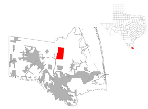
Arroyo Gardens-La Tina Ranch was a special area in Cameron County, Texas, United States. It was called a census-designated place (CDP). This means it was a place the government counted for population.
In the year 2000, about 732 people lived there. This community was part of the larger Brownsville–Harlingen area. This bigger area is known as a Metropolitan Statistical Area.
Where Was It Located?
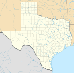
Arroyo Gardens-La Tina Ranch was located in southern Texas. Its exact spot was at these coordinates: 26°12′58″N 97°29′47″W / 26.21611°N 97.49639°W.
The total size of this area was about 16.5 square miles (42.7 square kilometers). Most of this land was dry, about 16.3 square miles (42.2 square kilometers). A small part, about 0.2 square miles (0.5 square kilometers), was water.
How Many People Lived There?
| Historical population | |||
|---|---|---|---|
| Census | Pop. | %± | |
| 2000 | 732 | — | |
| U.S. Decennial Census 1850–1900 1910 1920 1930 1940 1950 1960 1970 1980 1990 2000 2010 |
|||
A "census" is like a big count of all the people living in a country. The government does this to learn about the population. Arroyo Gardens-La Tina Ranch was first counted as a CDP in the year 2000.
Later, for the 2010 census, this one area was divided. It became two separate CDPs. These new areas were named Arroyo Gardens and La Tina Ranch.
Schools in the Area
The students who lived in Arroyo Gardens-La Tina Ranch went to schools in the Los Fresnos Consolidated Independent School District. This district managed the local public schools.
Also, the South Texas Independent School District ran special "magnet schools." These schools offered unique programs and were open to students from the community.
 | Claudette Colvin |
 | Myrlie Evers-Williams |
 | Alberta Odell Jones |


