Artesia, Mississippi facts for kids
Quick facts for kids
Artesia, Mississippi
|
|
|---|---|

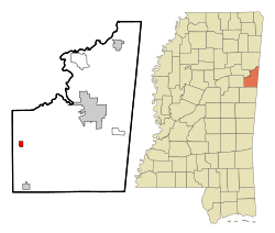
Location of Artesia, Mississippi
|
|
| Country | United States |
| State | Mississippi |
| County | Lowndes |
| Area | |
| • Total | 0.72 sq mi (1.88 km2) |
| • Land | 0.72 sq mi (1.87 km2) |
| • Water | 0 sq mi (0.00 km2) |
| Elevation | 230 ft (70 m) |
| Population
(2020)
|
|
| • Total | 304 |
| • Density | 420.47/sq mi (162.37/km2) |
| Time zone | UTC-6 (Central (CST)) |
| • Summer (DST) | UTC-5 (CDT) |
| ZIP code |
39736
|
| Area code(s) | 662 |
| FIPS code | 28-02100 |
| GNIS feature ID | 0666384 |
Artesia is a small town in Lowndes County, Mississippi. In 2020, about 304 people lived there. This number was a bit lower than in 2010, when 440 people lived in Artesia.
Contents
History of Artesia
Artesia started out as a place called Artesia Junction. This was an important spot where different parts of the Mobile and Ohio Railroad met. Back in the 1850s, when the railroad was being built, the builders asked nearby towns like Columbus and Aberdeen if they wanted the train tracks to go through their towns. Both towns said no at first.
A few months later, Columbus changed its mind. But by then, the railroad had already picked a path that went west of Columbus. However, the railroad did build a special side track, called a spur line, to connect to Columbus. This spur line joined the main railroad line right where Artesia is today.
Artesia is also known for an event in 1876. During that time, some people tried to stop others from voting. A group of armed white men from Starkville came to Artesia to scare black voters who were part of the Republican Club. Federal troops were called in to help. This made many white people angry, and they said it was a "negro riot."
The town's name, Artesia, comes from something cool found in the area: a bunch of artesian wells. These are special wells where water flows up from the ground naturally, without needing a pump.
Geography of Artesia
Artesia is located at 33°24′58″N 88°38′43″W / 33.41611°N 88.64528°W. This tells us its exact spot on a map.
The United States Census Bureau says that the town covers about 0.8 square miles (which is about 1.88 square kilometers). Most of this area is land, and a very small part (about 1.33%) is water.
People in Artesia
In 2020, the town of Artesia had 304 people living there. There were 159 households and 185 families.
Most people in Artesia are African American. In 2020, about 84.87% of the people were African American. About 10.86% were White, and a small number of people were Asian or from other backgrounds. About 3.62% of the population was Hispanic or Latino.
Here's how the population of Artesia has changed over many years:
| Historical population | |||
|---|---|---|---|
| Census | Pop. | %± | |
| 1880 | 150 | — | |
| 1890 | 313 | 108.7% | |
| 1900 | 343 | 9.6% | |
| 1910 | 535 | 56.0% | |
| 1920 | 583 | 9.0% | |
| 1930 | 612 | 5.0% | |
| 1940 | 521 | −14.9% | |
| 1950 | 594 | 14.0% | |
| 1960 | 469 | −21.0% | |
| 1970 | 444 | −5.3% | |
| 1980 | 526 | 18.5% | |
| 1990 | 484 | −8.0% | |
| 2000 | 498 | 2.9% | |
| 2010 | 440 | −11.6% | |
| 2020 | 304 | −30.9% | |
| U.S. Decennial Census | |||
In 2000, about 33.7% of the people in Artesia were under 18 years old. About 10.2% were 65 years or older. The average age in the town was 28 years old.
Education in Artesia
Students in Artesia go to schools that are part of the Lowndes County School District.
Notable Person from Artesia
- Jim Roberts – He was a baseball pitcher who played for the Brooklyn Robins.
See also
 In Spanish: Artesia (Misisipi) para niños
 | William M. Jackson |
 | Juan E. Gilbert |
 | Neil deGrasse Tyson |


