Ashburton River (Western Australia) facts for kids
Quick facts for kids Ashburton River |
|
|---|---|

Ashburton River at Nanutarra
|
|
| Country | Australia |
| Physical characteristics | |
| Main source | Pilbara region 571 metres (1,873 ft) |
| River mouth | Indian Ocean 20 km (12 mi) SW of Onslow |
| Length | 680 kilometres (423 mi) |
| Basin features | |
| Basin size | 66,850 square kilometres (25,811 sq mi) |
The Ashburton River is an important river in the Pilbara region of Western Australia. It flows through a dry, rugged landscape and is a vital water source for the area.
River Journey
The Ashburton River starts its journey about 100 kilometers (62 miles) south of a town called Newman. It then flows towards the west and north. Finally, it empties into the Indian Ocean, about 20 kilometers (12 miles) southwest of Onslow.
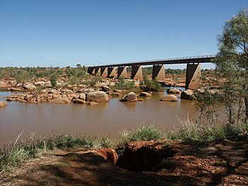
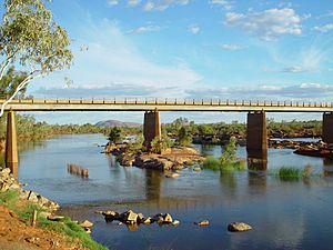
The North West Coastal Highway crosses the river at a place called Nanutarra. The river is quite long, stretching for about 680 kilometers (423 miles). The area that collects water for the river, known as its basin, is huge. It covers about 66,850 square kilometers (25,811 square miles). This large area includes the towns of Paraburdoo and Tom Price.
River Branches
The Ashburton River has many smaller rivers and creeks that flow into it. These are called tributaries.
Some of the bigger tributaries include:
- Beasley River
- Henry River
- Hardey River
- Ethel River
Smaller creeks that join the Ashburton River are:
- Duck Creek
- Turee Creek
- Tunnel Creek
- Angelo River
- Stockyard Creek
- Gorge Creek
- Goldfields Creek
- Peepingee Creek
- Jubricoo Creek
River History
Did you know the Ashburton River might have been named Willem's River a very long time ago? This happened during a trip by a Dutch ship called the Mauritius in 1618. The ship was part of the Dutch East India Company.
The captain of the Mauritius was Lenaert Jacobszoon, and Willem Janszoon was in charge of the cargo. This area was one of the first places in Australia visited by Europeans. Janszoon had also explored parts of Australia earlier, in 1605-1606, on a ship called the Duyfken.
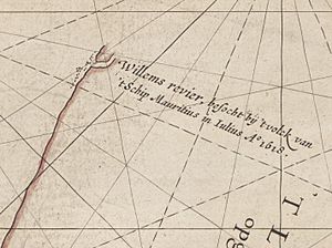
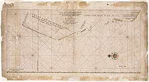
A map from 1627, called Caert van't Landt van d'Eendracht (which means "Chart of the Land of Eendracht"), shows the coastline of Western Australia. This map was made by Hessel Gerritsz. The Willem River is shown on the far left (north) side of this old map.

The map says "Willem's River, visited by the crew of the ship Mauritius in July 1618." The location of the river on this old map matches the Ashburton River almost perfectly. The map shows the river at 21 degrees 45 minutes south latitude, which is very close to the Ashburton River's actual location.
Other clues that this is the Ashburton River include:
- The river makes a sharp turn (almost 90 degrees) to the north-east once it enters the ocean, just like on the map.
- The shape of the northern part of the river's mouth also looks very similar to what is shown on the old chart.
The town of Onslow used to be right at the mouth of the Ashburton River. There was a jetty (a pier) there that worked as the town's port. But later, a new, deeper port was built 15 kilometers (9 miles) north of the old town. So, the town of Onslow was moved to the new location.
River Animals
The Ashburton River is home to many different kinds of animals, especially fish.
You can find fish like:
Sometimes, a saltwater crocodile is also seen in the river.
Many bird species live along the river banks, such as:
See also
 In Spanish: Río Ashburton para niños


