Atimokateiw River facts for kids
Quick facts for kids Atimokateiw |
|
|---|---|

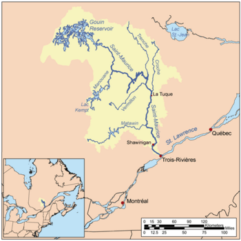
Plan de la rivière Saint-Maurice
|
|

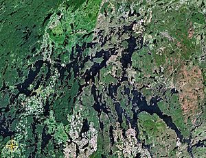
Map of Gouin Reservoir seen from space
|
|
| Country | Canada |
| Province | Quebec |
| Region | Mauricie |
| Physical characteristics | |
| Main source | Unidentified Lake La Tuque, Mauricie, Quebec 469 m (1,539 ft) 48°24′36″N 74°24′20″W / 48.41000°N 74.40556°W |
| River mouth | Gouin Reservoir (Kikendatch Bay) La Tuque, Mauricie, Quebec 402 m (1,319 ft) 48°22′25″N 74°20′20″W / 48.37361°N 74.33889°W |
| Length | 31.6 km (19.6 mi) |
The Atimokateiw River is a river in Quebec, Canada. It flows into the southern part of the Gouin Reservoir. This large reservoir is like a huge lake. The river is located in the Mauricie region, near the town of La Tuque.
The Atimokateiw River flows through a forest area. The main activities here are forestry, which means cutting down trees for wood. People also visit for fun, enjoying nature and outdoor activities.
A special forest road helps people get around this area. It connects to Route 400. This road goes around the southeastern part of the Gouin Reservoir. It also links the village of Parent, Quebec and the village of Wemotaci.
The river's surface usually freezes in the middle of November. It stays frozen until the end of April. It's generally safe to walk or travel on the ice from early December to late March.
River's Journey
The Atimokateiw River starts from a lake that doesn't have a name. This lake is about 469 metres (1,539 ft) (about 1,539 feet) above sea level.
From its start, the river flows for about 14.6 kilometres (9.1 mi) (about 9 miles). It winds its way through mountains and small lakes. Finally, it reaches the Gouin Reservoir.
The river's mouth is about 18.0 kilometres (11.2 mi) (about 11 miles) west of the Gouin Dam. This dam helps control the water levels of the reservoir.
After joining the Gouin Reservoir, the water flows into Kikendatch Bay. From there, it travels along the Saint-Maurice River. Eventually, it reaches the St. Lawrence River at Trois-Rivières.
Surrounding Areas
The land around the Atimokateiw River has many other rivers and lakes.
- To the north, you'll find the Gouin Reservoir and lakes like Magnan Lake.
- To the east, there's Kikendatch Bay and the Saint-Maurice River.
- To the south, you can find the Bazin River and Drouin River.
- To the west, there are lakes like Chapman Lake and Nevers Lake.
River's Name
The name "Atimokateiw River" comes from an Indigenous language. It has been the official name since May 31, 1985. The Commission de toponymie du Québec made it official.
 | Aurelia Browder |
 | Nannie Helen Burroughs |
 | Michelle Alexander |

