Attawapiskat Lake facts for kids
Quick facts for kids Attawapiskat Lake |
|
|---|---|
| Location | Kenora District, Ontario |
| Coordinates | 52°14′36″N 87°53′51″W / 52.24333°N 87.89750°W |
| Primary inflows | Otoskwin River, Marten-Drinking River, Pineimuta River |
| Primary outflows | Attawapiskat River, North Channel |
| Basin countries | Canada |
| Surface area | 281 square kilometres (108 sq mi) |
| Shore length1 | 596 kilometres (370 mi) |
| 1 Shore length is not a well-defined measure. | |
Attawapiskat Lake is a large lake located in northern Ontario, Canada. It's an important part of the local environment. Many rivers flow into it, and two main rivers flow out. The lake is also home to a First Nations community.
Contents
Attawapiskat Lake: A Cool Place in Ontario
Where is Attawapiskat Lake?
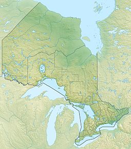
Attawapiskat Lake is found in the Kenora District of Ontario, Canada. It's quite a big lake, covering an area of about 281 square kilometers (108 square miles). The shoreline of the lake is very long, stretching for about 596 kilometers (370 miles).
Rivers and Water Flow
Several rivers flow into Attawapiskat Lake. These are the Otoskwin River, the Marten-Drinking River, and the Pineimuta River. The lake also has two main rivers that flow out of it. These are the Attawapiskat River and the North Channel. The North Channel eventually joins up with the Attawapiskat River.
Who Lives Nearby?
On the western side of Attawapiskat Lake, there is a First Nations community. This community is called Neskantaga First Nation. It is also known by another name, Lansdowne House, Ontario.
What's in a Name?
The name "Attawapiskat" comes from a special area along the Attawapiskat River. This area is less than 100 kilometers (62 miles) from where the river meets the sea. Here, the river has carved out unique groups of high limestone islands. These islands are so unique that canoeists have nicknamed them the "Birthday Cakes."
The formations are special to this region. The word for them in the Swampy Cree language (also called Omushkegowuk) is tawâpiskâ. This Cree word is where the river, and then the lake, got its name.
 | Leon Lynch |
 | Milton P. Webster |
 | Ferdinand Smith |


