Attica (region) facts for kids
Quick facts for kids
Attica
Περιφέρεια Αττικής
|
|
|---|---|
|
Administrative region
|
|
 |
|
| Country | |
| Decentralized Administration | Attica |
| Capital | Athens |
| Regional units |
List
|
| Government | |
| • Type | Regional council |
| Area | |
| • Total | 3,808.10 km2 (1,470.32 sq mi) |
| Population
(2021)
|
|
| • Total | 3,814,064 |
| • Density | 1,001.5661/km2 (2,594.044/sq mi) |
| Gross regional product | |
| • Total | €85.769 billion |
| • Per capita | €22,835 |
| Time zone | UTC+2 (EET) |
| • Summer (DST) | UTC+3 (EEST) |
| ISO 3166 code | GR-I |
| NUTS code | EL3 |
| HDI (2021) | 0.909 very high · 1st of 13 |
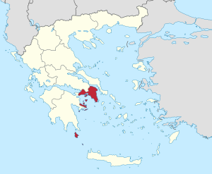
Attica is a large and important region in Greece. It includes Athens, which is the capital and biggest city of Greece. Attica is located in the central part of the country.
Contents
Discovering Attica: Location and Cities
Attica is found on the eastern side of Central Greece. It covers an area of about 3,808 square kilometers. This region is home to many cities and islands.
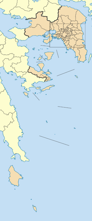
Besides Athens, other important cities in Attica include Elefsina, Megara, Laurium, and Marathon. The region also includes a small part of the Peloponnese peninsula.
Attica is also famous for its beautiful islands. These include Salamis, Aegina, Angistri, Poros, Hydra, Spetses, Kythira, and Antikythera.
Population of Attica
Around 3.8 million people live in the Attica region. Most of these people, over 95%, live in the Athens metropolitan area. In 2019, Attica had the highest Human Development Index (HDI) in Greece. This means people there generally have a good quality of life.
How Attica is Governed
Attica was officially set up as an administrative region in 1987. It is a self-governing body, meaning it manages its own affairs. This includes its budget and local powers.
The region is divided into eight smaller areas called regional units. These units help manage local services and administration.
- North Athens
- West Athens
- Central Athens
- South Athens
- West Attica
- East Attica
- Piraeus
- Islands
Voting Districts in Attica
The Attica region is also divided into eight areas for voting. These are called electoral districts. They help organize elections for government representatives.
Major Communities in Attica
Attica has many important towns and cities. Here are some of the biggest ones:
- Acharnes
- Agia Paraskevi
- Agios Dimitrios
- Aigaleo
- Alimos
- Athens (the capital city)
- Chalandri
- Galatsi
- Glyfada
- Ilion
- Ilioupoli
- Kallithea
- Keratsini
- Kifissia
- Korydallos
- Marousi
- Nea Ionia
- Nea Smyrni
- Nikaia
- Palaio Faliro
- Piraeus (a major port city)
- Peristeri
- Vyronas
- Zografou
Economy of Attica
Attica is a very important part of the Greek economy. In 2018, the region's total economic output, known as GDP, was about 87.4 billion Euros. This was almost half of Greece's entire economic output.
The GDP per person in Attica was also very high. It was 28,000 Euros in 2018. This makes Attica the region in Greece with the highest GDP per person. However, the unemployment rate was still quite high at 21.6% in 2017.
Getting Around Attica: Transportation
Attica has a good network of roads and public transport. This makes it easy to travel within the region and to other parts of Greece.
Roads and Highways
The main roads and highways in Attica include:
- Motorway 1 (connecting Athens to Thessaloniki)
- Motorway 6 (a northern beltway around Athens)
- Motorway 8 (connecting Eleusis to Corinth)
- Motorway 62 (linking to Athens Airport)
- Motorway 64 (an eastern beltway around Athens)
- Motorway 65 (a western beltway around Athens)
- Greek National Road 1 (the old road from Athens to Thessaloniki)
- Greek National Road 8 (the old road from Athens to Patras)
Ferry Connections
Many ferry lines connect the port of Piraeus to the islands in the Attica region. You can find both regular ferries and faster high-speed vessels.
Public Transport in Athens
The Athens Mass Transit System helps people move around the city. It includes:
- The Athens Metro (an underground train system)
- The Athens Tram (streetcars)
- The Proastiakos (suburban railway)
Sports in Attica
Attica is home to many sports clubs, especially football (soccer) teams. Many of Greece's top football clubs are based here.
Some of the well-known football clubs include:
- AEK
- Apollon
- Atromitos
- Olympiacos
- Panathinaikos
- Panionios
There are also clubs for other sports in Attica.
See also
 In Spanish: Periferia de Ática para niños
 | Georgia Louise Harris Brown |
 | Julian Abele |
 | Norma Merrick Sklarek |
 | William Sidney Pittman |


