Aubrey Hills facts for kids
Quick facts for kids Aubrey Hills |
|
|---|---|

View southeast.
The dark Aubrey Hills are adjacent the east side of Lake Havasu, southeast of Lake Havasu City. (expandable photo) |
|
| Highest point | |
| Peak | Peak 1537 (southeast, near terminus) |
| Elevation | 1,537 ft (468 m) |
| Dimensions | |
| Length | 16 mi (26 km) NW-SE |
| Width | 4.5 mi (7.2 km) |
| Geography | |
| Country | United States |
| Communities | Lake Havasu City and Parker Dam |
| Range coordinates | 34°19′N 114°6′W / 34.317°N 114.100°W |
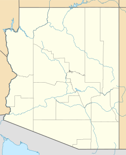
The Aubrey Hills are a small, rocky mountain range located in Arizona, United States. They sit right next to the southeast side of Lake Havasu, which is a large lake formed by the Colorado River. These hills are about 16 miles (26 kilometers) long. They stretch in a straight line from the northwest to the southeast.
Contents
Exploring the Aubrey Hills
The Aubrey Hills are part of the Lower Colorado River Valley. This area is known for its dry, desert landscape. Even though they are not very tall, the hills have a rugged, craggy look. This means they have many sharp rocks and uneven surfaces.
Where are the Aubrey Hills Located?
The Aubrey Hills are found in Mohave County, Arizona. They are close to Lake Havasu City, a popular spot for visitors. The hills form a natural border along the eastern edge of Lake Havasu. This lake is a big part of the Colorado River system.
What is the Highest Point?
The tallest part of the Aubrey Hills is called Peak 1537. It is located at the very southeast end of the range. This peak reaches an elevation of 1,537 feet (468 meters) above sea level. Even though it's not a giant mountain, it stands out in the local landscape.
Rivers and Mountains Nearby
The southeast end of the Aubrey Hills is also close to the Bill Williams River. This river flows west for a short distance before joining the Colorado River. To the east of the Aubrey Hills, you'll find the Bill Williams Mountains. These mountains are a bit taller and run parallel to the Aubrey Hills.
 | William M. Jackson |
 | Juan E. Gilbert |
 | Neil deGrasse Tyson |


