Auburn, North Dakota facts for kids
Quick facts for kids
Auburn, North Dakota
|
|
|---|---|

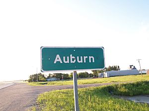
Sign for Auburn
|
|
| Country | United States |
| State | North Dakota |
| County | Walsh |
| Area | |
| • Total | 1.00 sq mi (2.60 km2) |
| • Land | 1.00 sq mi (2.60 km2) |
| • Water | 0.00 sq mi (0.00 km2) |
| Elevation | 843 ft (257 m) |
| Population
(2020)
|
|
| • Total | 31 |
| • Density | 30.85/sq mi (11.91/km2) |
| Time zone | UTC-6 (Central (CST)) |
| • Summer (DST) | UTC-5 (CDT) |
| ZIP code |
58237
|
| Area code(s) | 701 |
| FIPS code | 38-03740 |
| GNIS feature ID | 2584335 |
Auburn is a small place in Walsh County, North Dakota, in the United States. It's known as a census-designated place (CDP) and an unincorporated community. This means it's a group of homes and businesses that the government counts for population, but it doesn't have its own city government. In 2020, about 31 people lived there.
Contents
History of Auburn
Auburn got its start a long time ago.
- In 1883, a post office opened in Auburn. This was an important place for people to send and receive mail.
- However, the post office closed in 1943.
- A new railroad was built nearby, and many businesses moved to a bigger town called Grafton.
- Because of this, fewer people lived in Auburn over time.
Geography of Auburn
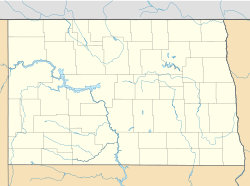
Auburn is located in North Dakota.
- The United States Census Bureau says that Auburn covers about 1 square mile (2.6 square kilometers) of land.
- There is no water area within Auburn.
People of Auburn
This section tells us about the people who live in Auburn.
| Historical population | |||
|---|---|---|---|
| Census | Pop. | %± | |
| 2020 | 31 | — | |
| U.S. Decennial Census | |||
Auburn's Population in 2010
In 2010, there were 48 people living in Auburn.
- There were 17 households, which means 17 different groups of people living together.
- About 11 of these households were families.
- Most of the people living in Auburn were White.
- Some residents (about 6 out of every 100) were of Hispanic or Latino background.
Households and Ages
- In 2010, about 23% of the households had children under 18 living there.
- Many households (about 47%) were married couples.
- The average age of people in Auburn was about 43.5 years old.
- About 27% of the people were under 18 years old.
- About 17% of the people were 65 years old or older.
- There were slightly more males (about 58%) than females (about 42%) living in Auburn.
See also
 In Spanish: Auburn (Dakota del Norte) para niños
Black History Month on Kiddle
Famous African-American Civil Rights Activists:
 | Aaron Henry |
 | T. R. M. Howard |
 | Jesse Jackson |

All content from Kiddle encyclopedia articles (including the article images and facts) can be freely used under Attribution-ShareAlike license, unless stated otherwise. Cite this article:
Auburn, North Dakota Facts for Kids. Kiddle Encyclopedia.

