
Bagh District facts for kids
Quick facts for kids
Bagh
|
|
|---|---|

Map of Azad Kashmir with Bagh highlighted
|
|
| Country | Pakistan |
| Established | 1988 |
| Area | |
| • Total | 1,368 km2 (528 sq mi) |
| Population
(2009)
|
|
| • Total | 503,000 |
| • Density | 424/km2 (1,100/sq mi) |
| Time zone | UTC+5 (PST) |
| Number of Tehsils | 3 |
| Website | http://www.apnabagh.com |
Bagh District (Urdu: ضلع باغ) is a special area in Azad Kashmir, Pakistan. It is one of eight districts there. Bagh District was created in 1988. Before that, it was part of Poonch District. This district is known for its yummy sweets and baked goods!
Contents
What is Bagh District?
Bagh District is a beautiful region covering about 1,368 square kilometers. It's a place with lovely green views and interesting towns.
Where is Bagh District Located?
Bagh District has many neighbors. To the north, you'll find Muzaffarabad District. To the east, it borders Punjab. It also shares a border with the divided Poonch District. To the south is the Poonch District of Azad Kashmir. To the east is the Poonch District in Jammu and Kashmir, India.
You can reach Bagh District from Muzaffarabad by two main roads. One road goes through Sudhan Gali and is about 80 kilometers long. The other road goes through Kohala and is about 97 kilometers long. Bagh District is also only 46 kilometers away from Rawalakot.
How Many People Live in Bagh District?
In 1998, about 395,000 people lived in Bagh District. By 2003, this number grew to about 434,000 people. The population keeps growing a little bit each year.
How is Bagh District Managed?
Bagh District is divided into smaller areas called tehsils. Think of a tehsil like a smaller county or sub-district. Each tehsil helps manage the local area.
What are Tehsils?
There are three tehsils in Bagh District:
These tehsils help the local government serve the people living in Bagh District.
Images for kids
-
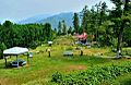
Dhirkot Park, Bagh District, Azad Kashmir

