Rawalakot facts for kids
Quick facts for kids
Rawalakot
راولا کوٹ
|
|
|---|---|
|
Town
|
|
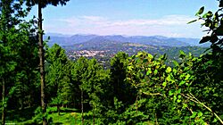 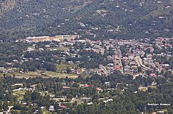
A view of Rawalakot
|
|
| Administering country | |
| Administrative Territory | |
| District | Poonch District |
| Elevation | 1,638 m (5,374 ft) |
| Population
(2017)
|
|
| • Total | 56,006 |
| • Estimate
(2018)
|
56,590 |
| • Density | 375/km2 (970/sq mi) |
| Languages | |
| • Official | Urdu |
| • Spoken |
|
| Time zone | UTC+5 (PST) |
| 05824 | 0092 |
| Number of towns | 3 |
| Number of Union councils | 21 |
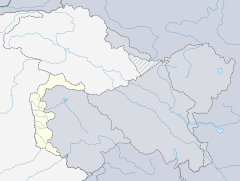
Rawalakot (Urdu: راولا کوٹ) is an important city in Azad Kashmir, Pakistan. It is the capital of the Poonch district. The city is nestled in the beautiful Pir Panjal Range mountains.
Contents
History of Rawalakot
The 1947 Poonch Rebellion
In 1947, a leader named Sardar Ibrahim Khan spoke to a large crowd in Rawalakot. He talked about the creation of Pakistan, a new Muslim country. He explained that the people of Jammu and Kashmir would also be affected by this big change. After his speech, the area became less peaceful.
Another leader, Chaudhary Hamidullah, visited Rawalakot soon after. He secretly started to organize former soldiers from the district. They prepared for a possible fight against the local army, known as the Dogra State Forces. Around October 6, an armed rebellion began in the Poonch district.
The fighters were a mix of people. They included soldiers who had left the State Army and Pakistani soldiers on leave. There were also former soldiers and other volunteers. These groups quickly took control of most of the Poonch district, including Rawalakot.
The 1955 Poonch Uprising
Rawalakot was also a key place during the 1955 Poonch uprising. This uprising was led by local people called the Sudhans. They were unhappy with their leader, Sher Ahmed Khan. They wanted Sardar Ibrahim Khan to be in charge again. They also wanted more democratic changes in their government.
The 2005 Kashmir Earthquake
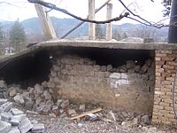
On Saturday, October 8, 2005, a very strong earthquake hit the region. It had a magnitude of 7.6. This earthquake caused a lot of damage in Pakistan, including Azad Kashmir. Sadly, 73,338 people lost their lives. Up to three million people were left without homes.
Rawalakot, being the capital of Poonch district, was badly affected. Most buildings were still standing, but many were too damaged to live in. Many people became homeless. Since then, most of the damaged buildings have been rebuilt.
Rawalakot's Location
Rawalakot is located at a latitude of 33°51'32.18"N and a longitude of 73°45'34.93"E. It sits at an Elevation of about 5,374 feet (1,638 meters) above sea level.
The city is about 76 kilometers (47 miles) from Kahuta. It is also about 120 kilometers (75 miles) from the big city of Rawalpindi, Pakistan. Rawalakot is connected to Rawalpindi and Islamabad by roads like Goyain Nala and Tain roads. Another road links it through Kotli Satiyan and Kahuta. There is also a road connection to Rawalpindi via Sudhnuti.
Getting Around Rawalakot
Travel Routes
A new road called the Ghazi-e-Millat road, also known as Guoien Nala road, has been built. This road connects Rawalakot to Azad Pattan. It has made travel time much shorter. This is the main road linking Rawalakot city to Islamabad and Rawalpindi.
Road Links
Another road goes through Pakgali-Paniola. This road connects Rawalakot to Bagh, Rawalpindi, and Muzaffarabad. There is also a shorter road through Mohri Farman Shah and Shuja Abad. This road also connects Rawalakot city with Bagh.
Cities like Murree, Islamabad, and Rawalpindi are located south of Rawalakot. The town also has a road connection to Kotli.
Airport
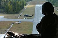
Rawalakot Airport is currently not in use. It has been closed since October 2005.
Climate and Weather
Rawalakot has a subtropical highland climate. This means it has mild to warm temperatures in spring and autumn. Summers are humid, and winters are cold, often with snow.
The weather in Rawalakot can change quickly. Temperatures can reach as high as 38°C (100°F) in mid-summer. In winter, they can drop below -1°C (30°F). Snow usually falls in December and January. Most of the rain happens during the monsoon season, from July to September.
| Climate data for Rawalakot, Azad Kashmir | |||||||||||||
|---|---|---|---|---|---|---|---|---|---|---|---|---|---|
| Month | Jan | Feb | Mar | Apr | May | Jun | Jul | Aug | Sep | Oct | Nov | Dec | Year |
| Record high °C (°F) | 25.6 (78.1) |
32.9 (91.2) |
34.4 (93.9) |
41.0 (105.8) |
45.0 (113.0) |
46.6 (115.9) |
43.2 (109.8) |
40.0 (104.0) |
39.4 (102.9) |
39.9 (103.8) |
33.3 (91.9) |
28.9 (84.0) |
46.6 (115.9) |
| Mean daily maximum °C (°F) | 17.3 (63.1) |
19.8 (67.6) |
24.7 (76.5) |
30.6 (87.1) |
36.3 (97.3) |
38.1 (100.6) |
34.8 (94.6) |
33.5 (92.3) |
33.2 (91.8) |
30.4 (86.7) |
25.2 (77.4) |
19.7 (67.5) |
28.6 (83.5) |
| Mean daily minimum °C (°F) | 3.8 (38.8) |
6.7 (44.1) |
11.1 (52.0) |
15.9 (60.6) |
21.0 (69.8) |
23.8 (74.8) |
24.3 (75.7) |
23.6 (74.5) |
21.1 (70.0) |
14.8 (58.6) |
8.8 (47.8) |
5.0 (41.0) |
15.0 (59.0) |
| Record low °C (°F) | −2.6 (27.3) |
0.0 (32.0) |
2.8 (37.0) |
3.3 (37.9) |
10.0 (50.0) |
13.0 (55.4) |
12.0 (53.6) |
12.7 (54.9) |
13.0 (55.4) |
1.9 (35.4) |
0.0 (32.0) |
−3.3 (26.1) |
−3.3 (26.1) |
| Average rainfall mm (inches) | 24.9 (0.98) |
30.8 (1.21) |
31.2 (1.23) |
20.1 (0.79) |
14.4 (0.57) |
44.1 (1.74) |
112.8 (4.44) |
136.3 (5.37) |
43.8 (1.72) |
15.7 (0.62) |
14.5 (0.57) |
19.1 (0.75) |
507.7 (19.99) |
Population of Rawalakot
According to the 2017 census, Rawalakot had an urban population of 56,006 people. This number grew slightly to 56,590 in 2018. Most of the people living in Rawalakot belong to an ethnic group called the Sudhan.
 | Emma Amos |
 | Edward Mitchell Bannister |
 | Larry D. Alexander |
 | Ernie Barnes |


