
Rawalpindi facts for kids
Quick facts for kids
Rawalpindi
راولپنڈی
|
||
|---|---|---|
|
Metropolis
|
||

From top, left to right:
Rawal Lake, Gulshan Dadan Khan Mosque, Bahria Town, Rawat Fort, Christ Church, Rawalpindi Railway Station |
||
|
||
| Nickname(s):
Pindi
|
||
.jpg)
Rawalpindi
Location in Punjab, Pakistan

Rawalpindi
Location in Pakistan

Rawalpindi
Location in South Asia
|
||
| Country | ||
| Province | ||
| Division | Rawalpindi | |
| District | Rawalpindi | |
| Tehsils | 8 | |
| Union councils | 38 | |
| Municipal status | 1867 | |
| Government | ||
| • Type | Metropolitan Corporation | |
| Area | ||
| • Metropolitan Corporation | 479 km2 (185 sq mi) | |
| • Metro | 311 km2 (120 sq mi) | |
| Elevation | 508 m (1,667 ft) | |
| Population
(2023)
|
||
| • Metropolitan Corporation | 2,284,014 | |
| • Rank | 4th, Pakistan | |
| • Density | 4,768/km2 (12,350/sq mi) | |
| • Metro | 3,357,612 | |
| Time zone | UTC+05:00 (PKT) | |
| • Summer (DST) | PKT | |
| Postal code |
46000
|
|
| Area code(s) | 051 | |
| Official Languages | Urdu, English | |
| Provincial Language | Punjabi | |
| Native Languages | Punjabi | |

Rawalpindi (/rɔːlˈpɪndi/; Punjabi, Urdu: راولپنڈی, romanized: Rāwalpinḍī) is a large city in the Punjab province of Pakistan. It is the fourth most populated city in Pakistan. Rawalpindi is located near the Soan River in northern Punjab. It is also the third-largest city in the world where people speak Punjabi.
Rawalpindi is right next to Islamabad, which is Pakistan's capital city. Because they are so close and share many things, they are often called the "twin cities".
For a long time, Rawalpindi was a small town. But in the 18th century, it started to become more important. The area is famous for its old history, like the nearby city of Taxila, which is a UNESCO World Heritage Site. In 1765, the city came under the rule of the Sukerchakia Misl. During the Sikh era, Rawalpindi grew into a major trading city because of its good location.
In 1849, the East India Company took control of Punjab. By the late 1800s, Rawalpindi became the biggest military base for the British Indian Army in the north. This was because its climate was good for the British. After Pakistan became independent in 1947, Rawalpindi became the main headquarters for the Pakistan Army.
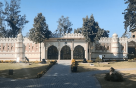
In 1959, Rawalpindi even served as Pakistan's temporary capital before Islamabad was fully built. Today, Rawalpindi and Islamabad are closely connected in many ways. Rawalpindi is also a key place for transport and supplies in northern Pakistan. It has old buildings and temples, and it's a starting point for tourists visiting places like Rohtas Fort, Azad Kashmir, Taxila, and Gilgit-Baltistan.
Contents
What Does the Name Rawalpindi Mean?
The name Rawalpindi might come from two Punjabi words. "Rawal" (راول) means "lake," and "pinḍ" (پِنڈی) means "village." So, Rawalpindi could mean "the village on the lake."
Another idea is that it means "Village of Rawals." This is because an old village here was home to a group of yogis (people who practice self-discipline) led by a yogi named 'Rawal'.
A Look at Rawalpindi's Past
Early History
People have lived in the Rawalpindi area for thousands of years. It is part of the ancient region of Gandhara, which has many old Buddhist ruins. In the area northwest of Rawalpindi, more than 55 stupas (Buddhist shrines), 28 Buddhist monasteries, and 9 temples have been found.


To the southeast, you can find the ruins of the Mankiala stupa. This stupa is from the second century. According to old stories, a previous form of the Buddha jumped off a cliff here to feed seven hungry tiger cubs. The nearby town of Taxila is believed to have been one of the first universities or learning centers in South Asia.
Medieval Times
Rawalpindi was first mentioned when Mahmud of Ghazni destroyed it. A chief named Kai Gohar rebuilt the town in the early 11th century. But it fell apart again after attacks by Mongols in the 14th century.
The town stayed empty until 1493. Then, Jhanda Khan Gakhar rebuilt it and named it Rawal.
Mughal Era

During the Mughal Empire, Rawalpindi was ruled by the Ghakhar clan. They were loyal to the Mughal emperors. The city became an important place to guard the borders of the Mughal Empire. In the 16th century, the Gakhars strengthened a nearby rest stop for travelers, turning it into the Rawat Fort. This helped protect the Pothohar plateau from Sher Shah Suri's forces.
In 1585, Emperor Akbar visited Rawalpindi. He stayed in the area for 13 years, expanding his empire. This time is called a "glorious period" in his rule.
Sikh Rule
As the Mughal power weakened, Rawalpindi became less important. In the mid-1760s, Sikhs led by Sardar Gujjar Singh captured the town. The city's management was given to Sardar Milkha Singh. He invited traders from nearby cities to settle there in 1766. The city then began to grow.
Later, the exiled king of Afghanistan, Shah Shuja, found safety in Rawalpindi in the early 1800s.
British Era

After the British East India Company took Rawalpindi, they decided to build a permanent military base there in 1851. The city got its first telegraph office in the early 1850s. The Garrison Church was built in 1854.
By 1867, Rawalpindi became a municipality (a self-governing town). The city was also connected to railways in the 1880s, linking it to India and Peshawar. Rawalpindi's military base supplied other British bases in the region.

Rawalpindi became a busy trading center. A large market was opened in 1883 by Sardar Sujan Singh. The British also built a shopping area called Saddar for the city's important people.
The military base in Rawalpindi became a major center of British military power after an arsenal (a place for weapons) was built in 1883. By 1921, the British army had made Rawalpindi the third-largest city in Punjab.
During World War I, Rawalpindi was very helpful in recruiting soldiers for the British. This led to more financial help from the British government for the area.
After Pakistan's Independence

When Pakistan became independent in 1947, many Hindu and Sikh people moved to India. Muslim refugees from India came to live in Rawalpindi.
After independence, many people from different parts of Pakistan, like Muhajir, Pashtun, and Kashmiri people, moved to Rawalpindi. Because it had been the largest British military base, Rawalpindi was chosen as the headquarters for the Pakistani Army.
Sadly, Rawalpindi was also where Pakistan's first Prime Minister, Liaquat Ali Khan, was assassinated in 1951. The place is now called Liaquat Bagh Park. In 2007, another former Prime Minister, Benazir Bhutto, was also assassinated here.


When Islamabad was built as the new capital in 1961, Rawalpindi received more investments. Rawalpindi is now very connected to Islamabad. Many people who work in Islamabad live in Rawalpindi's suburban areas. Rawalpindi is also a major center for transport and supplies in northern Pakistan. This is because it has the GHQ of the Pakistan Army, the PAF Base Nur Khan airbase, and connections to major motorways.
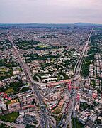
Geography and Climate


Rawalpindi has a climate with hot, wet summers and cooler, drier winters. It is close to the foothills of the Himalayas, so the weather can change a lot. Rawalpindi and Islamabad have many thunderstorms, more than any other city in Pakistan's plains. Strong windstorms are also common in summer.
The city gets a lot of rain, especially during the summer monsoon season. But it also rains quite a bit in winter. The highest temperature ever recorded was 47.7°C (117.9°F) in June 1954. The lowest was -3.9°C (25°F) in January 1967.
City Layout
-
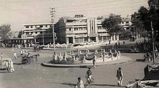
Fawara Chowk in 1940.
-
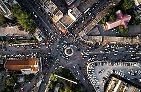
Fawara Chowk in 2021.
-
College Road, known for electronics.
-
Haveli Sujan Singh.
-
Poonch House.
-
Faizabad Interchange.
-
Lal Haveli.
-
Bahria Town, a private housing area.


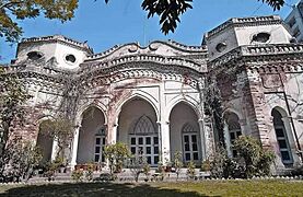
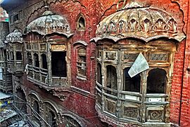
Rawalpindi's old city is made up of neighborhoods called Mohallahs. Each Mohallah has a nearby market (bazaar) and a mosque. These are places where people gather for trade and community. The neighborhoods have narrow streets called gallies. Houses are grouped around short lanes, which gives residents a sense of privacy. Important intersections are called chowks.
South of the old city, across the Lai Nullah stream, are the wide streets of the Rawalpindi Cantonment. This area has tree-lined roads and old buildings. It was the main European area during British rule. The British also built the Saddar Bazaar, a shopping area for the city's wealthy residents. Beyond the cantonment are large housing developments where people who work in Islamabad live.
Population and People
The population of Rawalpindi was 2,098,231 in 2017. Most people (84%) are Punjabi. About 9% are Pashtun, and 7% are from other groups.
Religions in Rawalpindi
-
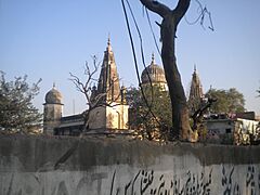
An old Hindu Temple at Bagh Sardaran.
-
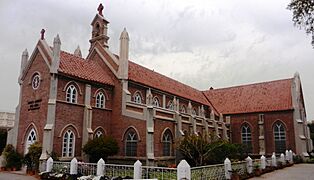
Christ Church, Rawalpindi.
-
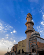
Moti Masjid.
-
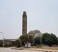
Fatima Masjid, Bahria Town.
-
Markazi Jamia Masjid.


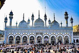
Most people in Rawalpindi (96.7%) are Muslim. About 3.1% are Christian, and 0.2% belong to other religions. The city's Kohaati Bazaar is known for large Shia processions during Ashura.
Before Pakistan became independent in 1947, Rawalpindi had many Hindu and Sikh people. After 1947, most Hindus and Sikhs moved to India. However, many old Hindu temples in the city still stand, though some are not used anymore. Many old neighborhoods still have Hindu and Sikh names.
The Shri Krishna Mandir is the only Hindu temple in Rawalpindi that is still used. It was built in 1897. Many churches were built during the British era for British soldiers.
Getting Around Rawalpindi
Public Transport


The Rawalpindi-Islamabad Metrobus is a bus system that connects Rawalpindi and Islamabad. It is 48.1 kilometers (30 miles) long. The first part of the Metrobus opened in 2015, connecting Pak Secretariat in Islamabad to Saddar in Rawalpindi. The second part opened in 2022. The system uses electronic tickets and is managed by the Punjab Mass Transit Authority.
Roads
Rawalpindi is on the old Grand Trunk Road. This road connects Peshawar to Islamabad and Lahore. There are also modern motorways like the M-1 Motorway and the M-2 Motorway that offer faster travel to other cities. The Grand Trunk Road also leads to the Afghan border through the Khyber Pass.
The Islamabad Expressway connects the eastern parts of Rawalpindi to Rawal Lake and the center of Islamabad.
Motorways

Rawalpindi is linked to Peshawar by the M-1 Motorway. This motorway also connects to cities like Charsadda and Mardan. The M-2 motorway provides fast access to Lahore. Other motorways are being built to connect Rawalpindi to cities like Faisalabad, Multan, and even Karachi.
Trains

The Rawalpindi railway station is in the Saddar area. It is a stop on Pakistan's main railway line, which connects Rawalpindi to Karachi and Peshawar. Many different trains stop at this station.
The railway line between Karachi and Peshawar is being improved. This will allow trains to travel much faster, at speeds of up to 160 kilometers per hour (100 mph).
Air Travel
Rawalpindi uses the Islamabad International Airport. This airport is about 21 kilometers (13 miles) west of the city. It has flights to many cities in Pakistan and to places in the Middle East, Europe, North America, and Asia.
City Divisions

The city of Rawalpindi is divided into one Municipal Corporation, two Cantonment Boards (military areas), and seven tehsils (smaller administrative areas):
- Rawalpindi Municipal Corporation Rawalpindi City
- Rawalpindi Cantonment Board Rawalpindi Cantt
- Chaklala Cantonment Board Chaklala Cantt
| Sr. | Tehsil | Headquarters | Area (km2) |
Population (2017) |
|---|---|---|---|---|
| 1 | Taxila | Taxila | NA | 677,951 |
| 2 | Rawalpindi | Rawalpindi | ? | 2,237,000 |
| 3 | Gujar Khan | Gujar Khan | 1,466 | 678,503 |
| 4 | Kallar Syedan | Kallar Syedan | 421 | 217,273 |
| 5 | Kahuta | Kahuta | NA | 220,576 |
| 6 | Kotli Sattian | Kotli Sattian | NA | 119,312 |
| 7 | Murree | Murree | NA | 233,471 |
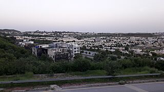
Rawalpindi also has many private housing areas that have grown quickly. Some examples are Bahria Town, which is one of Asia's largest private housing areas, and Gulraiz Housing Society.
Parks and Recreation


Rawalpindi has several parks where people can relax and have fun.
- Ayub National Park is a very large park, covering about 2,300 acres. It has a play area, a lake for boating, an aquarium, and a garden restaurant. This park is also home to "The Jungle Kingdom", which is very popular with young people. In 2019, a new amusement park called JoyLand opened in Ayub Park. It has many rides and activities, all imported and safe.
- Jinnah Park was opened in 2008 and is a popular spot. It has a modern cinema, a large supermarket, a McDonald's, gaming areas, and other fun facilities. It's also a great place for picnics.
- Liaquat Bagh is a park with a lot of history. It was here that Pakistan's first Prime Minister, Liaquat Ali Khan, was assassinated in 1950. Later, in 2007, former Prime Minister Benazir Bhutto was also assassinated at this park.
- Rawalpindi Public Park (now called Iqbal Park) is on Murree Road. It has a play area for children, green lawns, fountains, and flower beds. A cricket stadium was built nearby in 1992, and it hosted some matches during the 1996 Cricket World Cup.
-
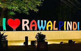
I Love Rawalpindi signboard.
-
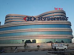
Giga Mall, a large mall in Rawalpindi.
-
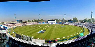
Pindi Cricket Stadium.
-
Ayub Park Rawalpindi Museum.
-
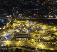
Night view of Joyland Rawalpindi.


- The Rawalpindi Golf Course was finished in 1926. It is one of Pakistan's oldest golf clubs. It now has 27 holes, making it the biggest golf course in Pakistan. From the clubhouse, you can see great views of the Faisal Mosque and the twin cities.
Education in Rawalpindi
-
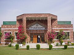
Govt College for Women.
-
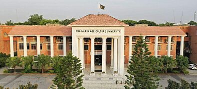
ARID Agriculture University.
-
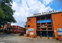
Gordon College.
-
Municipal Library.


Rawalpindi District has many government schools, including primary, middle, and high schools, and higher education colleges.
A high percentage of children aged 6–16 in Rawalpindi's urban areas attend school. This is one of the highest rates in Pakistan. Many students in Rawalpindi can read English sentences by Class 5. About 27% of children in Rawalpindi go to private schools.
Some important educational institutions include:
- College of Electrical & Mechanical Engineering: A large college that is part of NUST.
- Fatima Jinnah Women University: The first university in Pakistan specifically for women, started in 1998.
- Foundation University RWP Campus: Offers courses mainly in IT and Biotech.
Media and News
Rawalpindi has a very active media scene, with many newspapers and TV channels. There are over a dozen newspaper companies based in the city. Some popular Urdu newspapers include Daily Nawa-i-Waqt and Daily Jang. English newspapers include Dawn and The News International.
Many cable TV providers serve the city. There are also several television channels based in Rawalpindi, including:
- ATV
- Lights Asia
- Aapna Channel
- Pothohari TV (a channel in the local language)
- City 51
- Pahariwood Network (another local language channel)
- K2 TV
- Oxygene TV
- Samaa News
See also
 In Spanish: Rawalpindi para niños
