Islamabad facts for kids
Quick facts for kids
Islamabad
اسلامآباد
|
|
|---|---|
|
Federal capital city
|
|
|
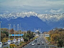
Islamabad Expressway
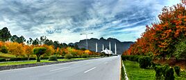
Pakistan Monument
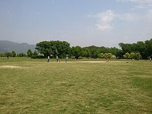
Fatima Jinnah Park
|
|
| Nickname(s):
Isloo, The Green City
|
|
| Country | |
| Adm. Unit | Islamabad Capital Territory |
| Constructed | 1960 |
| Established | 14 August 1967 |
| Government | |
| • Type | Metropolitan Corporation |
| • Body | Capital Development Authority |
| Area | |
| • City | 220.15 km2 (85.00 sq mi) |
| • Urban | 220.15 km2 (85.00 sq mi) |
| • Metro | 906.50 km2 (350.00 sq mi) |
| Highest elevation | 1,584 m (5,196 ft) |
| Lowest elevation | 490 m (1,610 ft) |
| Population
(2023 census)
|
|
| • City | 1,108,872 |
| • Rank | 9th (Pakistan) |
| • Density | 5,037/km2 (13,050/sq mi) |
| • Metro | 2,363,863 |
| • Metro density | 2,608/km2 (6,750/sq mi) |
| • Rank (Metro) | 4th (Pakistan) |
| Demonym(s) | Islamabadi |
| Time zone | UTC+05:00 (PKT) |
| Postcode |
44000
|
| Area code(s) | 051 |
Islamabad (meaning 'City of Islam') is the capital city of Pakistan. It is the country's ninth-largest city, with over 1.2 million people. The Pakistani government directly manages Islamabad as part of the Islamabad Capital Territory. It was built as a planned city in the 1960s and became the capital in 1967, replacing Karachi.
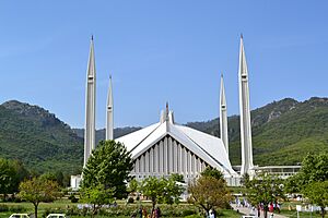
A Greek architect named Constantinos Apostolou Doxiadis created Islamabad's main plan. He divided the city into eight zones for different uses. These zones include areas for government, homes, schools, businesses, and green spaces. The city is famous for its many parks and forests, like the Margalla Hills National Park. Islamabad is also home to the Faisal Mosque, which is one of the world's largest mosques. Other important places are the Pakistan Monument and Democracy Square.
Islamabad is known for having a high cost of living in Pakistan. Many middle and upper-middle-class families live here. The city has twenty universities, including Quaid-i-Azam University and NUST. It is also considered one of the safest cities in Pakistan. This is partly due to a large camera system with nearly 2,000 CCTV cameras.
What's in a Name?
The name Islamabad means City of Islam. It comes from two words: Islam (the religion) and abad (a Persian word meaning 'cultivated place' or 'city'). A teacher and poet, Qazi Abdur Rehman Amritsari, suggested the name. Sometimes, people shorten Islamabad to ISB in texts. This comes from the airport code for Islamabad International Airport.
A Look Back: Islamabad's History
Early Times
The area where Islamabad now stands, called the Islamabad Capital Territory, has been home to people for a very long time. Some of the oldest Stone Age tools in the world, dating back 100,000 to 500,000 years, have been found here. Pottery and tools from prehistoric times have also been discovered.
Evidence shows that people lived here around 5000 BCE. They settled near the Soan River and later formed small communities around 3000 BCE. The Indus Valley civilization also thrived in this region. Many famous armies, like those of Genghis Khan and Timur, passed through this area. In 2015–16, a Buddhist stupa (a type of religious building) was found near the Shah Allah Ditta caves. It dates back to the 2nd to 5th century CE.
Building a Capital City
When Pakistan became independent in 1947, Karachi was its first capital. But in 1958, a group was formed to find a better location. They wanted a place that was easy to reach, had a good climate, and was safe. They chose the area northeast of Rawalpindi in 1959.
Islamabad was built as a "forward capital" for several reasons. Karachi was at the southern end of the country and open to attacks from the sea. Pakistan needed a capital that was more central. Also, Karachi was a busy business center, which some felt made it hard for the government to focus. The new location for Islamabad was closer to the army headquarters in Rawalpindi and the disputed area of Kashmir.
A Greek architecture firm, led by Konstantinos Apostolos Doxiadis, designed the city's main plan. It was shaped like a triangle, pointing towards the Margalla Hills. The capital first moved temporarily to Rawalpindi in the early 1960s. Then, in 1966, it officially moved to Islamabad once the main construction was done. In 1981, Islamabad became its own territory, separate from Punjab province. Famous architects like Edward Durell Stone also helped design parts of the city.
Recent Events
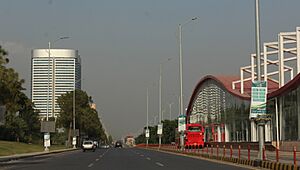
Islamabad has attracted people from all over Pakistan. This has made it one of the most diverse and modern cities in the country. As the capital, it has hosted many important meetings, like the South Asian Association for Regional Cooperation summit in 2004.
The city was affected by the 2005 Kashmir earthquake, which was very strong. In 2014, construction began on the Rawalpindi-Islamabad Metrobus, a public transport system. It was finished in 2015 and connects Islamabad with Rawalpindi.
Islamabad's Location and Climate
Geography
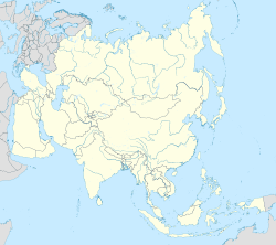
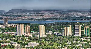
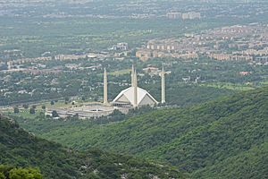
Islamabad is located at the northern edge of the Pothohar Plateau, right at the foot of the Margalla Hills. It sits about 540 meters (1,770 feet) above sea level. Islamabad and the nearby city of Rawalpindi are often called the "Twin Cities" because they are so close.
To the northeast is the hill station of Murree. To the north is the Haripur District. Islamabad is about 120 km (75 mi) south-southwest of Muzaffarabad and 295 km (183 mi) north-northwest of Lahore.
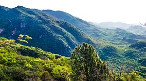
The city covers an area of 906 square kilometers (350 sq mi). The Margalla Hills National Park is in the north. The southern part of the city is a flat plain, drained by the Kurang River. The Rawal Dam is located on this river.
Climate
Islamabad has a humid subtropical climate. It experiences five seasons: Winter (November–February), Spring (March and April), Summer (May and June), Rainy Monsoon (July and August), and Autumn (September and October). June is usually the hottest month, with temperatures often going above 38°C (100°F). July is the wettest month, with heavy rains and thunderstorms. January is the coolest month.
The city's climate is influenced by three artificial lakes: Rawal, Simli, and Khanpur Dam. The Margalla Hills National Park covers a large part of the city. In July 1995, Islamabad had its highest monthly rainfall ever. Winters often have thick fog in the mornings and sunny afternoons. Snowfall is rare in the city itself, but it can happen on the peaks of nearby hills like Murree.
How Islamabad is Organized
City Zones
Islamabad is divided into five main zones: Zone I, Zone II, Zone III, Zone IV, and Zone V. Zone IV is the largest. Zone I has most of the developed residential areas. Zone III includes the Margalla Hills and Margalla Hills National Park. Zones IV and V contain Islamabad Park and rural areas. The Soan River flows through Zone V.
Each residential area is called a "sector" and is named with a letter and a number (like F-9 or G-6). These sectors are about 2 km by 2 km (1.25 mi by 1.25 mi) in size.
Important Sectors
- D Sectors: D-12 is a well-developed residential area near the Margalla Hills.
- E Sectors: E-7 to E-17. Many foreign and diplomatic people live here. E-8 and E-9 have university campuses like Bahria University and Air University.
- F Sectors: F-5 to F-17. F-5 is important for software companies. The entire F-9 sector is covered by Fatima Jinnah Park. The Centaurus complex is a famous landmark in F-8.
- G Sectors: G-5 to G-17. Important places include the Jinnah Convention Centre in G-5, the Red Mosque in G-6, and the Pakistan Institute of Medical Sciences (a large hospital) in G-8.
- H Sectors: H-8 to H-17. These are mostly for schools and hospitals. NUST is in H-12.
- I Sectors: I-8 to I-18. Except for I-8, these are mainly industrial areas.
Islamabad and Rawalpindi: Twin Cities
Islamabad and Rawalpindi are often called "Twin Cities." They are very close and depend on each other. Islamabad is the center for government activities. Rawalpindi is the center for industry, business, and military activities. The two cities are connected by major roads like Kashmir Highway and Islamabad Highway.
City Design
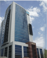
Islamabad's buildings mix modern styles with old Islamic and local traditions. The Saudi-Pak Tower shows this mix, with its beige color and blue Islamic tile work. The Pakistan Monument and Faisal Mosque also combine Islamic and modern designs.
The Faisal Mosque is unique because it doesn't have a traditional dome. It blends Arabic, Turkish, and Mughal architectural styles. The Centaurus is a modern building complex in Islamabad.
People of Islamabad
Languages Spoken
According to the 2023 census, most people in Islamabad speak Punjabi (50%). About 18% speak Pashto, and 15% speak Urdu, which is Pakistan's national language. Many people have moved to Islamabad from other parts of Pakistan, especially from Punjab.
Education and Learning
Islamabad has the highest literacy rate in Pakistan, at 88%. This means most people can read and write. The city has many advanced schools and universities. These include public and private institutions, and most are recognized by the Higher Education Commission of Pakistan.
There are 16 recognized universities in Islamabad. Many top-ranked universities, like NUST and PIEAS, have their main campuses here. The Allama Iqbal Open University, one of the world's largest universities by enrollment, is also in Islamabad. It offers distance education.
Religions
Islam is the main religion in Islamabad, followed by over 95% of the people. Christianity is the second largest religion, followed by about 4% of the population. A small number of people also follow Hinduism.
Islamabad's Economy
Islamabad plays a big part in Pakistan's economy. Even though it has less than 1% of the country's population, it contributes 1% to the country's total economic output. The Islamabad Stock Exchange, founded in 1989, was Pakistan's third-largest stock exchange. It later joined with others to form the Pakistan Stock Exchange.
The World Bank ranked Islamabad as the best place to start a business in Pakistan in 2010. Businesses in Islamabad are also very good at paying their taxes. The city has seen growth in technology with two Software Technology Parks. These parks host many local and international tech companies.
Culture and Heritage
Islamabad is home to people from all over Pakistan, which gives it a rich mix of cultures and religions. Because it's on the Pothohar Plateau, you can find traces of ancient cultures here. For example, the 15th-century Pharwala Fort is nearby. Rawat Fort, built in the 16th century, also stands in the region.
Saidpur village is a very old village, said to be 500 years old. It was once a place of Hindu worship. The village still has a small Hindu temple, showing the history of Hindu people in the area. The shrine of Sufi mystic Pir Meher Ali Shah is located at Golra Sharif, which has a long cultural history. You can also find remains from the Buddhist era. The shrine of Bari Imam was built by the Mughal Emperor Aurangzeb. Thousands of people visit this shrine every year for the annual Urs festival.
The Lok Virsa Museum in Islamabad shows off Pakistan's folk and traditional culture. It has a large collection of embroidered clothes, jewelry, musical instruments, and other traditional items from different parts of Pakistan.
Fun Things to Do: Tourism
The Faisal Mosque is a very important landmark that many tourists visit daily. Built in 1986, it was named after King Faisal of Saudi Arabia, who helped pay for its construction. This mosque can hold 24,000 people for prayers. Its design is unique, with no dome, and features beautiful writings from the Quran on its walls.
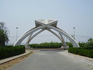
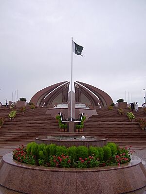
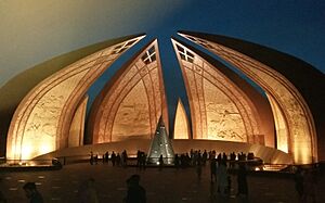
Another popular spot is the Pakistan Monument, built in 2007. This monument shows the pride and unity of Pakistan. It's shaped like a blooming flower, and its petals have art that shows other famous places in Pakistan, like the Badshahi Mosque and Lahore Fort.
Islamabad has some of Pakistan's best museums, like the Lok Virsa Museum. It also has important art galleries, such as the National Art Gallery. The Islamabad Museum has old items from the Gandhara period, which mixes Buddhist and Greek-Roman styles.
The city has many historic places that show civilizations from the Stone Age to modern times. Saidpur village, for example, dates back to the 16th century. It was once a sacred place with temples where Hindu Mughal commanders worshipped.
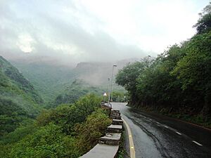
The Margalla Hills National Park is in the northern part of Islamabad, close to the Himalayas. This park has beautiful valleys and hills with lots of wildlife, including Himalayan goral and leopards. It's a great place for nature lovers and offers camping spots.
Faisal Mosque
The Faisal Mosque is a huge mosque in Islamabad. It's the largest in South Asia and the fourth largest in the world. It was finished in 1986 and named after King Faisal Bin Abdul Aziz of Saudi Arabia, who funded its building.
Trail 3
Trail 3 is a famous hiking path in Islamabad's Margalla Hills. It starts in sector F-6/3. The trail is quite steep but leads to a viewpoint in about 30-50 minutes. From there, you can continue for another 45-60 minutes to reach Pir Sohawa, where there are restaurants. The whole walk takes about one and a half hours.
Pakistan Monument
The Pakistan National Monument in Islamabad represents the four provinces and three territories of the country. Designed by Arif Masood, this flower-shaped building symbolizes Pakistan's growth and success.
Shah Allah Ditta Caves
Shah Allah Ditta village is a very old village, about 650 years old. It has ancient caves that show past civilizations. These 2500-year-old Buddhist caves are at the foot of the Margalla Hills. Near the caves, there's a spring, a pond, and a garden with old banyan trees. A Sufi saint named Shah Allah Ditta stayed here during the Mughal period.
Getting Around Islamabad
Flying In and Out
Islamabad is connected to the world through Islamabad International Airport (IIAP). This is Pakistan's largest airport. It opened in 2018 and is very big, covering 19 square kilometers (7.3 sq mi). It can handle many large airplanes.
Public Transport
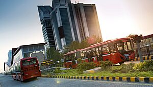
The Rawalpindi-Islamabad Metrobus is a bus system that runs for about 83.6 km (52 mi). It connects Islamabad with Rawalpindi. The first part of the system opened in 2015. More lines were added in 2022. The Metrobus uses electronic tickets and is popular with students and workers.
Trains
The Islamabad railway station is located in sector I-9. It's also known as Margala on the Pakistan Railways website.
Private Transport
For getting around locally, people use private taxis and ride-sharing services like Careem, Uber, Bykea, and SWVL.
Roads
The M-2 Motorway is 367 km (228 mi) long and connects Islamabad to Lahore. The M-1 Motorway connects Islamabad to Peshawar and is 155 km (96 mi) long. Islamabad is also linked to Rawalpindi by the Faizabad Interchange, which sees a lot of traffic every day.
Sports and Recreation
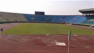
Islamabad has a large sports complex near Aabpara. It includes the Liaquat Gymnasium for indoor games and the Jinnah Sports Stadium for outdoor events. The stadium hosted the 2004 South Asian Games. Other sports places include the Diamond Club Ground and Islamabad Golf Club.
Another sports complex in F6 Markaz has tennis courts, a basketball court, and a Futsal ground. Popular sports in the city include cricket, football, squash, and hockey. Islamabad is home to Islamabad United, a cricket team that won the Pakistan Super League in 2016 and 2018.
The Margalla Hills also offer various spots for rock climbing. The Pakistan Sports Complex has swimming pools for children, which are very popular on weekends.
Sister Cities
Islamabad has friendly relationships with several cities around the world:
- Abu Dhabi, United Arab Emirates
- Amman, Jordan
- Ankara, Turkey
- Beijing, China
- Jakarta, Indonesia
- Madrid, Spain
- Minsk, Belarus
- Seoul, South Korea
- Astana, Kazakhstan
See also
 In Spanish: Islamabad para niños
 | Leon Lynch |
 | Milton P. Webster |
 | Ferdinand Smith |


