
Islamabad Capital Territory facts for kids

| Territory animal | Rhesus Macaque | |
|---|---|---|
| Territory bird | Rose-ringed Parakeet |  |
| Territory tree | Paper Mulberry | |
| Territory flower | Red rose |  |
The Islamabad Capital Territory (ICT for short) is a special area in Pakistan. It's one of two federal territories, which means it's directly managed by the country's government. The ICT is home to Islamabad, which is the capital city of Pakistan. It covers an area of about 1,165.5 square kilometers. The city of Islamabad itself takes up about 906 square kilometers, or 350 square miles, of this territory. Two representatives from the ICT are part of Pakistan's national assembly.
Contents
How Islamabad Became the Capital
The land for the Islamabad Capital Territory was bought in 1960 from two other regions of Pakistan: Khyber Pakhtunkhwa and Punjab. This was done to create a brand new capital city for Pakistan.
According to the original plan from 1960, the ICT was supposed to include the city of Rawalpindi. The land was planned to be used for different purposes:
- Rawalpindi city: 259 square kilometers
- Islamabad Proper (this included areas for buildings, businesses, and government): 220.15 square kilometers
- Islamabad (Margalla Hills) Park: 220.15 square kilometers
- Islamabad Rural Area (countryside): 446.20 square kilometers

However, the city of Rawalpindi was later removed from the ICT plan. The remaining territory is now divided into 5 zones. Zone I is where most of the homes, businesses, and government buildings are located.
About Islamabad City
Islamabad was designed and built to be a modern capital for Pakistan. It is located among the beautiful Margalla Hills at the northern end of the Potohar Plateau. The city was officially established in 1960, under the orders of the President at that time, General Ayub Khan.
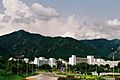
The capital city is known for its natural beauty, with many terraces and green meadows. It covers a southern plain that has a river called Kurang flowing through it. The Margalla Hills are found to the north-east of the ICT.
People of the Islamabad Capital Territory
Dhanyal is one of the largest tribes living in the areas around the Potohar plateau and the Lower Himalayas. This tribe believes their family line goes back to Ali ibn Abi-Talib, an important historical figure. Most Dhanyals live in the cities of Rawalpindi and Islamabad, and in the Murree Hills. Other parts of the tribe live in places like Kashmir, Abbottabad, Sialkot, and Hazara.
The Dhanyals are known for being brave. Members of this tribe served in the armies of the Mughal Empire and the British Empire. After Pakistan became independent from the British in 1947, many Dhanyals also joined the Pakistani Army.
Since Pakistan gained independence, Dhanyals living in cities have started working in other fields. Many have become successful in education, medicine, engineering, business, and social sciences. This tribe is known for having a very high literacy rate, meaning almost everyone can read and write.
Images for kids
-
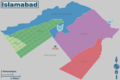
The five zones and sectors of Islamabad
-
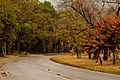
Islamabad's deciduous trees colours in Autumn
-
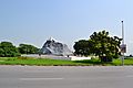
Chaghi Monument
-
Pakistan Secretariat
-
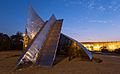
Star and Crescent Monument near the start of Shakarparian
-
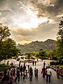
Daman-e-Koh Park
-
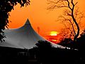
Sunset over the Lake View Park
-
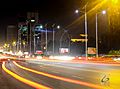
view of Blue Area, the commercial hub of the city.


