Bald Knob, Arkansas facts for kids
Quick facts for kids
Bald Knob
|
|
|---|---|

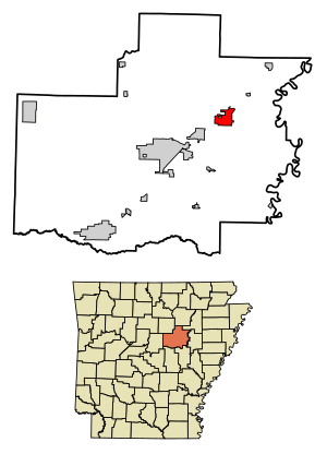
Location of Bald Knob in White County, Arkansas.
|
|
| Country | United States |
| State | Arkansas |
| County | White |
| Area | |
| • Total | 5.03 sq mi (13.01 km2) |
| • Land | 4.96 sq mi (12.83 km2) |
| • Water | 0.07 sq mi (0.18 km2) |
| Elevation | 246 ft (75 m) |
| Population
(2020)
|
|
| • Total | 2,522 |
| • Density | 508.98/sq mi (196.52/km2) |
| Time zone | UTC-6 (Central (CST)) |
| • Summer (DST) | UTC-5 (CDT) |
| ZIP code |
72010
|
| Area code(s) | 501 |
| FIPS code | 05-03280 |
| GNIS feature ID | 2403148 |
Bald Knob is a small city located in White County, Arkansas, in the United States. In 2020, about 2,522 people lived there.
Contents
What's in the Name?
Bald Knob got its name from a special hill nearby. This hill was "bald," meaning it had no trees on top. It was made of layered rock and helped early travelers find their way. It was a very important landmark for pioneers.
Places to See
You can visit the Campbell-Chrisp House in Bald Knob. This historic house was built in 1899. It was designed by an architect named Charles L. Thompson. The house is so important that it is listed on the U.S. National Register of Historic Places. This means it's a special place worth preserving.
About the Area
Bald Knob covers a total area of about 13 square kilometers (5 square miles). Most of this area is land, with a small part being water.
| Historical population | |||
|---|---|---|---|
| Census | Pop. | %± | |
| 1880 | 221 | — | |
| 1900 | 707 | — | |
| 1910 | 617 | −12.7% | |
| 1920 | 958 | 55.3% | |
| 1930 | 1,273 | 32.9% | |
| 1940 | 1,445 | 13.5% | |
| 1950 | 2,022 | 39.9% | |
| 1960 | 1,705 | −15.7% | |
| 1970 | 2,094 | 22.8% | |
| 1980 | 2,756 | 31.6% | |
| 1990 | 2,653 | −3.7% | |
| 2000 | 3,210 | 21.0% | |
| 2010 | 2,897 | −9.8% | |
| 2020 | 2,522 | −12.9% | |
| U.S. Decennial Census 2014 Estimate |
|||
Getting Around Bald Knob
Airports
Bald Knob has its own airport called Bald Knob Municipal Airport. It has a paved runway for planes to land and take off. If you need to fly on a bigger airplane, the Bill and Hillary Clinton National Airport is about 62 miles away in Little Rock.
Railroads
Bald Knob is a very important spot for the Union Pacific Railroad. It's where two major train lines meet: the Memphis line and the Chicago line from Little Rock. More than 60 trains pass through Bald Knob every single day! Because of its long history with the railroad, Union Pacific has even called Bald Knob a "Train Town USA." This is a special title given to towns that have a strong connection to the railroad.
Who Lives Here?
According to the 2020 United States census, there were 2,522 people living in Bald Knob. These people made up 1,123 households, with 682 of them being families.
See also
 In Spanish: Bald Knob (Arkansas) para niños


