Balish Glacier facts for kids
Quick facts for kids Balish Glacier |
|
|---|---|

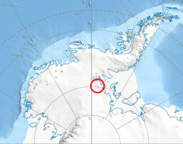
Location of Heritage Range in Western Antarctica
|
|
| Location | Heritage Range |
| Coordinates | 79°25′S 84°30′W / 79.417°S 84.500°W |
| Length | 18 nmi (33 km; 21 mi) |
| Thickness | unknownn |
| Terminus | Splettstoesser Glacier |
| Status | unknown |
The Balish Glacier (79°25′S 84°30′W / 79.417°S 84.500°W) is a large river of ice found in Antarctica. It is about 18 nautical miles (or 33 kilometers) long. This glacier flows north from a group of mountains called the Soholt Peaks. It eventually joins another large glacier, the Splettstoesser Glacier.
You can find the Balish Glacier in the Heritage Range, which is part of the larger Ellsworth Mountains. These mountains are located in a very cold and icy part of Antarctica.
Contents
Exploring and Naming the Balish Glacier
How Was the Glacier Mapped?
The Balish Glacier was first mapped by the United States Geological Survey (USGS). This is a science agency in the United States that studies the Earth. They used special surveys and air photos taken by the United States Navy (U.S. Navy) to create detailed maps. These photos were taken between 1961 and 1966. Air photos are pictures taken from airplanes, which help scientists see large areas.
Who Is Balish Glacier Named After?
The glacier was named by the Advisory Committee on Antarctic Names. This committee is in charge of naming places in Antarctica. They named it after Commander Daniel Balish. He was an important officer in a U.S. Navy squadron called VX-6.
Commander Balish served as the Executive Officer of VX-6 in 1965. Later, he became the Commanding Officer in 1967. His squadron was part of a big operation called Operation Deep Freeze. This operation helps support scientific research in Antarctica. Naming the glacier after him was a way to honor his contributions.
See also
 In Spanish: Glaciar Balish para niños
 | John T. Biggers |
 | Thomas Blackshear |
 | Mark Bradford |
 | Beverly Buchanan |


