Baring Head / Ōrua-pouanui facts for kids
Quick facts for kids Baring Head / Ōrua-pouanui |
|
|---|---|

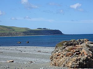
Baring Head / Ōrua-pouanui from the North
|
|
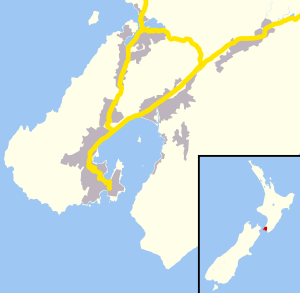
| Location | Wellington Region, New Zealand |
| Coordinates | 41°25′00″S 174°52′00″E / 41.416667°S 174.866667°E |
| Part of | North Island |
| Offshore water bodies | Cook Strait |
Baring Head / Ōrua-pouanui is a special headland located in New Zealand. It sits at the southern end of the North Island, between Wellington Harbour and Palliser Bay.
This area is known for its natural beauty and important scientific work. The Baring Head Lighthouse, built in 1935, stands on the headland. It helps guide ships and marks the southern edge of Fitzroy Bay.
Contents
Amazing Wildlife at Baring Head
Baring Head / Ōrua-pouanui is home to many different kinds of birds. At least nine bird species found here are considered "Nationally Threatened" or "At Risk." This means they are rare or their numbers are decreasing.
Some of these special birds include the black shag, Caspian tern, and banded dotterel. The banded dotterel even has a place at Baring Head where it lays its eggs and raises its young. This area is very important for protecting these native birds.
Baring Head Regional Park
In 2010, a large piece of land near the Baring Head lighthouse was bought to become part of the East Harbour Regional Park. This land is about 284.6 hectares, which is like 700 football fields!
Many groups worked together to buy this land. These included the Greater Wellington Regional Council, the New Zealand Government, the Department of Conservation, Hutt City Council, and a private helper. They wanted to protect the area's beautiful scenery, history, and nature.
The park was opened to everyone on February 13, 2011. A group called the Friends of Baring Head was also started to help look after the park.
Inside the park, there are natural rock formations. These rocks are popular for rock climbing, especially a type called bouldering. Bouldering is climbing on smaller rocks without ropes. Some people say this area is where bouldering first started in New Zealand! There are over 200 climbing paths listed on these rocks.
Tracking Carbon Dioxide in the Air
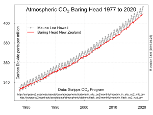
Scientists at Baring Head have been watching the amount of carbon dioxide in the air for a long time. This important work started in 1972 with a scientist named Dave Lowe.
Carbon dioxide is a gas that can affect our planet's climate. By measuring it regularly, scientists can understand how the air is changing. Data from Baring Head has been collected for many years, helping us learn more about our atmosphere.
Wind Farm Idea
In the early 1990s, there was an idea to build a wind farm at Baring Head. A company wanted to put up wind turbines to make electricity. This would have been the first wind farm in New Zealand.
However, the local council did not approve the plan. So, the wind farm was never built. At that time, the land was owned by a private person.
Images for kids
 | Calvin Brent |
 | Walter T. Bailey |
 | Martha Cassell Thompson |
 | Alberta Jeannette Cassell |


