Barnes City, Iowa facts for kids
Quick facts for kids
Barnes City, Iowa
|
|
|---|---|

Location of Barnes City, Iowa
|
|
| Country | |
| State | |
| Counties | Mahaska, Poweshiek |
| Government | |
| • Type | mayor-council |
| Area | |
| • Total | 0.59 sq mi (1.53 km2) |
| • Land | 0.59 sq mi (1.53 km2) |
| • Water | 0.00 sq mi (0.00 km2) |
| Elevation | 902 ft (275 m) |
| Population
(2020)
|
|
| • Total | 156 |
| • Density | 264.41/sq mi (102.14/km2) |
| Time zone | UTC-6 (Central (CST)) |
| • Summer (DST) | UTC-5 (CDT) |
| ZIP code |
50027
|
| Area code(s) | 641 |
| FIPS code | 19-04555 |
| GNIS feature ID | 2394064 |
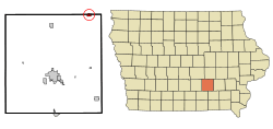
Barnes City is a small city located in the state of Iowa, USA. It's unique because it sits across two different counties: Mahaska County and Poweshiek County. In 2020, about 156 people lived there.
Contents
History of Barnes City
Barnes City started out with a different name: New Barnes. The city officially became "Barnes City" when it received its charter in 1898. A charter is like a special permission from the government that allows a place to be an official city.
The city came to be because of the Chicago, Rock Island and Pacific Railroad. This railroad needed a central spot between two towns, Montezuma and Thornburg. They decided to build a small train station, called a depot, right in the middle.
This spot happened to be on land owned by a person named James Barnes in 1881. That's how Barnes City got its name!
Geography of Barnes City
Barnes City is located in Iowa. It covers a total area of about 0.59 square miles (1.53 square kilometers). All of this area is land, meaning there are no large lakes or rivers within the city limits.
Population and People
The number of people living in Barnes City has changed over the years. In 1900, there were 274 residents. The population grew to 473 people in 1920, which was its highest point. Since then, the number of residents has slowly decreased.
Barnes City Population in 2020
According to the 2020 census, 156 people lived in Barnes City. There were 80 households and 47 families. This means there were about 264 people for every square mile of land.
Most of the people living in Barnes City were White (about 93.6%). A small number were Black or African American (0.6%) or Native American (0.6%). About 5.1% of the population identified as being from two or more races.
The average age of people in Barnes City was 53.7 years old. About 16% of the residents were under 20 years old. Many residents were older, with 26.3% being 65 years or older. The city had slightly more females (52.6%) than males (47.4%).
Schools in Barnes City
Students in Barnes City attend public schools operated by two different school districts. The North Mahaska Community School District serves most of the area. Part of the city, especially near its northern edge, is also served by the Montezuma Community School District.
Images for kids
See also
 In Spanish: Barnes City para niños
 | Kyle Baker |
 | Joseph Yoakum |
 | Laura Wheeler Waring |
 | Henry Ossawa Tanner |


