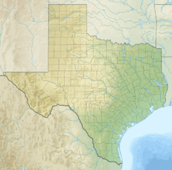
Barnhart, Texas facts for kids
Quick facts for kids
Barnhart, Texas
|
|
|---|---|
| Country | |
| State | |
| County | Irion |
| Elevation | 1,953 ft (595 m) |
| Population
(2017)
|
|
| • Total | 105 |
| Time zone | UTC-6 (Central (CST)) |
| • Summer (DST) | UTC-5 (CDT) |
| ZIP code |
76930
|
| Area code(s) | 325 |
Barnhart is a small community in Irion County, Texas, Texas, United States. It is not an officially organized town. In 2017, about 105 people lived there. You can see many oil rigs in the areas around Barnhart.
History of Barnhart
Barnhart was started in 1910 by Willam E. Barnhart. This happened when the Kansas City, Mexico and Orient Railway built its tracks through West Texas. The railroad passed right through this area.
A post office opened in Barnhart in 1912. A school also operated in the community. It taught students from 1912 until 1969. By 1915, about 50 people lived in Barnhart.
In the 1920s, Barnhart had its own bank. It also had a newspaper called the Barnhart Range. In the 1920s and 1930s, Barnhart became a very busy shipping spot. This was because of its location between major railroad lines.
People described Barnhart back then as a place with "dusty, bawling cattle, hell-raising cowboys and trains a half-mile long." It had everything cowboys and railroad workers needed. There was a hotel, a cafe, a bank, and even a theater.
Because West Texas was so far away from big cities, traditional cattle drives continued in Barnhart. This was long after they stopped being popular in other places. The large number of cattle coming through caused problems for local ranchers. To protect their pastures from being over-grazed, ranchers started building more fences.
To help with this issue, the Ozona-Barnhart Trap Company was formed in 1924. They created a long, narrow path of land. This path stretched 34 miles from south of Ozona, Texas to Barnhart. It became Texas’ last major cattle trail.
During the Great Depression, the government bought cattle from farmers. This helped farmers and the cattle market. By the year 2000, Barnhart's population was estimated to be 160 people.
Education in Barnhart
The Irion County Independent School District serves the students who live in the Barnhart area.
Highways Nearby
 US 67
US 67 SH 163
Barnhart's Climate
Barnhart has a semi-arid climate. This means it is usually dry, but not a desert. It gets some rain, but not a lot. On climate maps, this type of climate is called "BSk."
| Climate data for Barnhart, Texas | |||||||||||||
|---|---|---|---|---|---|---|---|---|---|---|---|---|---|
| Month | Jan | Feb | Mar | Apr | May | Jun | Jul | Aug | Sep | Oct | Nov | Dec | Year |
| Record high °F (°C) | 84 (29) |
93 (34) |
96 (36) |
100 (38) |
111 (44) |
115 (46) |
110 (43) |
109 (43) |
105 (41) |
102 (39) |
89 (32) |
84 (29) |
115 (46) |
| Mean daily maximum °F (°C) | 57.5 (14.2) |
61.6 (16.4) |
69.9 (21.1) |
79.1 (26.2) |
86.8 (30.4) |
92.5 (33.6) |
94.8 (34.9) |
93.8 (34.3) |
86.7 (30.4) |
77.8 (25.4) |
66.8 (19.3) |
58.7 (14.8) |
77.2 (25.1) |
| Mean daily minimum °F (°C) | 27.8 (−2.3) |
31.3 (−0.4) |
38.7 (3.7) |
47.7 (8.7) |
57.5 (14.2) |
65.2 (18.4) |
67.4 (19.7) |
66 (19) |
59.4 (15.2) |
48.3 (9.1) |
37.1 (2.8) |
28.9 (−1.7) |
47.9 (8.8) |
| Record low °F (°C) | −9 (−23) |
−9 (−23) |
2 (−17) |
18 (−8) |
33 (1) |
45 (7) |
48 (9) |
49 (9) |
32 (0) |
20 (−7) |
10 (−12) |
−7 (−22) |
−9 (−23) |
| Average precipitation inches (mm) | .6 (15) |
.9 (23) |
.9 (23) |
1.3 (33) |
2.4 (61) |
2.2 (56) |
1.8 (46) |
1.9 (48) |
2.6 (66) |
1.9 (48) |
.9 (23) |
.8 (20) |
18 (460) |
| Average precipitation days | 3 | 3 | 3 | 3 | 5 | 4 | 4 | 4 | 5 | 4 | 2 | 2 | 42 |
| Source: Weatherbase | |||||||||||||
In 2013, Barnhart had a drought. This means there was very little rain. The drought was made worse because a lot of groundwater was used. This water was needed for a process called hydraulic fracking. Fracking is used to get petroleum (oil) out of the ground.
 | Bessie Coleman |
 | Spann Watson |
 | Jill E. Brown |
 | Sherman W. White |


