
Bartın facts for kids
Quick facts for kids
Bartın
|
|
|---|---|
 |
|

Bartın
Location in Turkey
|
|
| Country | Turkey |
| Province | Bartın |
| District | Bartın |
| Elevation | 27 m (89 ft) |
| Population
(2021)
|
81,692 |
| Time zone | TRT (UTC+3) |
| Postal code |
74100
|
| Area code | 0378 |
| Climate | Cfb |
Bartın is a city in northern Turkey, located close to the Black Sea. It is the main city of Bartın Province and Bartın District. In 2021, about 81,692 people lived there.
Bartın used to be part of Zonguldak Province. In 1991, it became its own province. The city is about 14 kilometers (9 miles) inland from the sea. It sits on the Bartın River (Bartın Çayı). This river is special because it is the only river in Turkey that ships can travel on between the city and the Black Sea coast.
Contents
A Look at Bartın's Past
The history of Bartın, once called Parthenios or Parthenia in ancient Greek, goes back a very long time. Around 1200 BC, a tribe called the Kaskians lived in this area.
Over the centuries, many different groups ruled the region. These included the Hittites, Phrygians, Cimmerians, Lydians, Greeks, and Persians. Later, it became part of the powerful Roman Empire and then the Byzantine Empire.
Between the 11th and 13th centuries AD, the area was taken over by the Seljuk Turks and the Candaroğulları State. Finally, in 1392, the Ottoman sultan Mehmet II conquered Bartın. In the late 1800s and early 1900s, Bartın was part of the Kastamonu Vilayet in the Ottoman Empire.
Cool Places to See in Bartın
Bartın is a member of the European Association of Historic Towns and Regions. This means it's recognized for its important historical places.
Some of the main sights in Bartın include an old castle and two churches. There's also a bedesten, which is a covered market. You can also see the Kuşkayası Road Monument and the İnziva (seclusion) Cave in the city center.
Many parts of the ancient city are now buried underground. These include the forum (a public square), the council palace, a road of honor, a theatre, the acropolis (a high part of the city), and a necropolis (an ancient cemetery).
The old wooden houses in Bartın show special building styles from after the Tanzimat Fermanı (Reforms Decree) in the Ottoman Empire.
Bartın's Geography
The city of Bartın is made up of 22 different neighborhoods, called quarters. Here are some of them:
- Kırtepe
- Kemerköprü
- Gölbucağı
- Orta
- Okulak
- Köyortası
- Orduyeri
- Tuna
- Demirciler
- Aladağ
- Karaköy
- Çaydüzü
- Esentepe
- Cumhuriyet
- Hürriyet
- Karaçay
- Ağdacı
- Gecen
- Gürgenpınarı
- Şiremirçavuş
- Uzunöz
- Yıldız
Weather in Bartın
Bartın has a climate that is a mix of oceanic and humid subtropical. This means it gets influences from both types of weather.
Summers in Bartın are warm. The average temperature in July and August is around 22.5°C (72.5°F). Winters are cool and wet. The average temperature in January and February is about 4°C (39°F).
For a long time, Bartın was mostly known for its oceanic climate. However, due to climate change and global warming, its climate is slowly becoming more humid subtropical.
It rains most in autumn and early winter. Spring usually has the least rain. Snowfall is common between December and March. It can snow for a week or two, and sometimes it snows a lot!
The highest temperature ever recorded in Bartın was 42.8°C (109°F) on July 13, 2000. The lowest temperature ever recorded was -18.6°C (-1.5°F) on February 23, 1985.
Images for kids
-
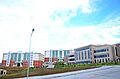
Bartın University Campus
-

A market in Bartın


See also
 In Spanish: Bartın para niños
