Bayview Heights, Queensland facts for kids
Quick facts for kids Bayview HeightsQueensland |
|||||||||||||||
|---|---|---|---|---|---|---|---|---|---|---|---|---|---|---|---|

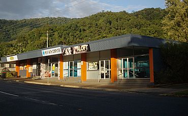
Marti Street, Bayview Heights
|
|||||||||||||||
| Population | 4,175 (2021 census) | ||||||||||||||
| • Density | 971/km2 (2,510/sq mi) | ||||||||||||||
| Postcode(s) | 4868 | ||||||||||||||
| Area | 4.3 km2 (1.7 sq mi) | ||||||||||||||
| Location |
|
||||||||||||||
| LGA(s) | Cairns Region | ||||||||||||||
| State electorate(s) | Mulgrave | ||||||||||||||
| Federal Division(s) | Leichhardt | ||||||||||||||
|
|||||||||||||||
Bayview Heights is a suburb located south of Cairns in Queensland, Australia. It's part of the Cairns Region. In 2021, about 4,175 people lived there.
A Look Back
Bayview Heights is on the traditional land of the Yidinji people, who are Aboriginal people. The area was first called "Bayview" in 1947 because of its great views of the sea. Later, in April 1970, the name was changed to Bayview Heights.
Who Lives Here?
Let's look at how many people call Bayview Heights home.
- In 2011, there were 4,150 people.
- By 2016, the population grew slightly to 4,238 people.
- In the most recent count from 2021, the population was 4,175 people.
Learning and Schools
There are no schools directly in Bayview Heights. Students usually go to schools in the nearby suburb of Woree. The closest government schools are Woree State School for primary students and Woree State High School for secondary students.
See also
 In Spanish: Bayview Heights (Queensland) para niños
Black History Month on Kiddle
Famous African-American Civil Rights Activists
 | Roy Wilkins |
 | John Lewis |
 | Linda Carol Brown |

All content from Kiddle encyclopedia articles (including the article images and facts) can be freely used under Attribution-ShareAlike license, unless stated otherwise. Cite this article:
Bayview Heights, Queensland Facts for Kids. Kiddle Encyclopedia.

