Beachlands, New Zealand facts for kids
Quick facts for kids
Beachlands
|
|
|---|---|
|
Suburb
|
|
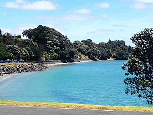
Sunkist Bay in Beachlands, New Zealand
|
|
| Country | New Zealand |
| Local authority | Auckland |
| Electoral ward | Franklin ward |
| Local board | Franklin Local Board |
| Established | 1920s |
| Area | |
| • Land | 882 ha (2,179 acre) |
| Population
(June 2023)
|
|
| • Total | 7,770 |
| Ferry terminal(s) | Pine Harbour Marina |
|
|
||
Beachlands is a cool coastal suburb located in Auckland, New Zealand. It started as a holiday spot in the 1920s and became a popular place to live in the 1950s. Beachlands is part of the beautiful Pōhutukawa Coast and is close to Maraetai.
Contents
Where is Beachlands Located?
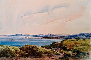
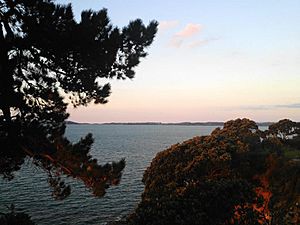
Beachlands is right next to the Tāmaki Strait, which is part of the Hauraki Gulf in New Zealand. It's about 20 kilometres east of the Auckland City Centre. The area has many lovely bays and beaches. These include Sunkist Bay, Pohutukawa Bay, View Bay, and Shelly Bay. It is also west of the Ōmana Regional Park.
What is the History of Beachlands?
Māori History of Beachlands
The Pōhutukawa Coast was first visited by the Tainui canoe (waka) around the year 1300. Some of the Tainui people, called Ngā Oho, decided to live here. The Ngāi Tai ki Tāmaki people, who are the original people of this land (mana whenua), are descendants of these early settlers.
Ngāi Tai stories say that the land was already home to special people called Tūrehu. Many local place names, like Hinerangi, come from these Tūrehu figures.
The traditional name for the Beachlands area is Kahawairahi. This name means there were lots of kahawai fish in the water. The inland area was called Kauriwhakiwhaki. This was a place where kauri wood was gathered to build canoes (waka). Kauri gum was also collected for kapoa, a type of traditional chewing gum.
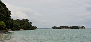
This area was very important for gardening and fishing. You can still find old sites like middens (shell heaps) and terraces. The land between Sunkist Bay and Shelly Bay had a fortified village (pā) called Te Kawau. Motukaraka Island was famous for its kūmara (sweet potato) gardens. It used to be connected to the mainland by a sandy strip at low tide. The waters around Motukaraka were also great for shark fishing.
Kahawairahi remained an important Ngāi Tai settlement even when Europeans started arriving. In the 1860s, European settlers saw Ngāi Tai people drying fish here. In the 1830s, much of the area was empty because of conflicts during the Musket Wars. Many Ngāi Tai people had moved to a safer place in the Waikato.
Later, in 1836, a large piece of land was purchased by William Thomas Fairburn. However, the government later decided this purchase was too big. The land that was not allowed to be bought was not given back to Ngāi Tai. Instead, a special area was set aside for them in 1854.
During the Invasion of the Waikato in 1863, a Ngāi Tai village near Clevedon was attacked. The villagers moved to communities near the river's mouth. Ngāi Tai remained neutral and were seen as "friendly" by the government. After 1865, many Ngāi Tai lands were taken by the government. The remaining land was divided up and slowly sold to European farmers.
How Beachlands Grew as a Suburb
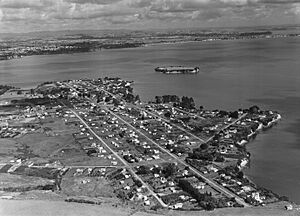
Before 1922, the Beachlands area was mostly farmland. Then, a man named Richard W. Kipplewhite divided the land into sections. Beachlands was advertised as a "new marine garden suburb" of Auckland. People from Auckland would visit Beachlands for day trips by ferry. Soon, a holiday community started to grow here.
In 1929, the first bus service began. It connected Maraetai, Beachlands, and Whitford to Auckland. The Beachlands RSA Hall was built in 1948.
Beachlands grew a lot in the 1950s. It changed from just a holiday spot to a place where people lived all the time. In the 1960s, property values here dropped for a while. This was because there was a plan to build an oil refinery in the area. The refinery was eventually built somewhere else.
Pine Harbour Marina was built in 1988. The Formosa Golf Club opened in 1997. In 2017, the Pohutukawa Coast Shopping Centre opened in Beachlands.
Many people from England and South Africa have moved to Beachlands recently. Older houses in Beachlands often have large gardens. The homes range from fancy houses on cliffs to smaller, older holiday homes called baches. Newer areas like Pine Harbour and Spinnaker Bay have modern houses with smaller gardens.
Most homes in Beachlands collect their own rainwater. Some also use water from underground sources.
What is Beachlands Like Today?
Beachlands is considered a small urban area. It covers about 8.82 square kilometres. As of 2023, it has an estimated population of around 8,000 people.
The population of Beachlands has grown quite a bit over the years:
- In 2006, there were 3,417 people.
- By 2013, it grew to 4,566 people.
- In 2018, the population was 6,261 people.
In 2018, there were about 2,046 households. There were slightly more males than females. About 24.6% of the people were under 15 years old. Most people (91.7%) identified as European/Pākehā. There were also people identifying as Māori (8.6%), Asian (5.3%), and Pacific peoples (2.6%). About 27.2% of people were born overseas.
When asked about religion, most people (55.4%) said they had no religion. About 34.7% were Christian.
What are the Landmarks and Features in Beachlands?
Beachlands has many natural attractions. These include Sunkist Bay Beach, Shelly Beach, and Snapper Rock. The Domain is a small park in the centre of Beachlands. It is located at the corner of Beachlands Road, Sunkist Bay Road, and Karaka Road.
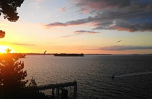
Offshore, you can see Motukaraka Island. It is also known as Flat Top Island or Flat Island. You can walk to it from the shore when the tide is low. There is also a walkway and cycleway that goes between Maraetai and Beachlands, following the coast through Omana and Te Puru.
What About Education in Beachlands?
The first Beachlands School opened way back in 1925. The current Beachlands School opened in 1949. It is a school for students in years 1 to 8. As of 2023, it has about 1,224 students.
There are no high schools (colleges) right in Beachlands. However, free buses take students to other schools nearby. These include Howick College and Botany Downs Secondary College. There are also buses to special character schools like Elim Christian College, Sancta Maria College, and Saint Kentigern College.
How Do People Get Around in Beachlands?
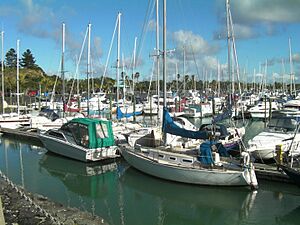
The Pine Harbour Marina is a very important transport hub for Beachlands. It has a ferry service that goes to central Auckland. On weekdays, there are 20 ferry trips each way! In 2015, the marina, which has 570 berths for boats, was sold for $22 million.
What Sports and Recreation are There?
The Te Puru Sports Centre is located in Te Puru Park, between Beachlands and Maraetai. It is a big community hub. It is home to the Te Puru Keas (junior cubs), Cubs, Scouts, and Venturers groups.
The centre also has a gym, tennis courts, sports fields, and a large indoor arena. This centre helps bring the Beachlands and Maraetai communities together as the 'Pohutukawa Coast' community. The Te Puru Centre was built with a lot of help from local fundraising and a grant from former Manukau City Mayor Sir Barry Curtis.
Images for kids
 | Lonnie Johnson |
 | Granville Woods |
 | Lewis Howard Latimer |
 | James West |


