Motukaraka Island facts for kids
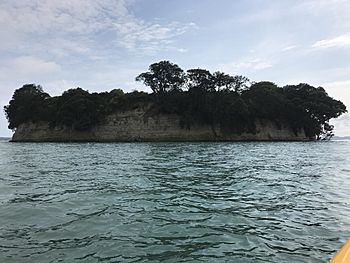
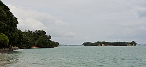
Motukaraka Island, which means "Island of Karaka trees," is a small, empty island in New Zealand. It is about 5.7 hectares (about 14 acres) in size. The island is located about 500 meters (1,640 feet) off the coast of Beachlands in Auckland. It has a very interesting past, especially with the Māori.
The island is mostly flat and sits about 15 meters (49 feet) above sea level. You can reach it from the mainland by walking across a raised shell bank. This path is usually open for about two hours before and after low tide. The rocks around the island are a popular spot for day trips and fishing. However, it's hard to get to the top of the island because of the steep cliffs.
Many other places in New Zealand are also called "Motukaraka." These include areas in Green Bay (an Auckland suburb) and in the Hokianga Harbour. To avoid confusion, this particular island is often described as being "near Howick."
Island's Past: A Look at Motukaraka's History
Historians tell us that in the late 1700s, Motukaraka Island was a strong pā (a fortified village or settlement). About 100 members of the Ngāti Pāoa tribe lived there. Around this time, another group called Ngāti Rongo attacked the island. They were seeking revenge for an earlier fight with Ngāti Pāoa.
The attackers used tall kauri tree trunks as ladders to climb the walls. They attacked at dawn. In the battle that followed, almost everyone living on the island was defeated, including the Ngāti Pāoa chief, Taeiwi. The island has been empty ever since that time.
Motukaraka Island was the first "historic category scenic reserve" in New Zealand. This means it was set aside in March 1905 to protect its natural beauty and historical importance. In the 1920s, people used the island for farming. They grew karaka trees and potatoes, and even raised rabbits. A special chute was built to slide bags of potatoes down to waiting carts. Even though it was used for farming, no one lived on the island permanently.
In 1965, a big fire started on the island. It burned for three days without stopping. Almost all the plants were destroyed, except for a few pohutukawa trees near the coast.
Over the years, the island has been known by other names too. These include Flat Island, Motu Ika (which means "Fish Island"), and Reserve Island.
Nature and Fun: Exploring Motukaraka Island
In the 1990s and 2000s, many trips were made to the island. Scientists wanted to study the plants and animals that had grown back after the fire. They also worked to remove pests. It seems that getting rid of pests has been successful. However, because the old trees and plants were lost in the fire, some weeds have grown easily.
At different times, stairs were built to make it easier to get onto the island. But problems with drainage and the tough weather meant they had to be removed. Even without easy stairs, the island is still a popular place for walks and fishing.
 | Percy Lavon Julian |
 | Katherine Johnson |
 | George Washington Carver |
 | Annie Easley |


