Hokianga facts for kids
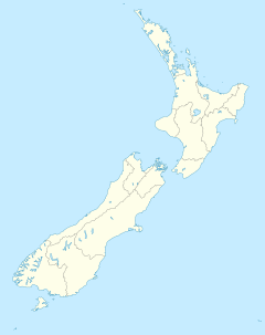
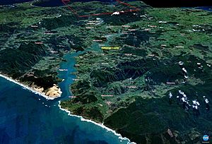
The Hokianga is a special area in the north of New Zealand's North Island. It surrounds the Hokianga Harbour, which is also called the Hokianga River. This harbour is a long, narrow bay formed when a river valley was flooded by the sea. It's located on the west coast.
Local Māori have several names for this place. One is Te Kohanga o Te Tai Tokerau, meaning "the nest of the northern people." Another is Te Puna o Te Ao Marama, which means "the wellspring in the world of light." The full name of the harbour is Te Hokianga-nui-a-Kupe. This translates to "the place of Kupe's great return."
Contents
Exploring Hokianga's Geography
The Hokianga area is part of the Far North District. This district is located within the Northland Region. It's about 120 kilometers (75 miles) northwest of Whangārei City. It's also 40 kilometers (25 miles) west of Kaikohe by road.
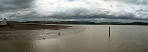
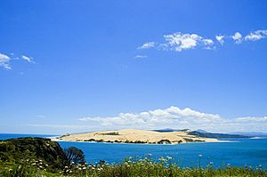
The harbour stretches inland for about 30 kilometers (19 miles) from the Tasman Sea. Small boats can travel along most of its length. However, there is a sandbar at the entrance. This sandbar can make it tricky for larger ships to enter.
How Hokianga Harbour Was Formed
About 12,000 years ago, Hokianga was a river valley. It was surrounded by steep hills covered in thick bush. After the last ice age, sea levels rose dramatically. This slow rise in water flooded the valley. It turned it into a tidal saltwater harbour. This new harbour had many sheltered, deep-water spots for boats.
This was the harbour that the famous explorer Kupe left from. Later, in 1822, it became home to the first European timber businesses. Today, you might see small dolphins and killer whales in the harbour. Large whales are rarely seen here.
Islands and Waterways in Hokianga
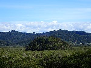
Many small islands are found in the Hokianga Harbour. These include Ruapapaka Island, Motukaraka Island, and To Motu Island. To Motu Island was once the site of an old pā (a Māori fortified village).
Since Hokianga is a flooded valley, many "tributaries" flow into it. Many of these are still called rivers. However, they are actually more like bays or inlets. Some of these waterways include:
- Whakarapa River
- Motuti River
- Whangapapatiki Creek
- Tapuwae River
- Mangamuka River
- Orira River
- Waihou River
- Wairere River
- Waima River
- Omanaia River
- Whirinaki River
Towns and Villages Around Hokianga
The area around the harbour is split into three parts by the water. To the south, you'll find towns like Waimamaku, Ōmāpere, Opononi, Pakanae, Koutu, Whirinaki, Rawene, Omanaia, Waima, and Taheke.
On the north side are Broadwood, Pawarenga, Panguru, Mitimiti, and Rangi Point. At the very top of the harbour, past the narrows, are Horeke, Kohukohu, and Mangamuka.
Hokianga's Rich History
Hokianga has a long and important history. It is considered one of the oldest settlements in Aotearoa (New Zealand). It remains a very important place for Māori people.
Early Māori Settlers
According to Te Tai Tokerau stories, the legendary Polynesian explorers, Kupe and Ngāhue, arrived in Hokianga around 925 AD. They came after their discovery journey from Hawaiki in their canoes, Matahorua and Tāwhirirangi. When Kupe left, he said this would be the place of his return. He left behind some items, including his canoe's bailer. Later, Kupe's grandson, Nukutawhiti, returned from Hawaiki to live in Hokianga.
In the 14th century, a great chief named Puhi landed south of the Bay of Islands. Puhi's tribe, Ngāpuhi, slowly moved west. They eventually reached the west coast and settled on both sides of Hokianga. Rahiri, who founded the Ngāpuhi iwi (tribe) in the 17th century, was born at Whiria pā. This pā is south of the harbour, and a monument stands there in his memory.
Over centuries, Ngāpuhi created a complex network of walking tracks. Many of these tracks later became the roads we use today.
Ancient Pā Sites
More than a dozen pā sites are located near the Hokianga. One important site is Motukauri Pā. It sits on a headland between the Motuti River and Whangapapatiki Creek.
Europeans Arrive in Hokianga
Wesleyan and later Anglican missionaries were guided along the Ngāpuhi tracks. They discovered Hokianga and its valuable timber. Their reports quickly reached merchant ship captains in the Bay of Islands.
Captain James Herd of the Providence was the first to respond. With missionary Thomas Kendall as his guide, he crossed the sandbar and entered the harbour in 1822. His ship was the first European vessel to do so. It left with the first shipment of timber from Hokianga. His success led to many others following. The cutting down of Hokianga's forests began and continued until the early 1900s.
The sandbar at the harbour's entrance was the only challenge to Hokianga's timber trade. Hundreds of ships successfully navigated it. However, 16 ships were recorded as being lost. Most accidents happened when ships were leaving fully loaded. They would get caught in the wind shadow from South Head. A sudden calm or change in wind could cause a sailing ship to lose control. It would then be swept onto the rocky shore.
In 1828, the missionary schooner Herald sank while trying to enter Hokianga Harbour. The last recorded shipwreck was the schooner Isabella de Fraine. It was lost with all eight crew in July 1928 after capsizing on the bar.
In 1837, a French adventurer named Baron Charles de Thierry arrived with 60 settlers. He wanted to claim a large area of land. He believed he had bought it 15 years earlier for 36 axes. He was eventually given about 400 hectares (1,000 acres) at Rangiahua. There, he set up his colony. He called himself "Sovereign Chief of New Zealand." This title did not make him popular with Ngāpuhi. His project failed. However, it showed the British Colonial Service that they needed to protect against other European powers.
The year after de Thierry arrived, another Frenchman, Bishop Jean Baptiste Pompallier, came. He wanted to set up a Catholic mission. He found the southern shores already settled by Methodist and Anglican missionaries. But the northern side was ready for his message. His remains are now buried where his mission began.
Just six days after the Treaty of Waitangi was signed, Governor Hobson visited the Māngungu Mission near Horeke. He wanted to get full support from Ngāpuhi. About 3,000 people were waiting there. The second signing of the Treaty of Waitangi happened on February 12, 1840. With the right signatures, Hobson could claim support from the country's largest tribe.
While the country's future was being decided, the timber cutters of Hokianga kept working. At times, up to 20 ships would be loading timber from Hokianga. Whole hillsides, now bare of trees, began to slide into the harbour. This choked its smaller rivers with mud.
The relationship between Māori and Pākehā (European) settlers was often difficult. This was especially true during the Dog Tax War of the 1890s. This conflict was mainly centered around Hokianga.
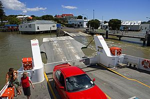
By 1900, most of the forest had been cut down and shipped out. The remaining topsoil was used for dairy farming. Most of the cream for the Motukaraka Dairy Factory was brought by about fifty local boats. These boats crossed the harbour daily. They also provided transport for people and goods. For 50 years, communities on both sides of the harbour were connected by sea. But in the 1950s, better roads took over. The harbour once again divided the community.
By 1914, a simple telephone system connected some Hokianga communities. It also linked them to the outside world. A government-supported weekly shipping service ran between Onehunga and Hokianga. It brought in goods and took away butter.
Horeke and Rawene are the second and third oldest European settlements in New Zealand. Rawene is still the most important coastal town in Hokianga. It is home to Hauora Hokianga, the community-owned health services, located at the Hokianga Hospital.
The 1918 Flu Pandemic
The influenza pandemic reached Hokianga in September 1918. The remote settlement of Waiotemarama was one of the first to be affected. Soup kitchens were set up in each community. Dr George McCall Smith, the head doctor at Rawene Hospital, gave strict orders. Armed guards on horseback stood at all crossroads. They turned back visitors to stop the disease from spreading between settlements. Travelers trying to enter Hokianga were simply stopped at the border. The rule was clear: anyone could leave, but no one could enter.
The local outbreak lasted six weeks. Many people died. Each community took care of its own. Mass burials were common. Few Māori deaths were officially recorded. So, the true impact of the flu on Māori is not fully known.
Industries and Tourism in Hokianga
Hokianga's first big industry was based on kauri trees. This included both logging the trees and collecting their gum. Kauri gum is a strong, thick resin from the trees. After the forests became thin, dairy farming and cheese making became the main industries. But these also declined after the Motukaraka Dairy Cooperative closed in 1953. For a while in the 1970s and 1980s, there was little economic activity. The area became a place for people seeking alternative lifestyles.
In recent years, tourism has grown in the region. Many attractions bring visitors every year. These include the huge kauri trees of the Waipoua Forest. This forest is home to Tane Mahuta, the country's largest tree. Other attractions are the historic waterfront villages of Kohukohu and Rawene. There are also cafes, the Horeke basalts (unique rock formations), beaches, old buildings, nature walks, horse riding, boat trips, and fishing.
In 2002, the first walking tracks opened at the Wairere Boulders. These tracks allow visitors to see the basalt rocks in the Wairere valley up close. Hokianga offers different types of places to stay for all budgets. It's a great choice for travelers who want a quieter holiday than the busier east coast. Visiting Hokianga is like seeing what New Zealand was like many years ago, with its unspoiled landscapes.
Famous People Connected to Hokianga
Three important figures in New Zealand history have strong ties to Hokianga.
Dame Whina Cooper: A Māori Leader
Dame Whina Cooper was born at Te Karaka, Hokianga, on December 9, 1895. She was the daughter of a leader from the Te Rarawa iwi.
From a young age, she was interested in community matters and politics. Her skills led her to become the main Māori leader of northern Hokianga by her mid-30s.
In 1949, she moved to Auckland. By 1951, she was elected the first president of the new Māori Women's Welfare League. The league's success was largely thanks to Whina's hard work. She became well known across the country. In 1957, she stepped down as president. The annual conference honored her with the title Te Whaea o te Motu, meaning "Mother of the Nation."
Whina Cooper continued to work for her community throughout the 1960s. But she is best remembered for leading a hīkoi (a symbolic march) in 1975. This march protested the loss of Māori land. The march went from the northern tip of the North Island all the way to Parliament in Wellington. This made her famous nationwide. Her determined figure, though no longer strong in body, was strong in mana (spiritual power) and will. She walked at the front of the march from Te Hapua to Wellington.
She was made a DBE (Dame Commander of the Order of the British Empire) in 1981. She also became a member of the Order of New Zealand in 1991. She had returned to Panguru in Hokianga in 1983. She passed away there on March 26, 1994, at the age of 98.
Bishop Jean Baptiste Pompallier
Bishop Jean Baptiste Pompallier (1802–1871) was the first Roman Catholic bishop in New Zealand. His first mission station was at Pūrākau in Hokianga. It operated from 1839 until 1915. He held the first Catholic mass on New Zealand land at Tōtara Point, Hokianga, in 1838. His remains were reburied in Motuti, Hokianga, in 2002 after a nationwide hīkoi.
Opo the Dolphin: A Local Legend
Opononi became famous across New Zealand in 1955 and 1956. This was because of a bottlenose dolphin nicknamed "Opo". Opo was a wild dolphin who started following fishing boats around Opononi in early 1955. This happened after her mother was killed. She would swim daily in the bay close to town. She was first called "Opononi Jack," like Pelorus Jack, because people thought she was male.
Unlike most dolphins, Opo was not afraid of people. She would perform tricks for locals. She played with objects like beach balls and beer bottles. She even let children swim with her and touch her.
The dolphin became a local celebrity. News of her soon spread, and visitors from all over the country came to watch her. On March 8, 1956, official protection for Opo became law. Locals had asked for this. But on March 9, she was found dead in a rock crevice at Koutu Point. It is thought she was accidentally killed by fishermen using explosives. Her death was reported nationwide. She was buried with full Māori honors in a special plot next to the town hall.
Schools in Hokianga
There are schools that teach all years (1–15) in Opononi, Panguru, and Broadwood.
There are also primary schools in Mangamuka, Horeke, Kohukohu, Matihetihe, Omanaia, Pawarenga, Rawene, Waimā, Whirinaki, and Umawera.
See also
 In Spanish: Hokianga para niños
 | Madam C. J. Walker |
 | Janet Emerson Bashen |
 | Annie Turnbo Malone |
 | Maggie L. Walker |


